Halloween Dayside Dry Some Showers Overnight
Warmer Than Average Week Ahead
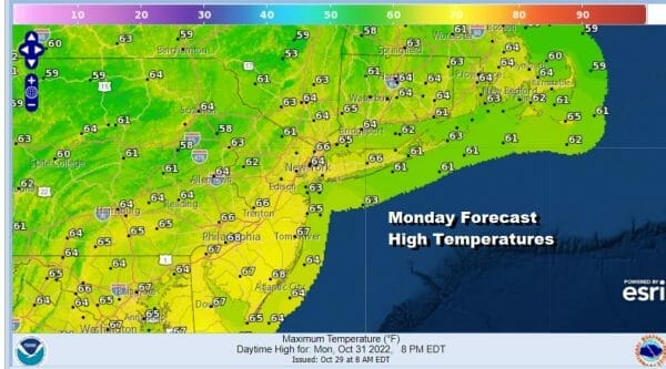
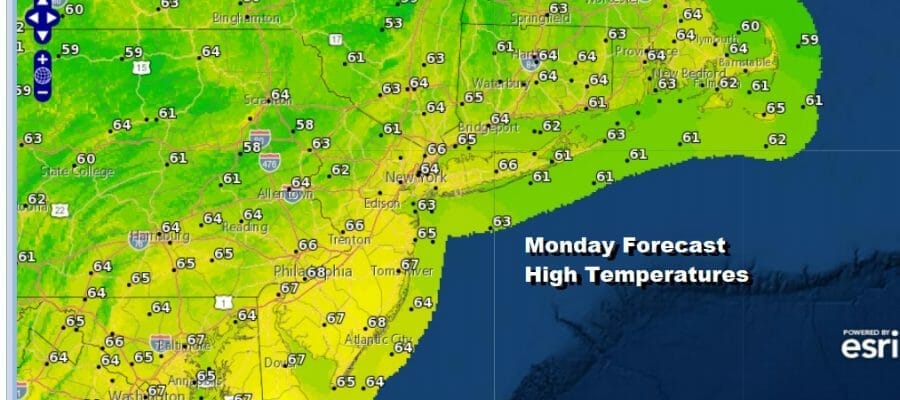
The last day of the month of October, known as Halloween, is not much of a scary day. We have clouds that are starting to roll in from the west but it doesn’t look to be a solid overcast at least initially. There are some showers on the radar loops out to the west moving into Western and Central Pennsylvania. Those showers are moving northeast and should be an issue during the day for Eastern Pennsylvania to Southern New England. Therefore we look for changeable sky conditions today with most highs in the 60s.
SATELLITE

WEATHER RADAR

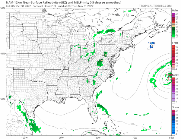
Low pressure in the Ohio Valley is weakening as it moves northeast and the area of showers that we see on the radar will weaken as well. However there is enough here that we could see an area of showers move through the area overnight. Lows tonight will be in the 50s. Rainfall overnight won’t amount to much; under a quarter of an inch seems likely.
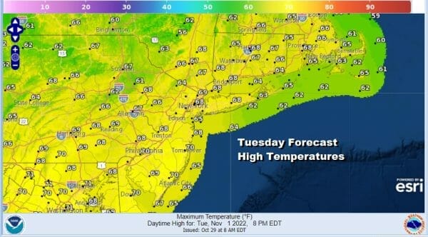
Once the showers are done and the weather system exits Tuesday morning, we will likely see leftover clouds slowly decrease. The air behind this system is as warm as the air ahead of it as we will still remain in a ridge position in the Eastern US for this week. Some sun should break through the clouds in the afternoon and highs will again be in the 60s.
There is really not going to me much change from day to day this week as the trend of above average temperatures continues probably right through the upcoming weekend. The rest of the week looks to be dry with sunshine or at least some sunshine each day Wednesday through Friday. Highs each day will be in the mid to upper 60s. Nights could see some patchy areas of low clouds and patchy fog developing especially in cooler inland valleys with overnight lows generally in the 40s inland with a few 30s in coldest spots. Warmer urban centers and the coast will bottom in the upper 40s and lower 50s. These conditions will conintue through next weekend and we could see highs into the 70s Saturday and Sunday depending on wind direction and how much sun we get. Longer range we may have to wait until the middle of next week, around Nov 8th or 9th when we could see the current pattern finally break down. Until then, after we see showers tonight, no rain is forecast through the weekend and into early next week.
BE SURE TO DOWNLOAD THE FREE METEOROLOGIST JOE CIOFFI WEATHER APP &
ANGRY BEN’S FREE WEATHER APP “THE ANGRY WEATHERMAN!
MANY THANKS TO TROPICAL TIDBITS & F5 WEATHER FOR THE USE OF MAPS
Please note that with regards to any severe weather, tropical storms, or hurricanes, should a storm be threatening, please consult your local National Weather Service office or your local government officials about what action you should be taking to protect life and property.


