
Showers This Evening As Upper Low Spins & Spins
Showers This Evening As Upper Low Spins & Spins
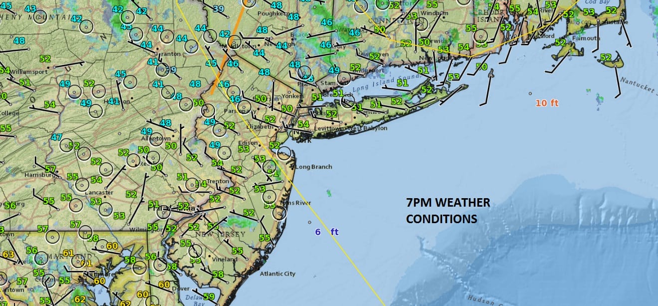
We continue to see the impact of the upper low over the northeast. It is spinning and spinning. Very cold air aloft and instability are creating showers this evening as evidenced on the local radars below. Again the showers are scattered around and not everyone is seeing shower activity much like last night. Temperatures struggled all day in the 50s to near 60 and Monday looks to be even cooler as the core of the cold air aloft moves overhead. Clouds and showers this evening will diminish and skies will clear out late tonight much like they did last night. It will be rather chilly though with most lows in the upper 30s and lower 40s though some inland areas will be a bit lower.
SATELLITE LOOP

REGIONAL RADAR

LOCAL RADAR NEW YORK CITY

LOCAL RADAR PHILADELPHIA


Monday will be quite cool with highs in many areas just in the low to mid 50s. We will once again see clouds develop and there is the chance for the passing shower going by. By Tuesday the atmosphere should have stabilized enough to see a mix of sun and clouds with highs in the 50s to near 60.
GFS MODEL FRIDAY NIGHT INTO SUNDAY MAY 13-15
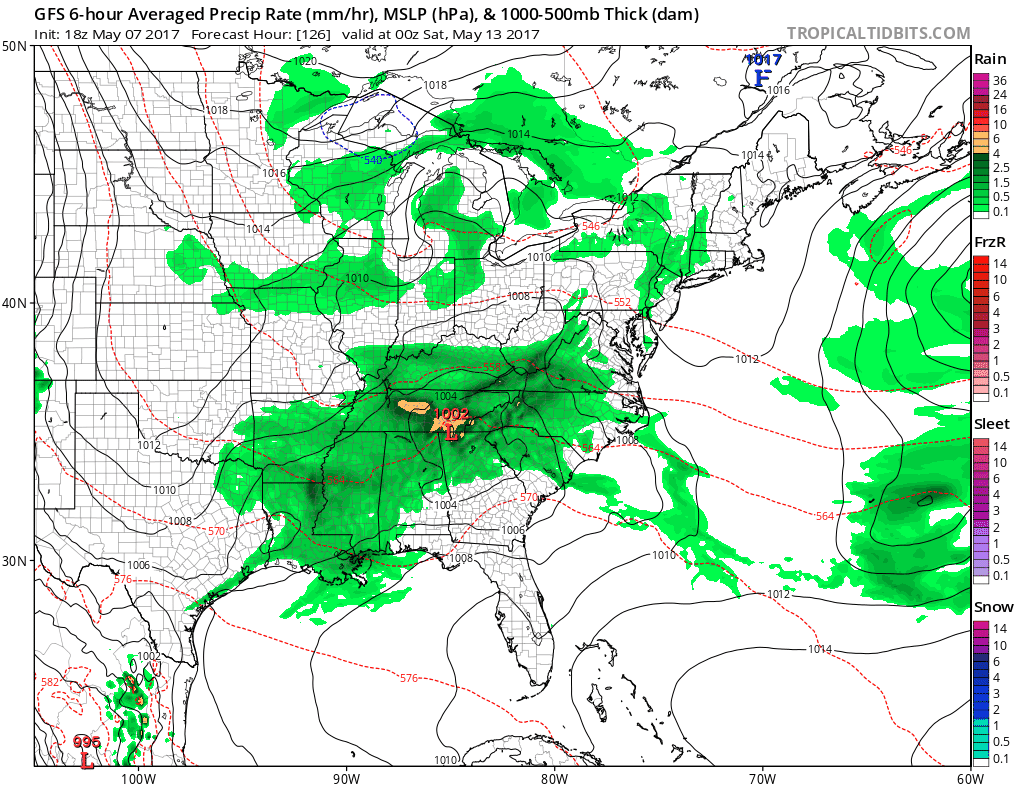
Weather models have been hinting at a coastal low for the last several days and much like in the storm from last Friday there was a mid cycle backing off before coming back to the original idea which is what resulted in Friday’s soaking rain. The block is going to be gradually breaking down however sometimes the breakdown takes longer than models forecast. This afternoon’s GFS model has brought the idea of a soaking rain next weekend back on the table. Lets see if future runs continue with this idea. For now the weather for the rest of the week will be rather uneventful though we will be dealing with clouds and cooler air all weak long.
 GET JOE A CIGAR IF YOU LIKE

LANDSCAPE COMPANIES FOR YOUR NEEDS
LONG ISLAND ROCKLAND COUNTY Connecticut

![]()

ROCKLAND COUNTY TRI STATE SNOW REMOVAL JOHNSTOWN PA


FiOS1 News Weather Forecast For Long Island
FiOS1 News Weather Forecast For New Jersey
FiOS1 News Weather Forecast For Hudson Valley
NATIONAL WEATHER SERVICE SNOW FORECASTS
LATEST JOESTRADAMUS ON THE LONG RANGE
Weather App

Don’t be without Meteorologist Joe Cioffi’s weather app. It is really a meteorologist app because you get my forecasts and my analysis and not some automated computer generated forecast based on the GFS model. This is why your app forecast changes every 6 hours. It is model driven with no human input at all. It gives you an icon, a temperature and no insight whatsoever.
It is a complete weather app to suit your forecast needs. All the weather information you need is right on your phone. Android or I-phone, use it to keep track of all the latest weather information and forecasts. This weather app is also free of advertising so you don’t have to worry about security issues with your device. An accurate forecast and no worries that your device is being compromised.
Use it in conjunction with my website and my facebook and twitter and you have complete weather coverage of all the latest weather and the long range outlook. The website has been redone and upgraded. Its easy to use and everything is archived so you can see how well Joe does or doesn’t do when it comes to forecasts and outlooks.
Just click on the google play button or the apple store button on the sidebar for my app which is on My Weather Concierge. Download the app for free. Subscribe to my forecasts on an ad free environment for just 99 cents a month.
Get my forecasts in the palm of your hand for less than the cost of a cup of Joe!


