
Chilly May Morning Noreaster Threat Weekend?
Chilly May Morning Noreaster Threat Weekend?
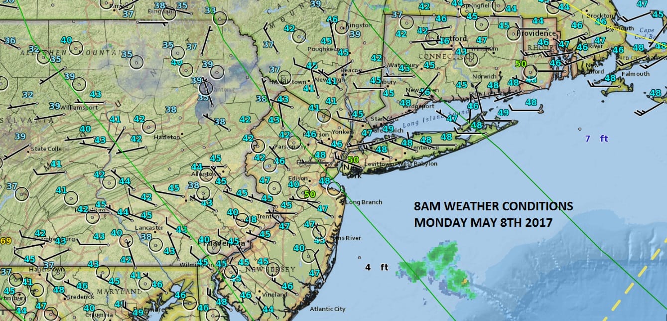
With average high temperatures near 70 now and rising we have a day head where 60 will be out of reach for most. We are still under the influence of this upper low to the north that is spinning over New England and shows no signs of getting out of the way. If you want to see the block at work you can look at the upper right corner of the satellite loop. Notice those clouds are backing westward. That is due to a big storm over the Azores which has been stalled for days and will remain stalled for a few more. Until that gets out of the way weather systems can’t follow their normal progression. It will be another day with sun at the start followed by clouds and the chance for passing showers later this afternoon and evening; much like the past several days with temperatures not out of the 50s.
SATELLITE LOOP

REGIONAL RADAR

LOCAL RADAR NEW YORK CITY

LOCAL RADAR PHILADELPHIA


The atmosphere should stabilize somewhat over the next several days with a mix of sun and clouds each and temperatures into the low or even middle 60s by day/ There will be weak weather sytems passing to the south. The more important system looks to be for next weekend and depending on the state of the block, it could mean wind and rain for Saturday and Sunday.
CHILLY MAY PATTERN GFS FORECAST SATURDAY THROUGH MONDAY
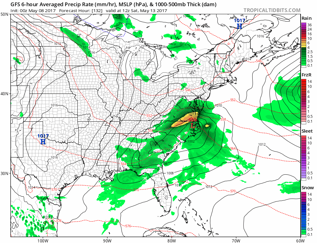
Weather models are still showing a storm developing along the coast this coming weekend with various models more tucked in along the coast than others. How the block breaks down and how much room will their be for a low to move northward will be key. For now we will mention the chance for rain late Saturday into Sunday and leave it at that until we see where all this goes. In the meantime a chilly May pattern continues going forward.
 GET JOE A CIGAR IF YOU LIKE

LANDSCAPE COMPANIES FOR YOUR NEEDS
LONG ISLAND ROCKLAND COUNTY Connecticut

![]()

ROCKLAND COUNTY TRI STATE SNOW REMOVAL JOHNSTOWN PA


FiOS1 News Weather Forecast For Long Island
FiOS1 News Weather Forecast For New Jersey
FiOS1 News Weather Forecast For Hudson Valley
NATIONAL WEATHER SERVICE SNOW FORECASTS
LATEST JOESTRADAMUS ON THE LONG RANGE
Weather App

Don’t be without Meteorologist Joe Cioffi’s weather app. It is really a meteorologist app because you get my forecasts and my analysis and not some automated computer generated forecast based on the GFS model. This is why your app forecast changes every 6 hours. It is model driven with no human input at all. It gives you an icon, a temperature and no insight whatsoever.
It is a complete weather app to suit your forecast needs. All the weather information you need is right on your phone. Android or I-phone, use it to keep track of all the latest weather information and forecasts. This weather app is also free of advertising so you don’t have to worry about security issues with your device. An accurate forecast and no worries that your device is being compromised.
Use it in conjunction with my website and my facebook and twitter and you have complete weather coverage of all the latest weather and the long range outlook. The website has been redone and upgraded. Its easy to use and everything is archived so you can see how well Joe does or doesn’t do when it comes to forecasts and outlooks.
Just click on the google play button or the apple store button on the sidebar for my app which is on My Weather Concierge. Download the app for free. Subscribe to my forecasts on an ad free environment for just 99 cents a month.
Get my forecasts in the palm of your hand for less than the cost of a cup of Joe!


