
Showers Arrive Tonight Showery Rains Severe Thunderstorms Wind Thursday Night
This developing storm heading for the Great Lakes is going to be packing quite a punch. The worst of it will be Thursday evening and Thursday night when the cold front pushes on through. Showery rains are likely beginning later tonight and lasting on and off on Thursday but then the front arrives with a solid line of thunderstorms moving through.

The set up continues to unfold in the east. The water vapor loop at high levels shows the deep trough in the west swinging eastward with a solid tropical feed that continues to surge out of the Gulf of Mexico. Low pressure is developing on the southern end of a long frontal boundary that runs up the Appalachians.
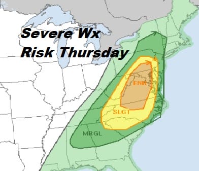
All of these factors and a rather aggressive run of weather models today is leading the Storm Prediction Center to not only expand the geographic area of the severe weather threat for late Thursday and Thursday night but they have added an enhanced risk area that reaches from the Middle Atlantic states into Pennsylvania with marginal risk pushed up well north into NY state.
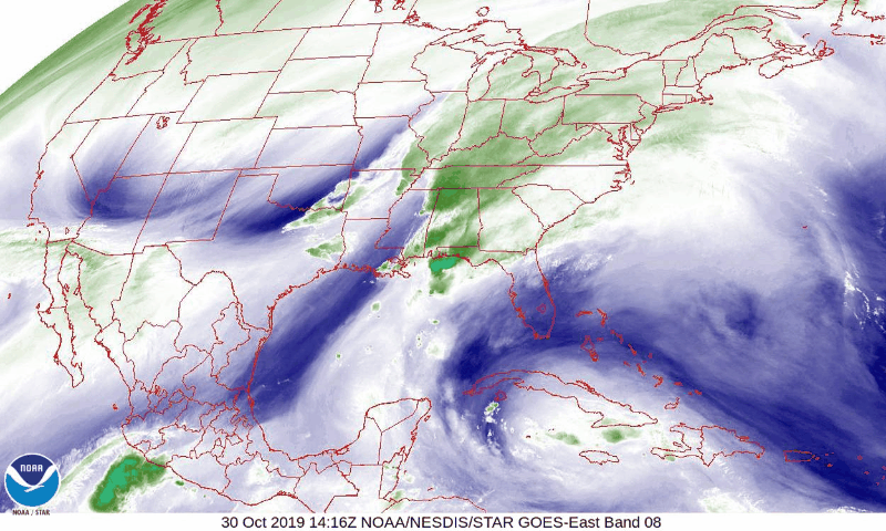
The satellite picture (in real time) shows us in lots of clouds as we are still dealing with the impact of the onshore flow. However that flow is weakening now as the low develops in the Gulf States. Higher clouds from the tropical moisture are moving in now as we set up for some overnight showery rains.
SATELLITE

REGIONAL RADAR

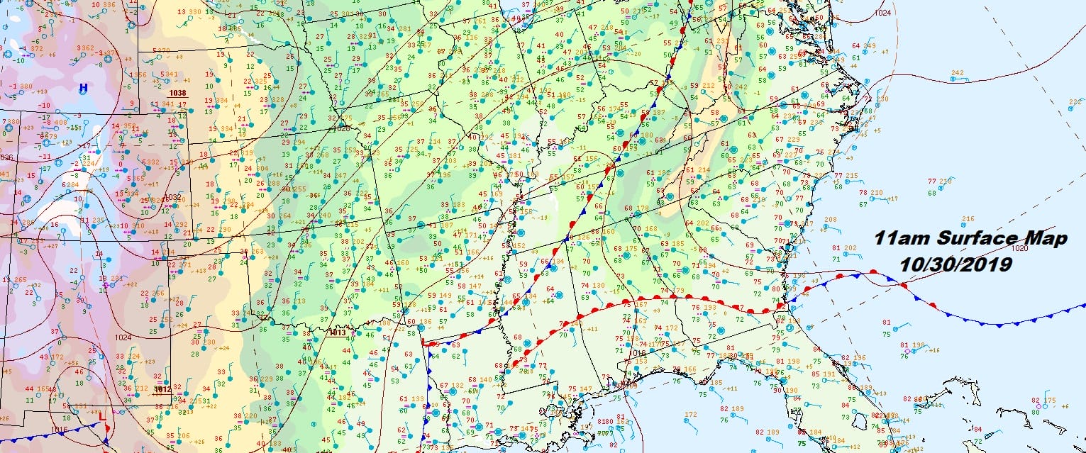
Regional radar is showing showers expanding across Virginia and West Virginia and moving northeastward. They should arrive in our area tonight. Meanwhile the local radars are still showing the light rain and drizzle that has been around from time to time and from place to place today. Temperatures have climbed up into the 60s as that tropical air pushes steadily northward.
LOCAL RADAR NEW YORK CITY

LOCAL RADAR PHILADELPHIA


Look for showery rains tonight into Thursday. During the day Thursday showers will come and go before the cold front approaches. Temperatures cold reach the upper 60s and low 70s with ease. Then the front arrives tomorrow night with a squall line of thunderstorms and a very sharp wind shift line when the front passes during the early morning hours.

At 2am Friday the front is on the coast and the winds will be howling at 20 to 30 mph with gusts of 40 to 50 mph possible. The GFS map above shows the extent of the sustained winds with gales along the coast. Those strong winds will last into Friday morning. Sky conditions should improve Friday as the front moves offshore and skies clear out. Temperatures will settle into the 50s late in the day Friday.
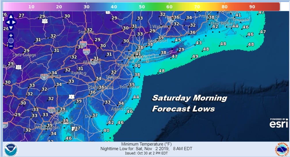
Saturday morning we will be waking up to lows in the 30s with inland areas near or below freezing. The weekend looks dry and cold with some sunshine for Saturday and Sunday. Highs will be just into the 50s with nights in the 30s. The exception will be the warmer urban areas which will bottom close to 40. Sunday night into Monday morning will be the coldest night of the stretch with most lows in the upper 20s to lower 30s away from warmer urban areas.
BE SURE TO DOWNLOAD THE FREE METEOROLOGIST JOE CIOFFI WEATHER APP &
ANGRY BEN’S FREE WEATHER APP “THE ANGRY WEATHERMAN!
MANY THANKS TO TROPICAL TIDBITS FOR THE USE OF MAPS
Please note that with regards to any severe weather, tropical storms, or hurricanes, should a storm be threatening, please consult your local National Weather Service office or your local government officials about what action you should be taking to protect life and property.


