
Showers Arrive Ahead of Springlike Weather Tuesday Wednesday
Showers Arrive Ahead of Springlike Weather Tuesday Wednesday
We are starting out this presidents day with clouds that are already pushing in from the west as the leading edge of warmer air heads east. Some showers are breaking out on the regional radar also to the west of us and they will be arriving during this afternoon.

Temperatures today should reach the mid 40s to some lower 50s inland depending on how fast it clouds up. This is a warm front that is pushing through and warm fronts can have a tough time getting by. Along with showers that will last into tonight we will also see some fog especially along coastal areas.
US SATELLITE

REGIONAL RADAR

Radar is showing bands of showers with one across the Middle Atlantic States passing by to the south and the other to the west which should be arriving here mid to late afternoon from west to east.
LOCAL RADAR NEW YORK CITY

LOCAL RADAR PHILADELPHIA


Tuesday and Wednesday will be two very warm days for most of the area with exception perhaps of coastal areas like Long Island and Southern New England near the coast could have a bit of a problem with the low clouds, fog, and the south wind. Otherwise we should see temperatures into the 60s away from the ocean Tuesday and upper 60s and lower 70s on Wednesday. Some record highs are likely especially across inland New Jersey and Eastern Pennsylvania.
GFS MODEL FORECAST THURSDAY THROUGH SUNDAY CLICK TO ANIMATE
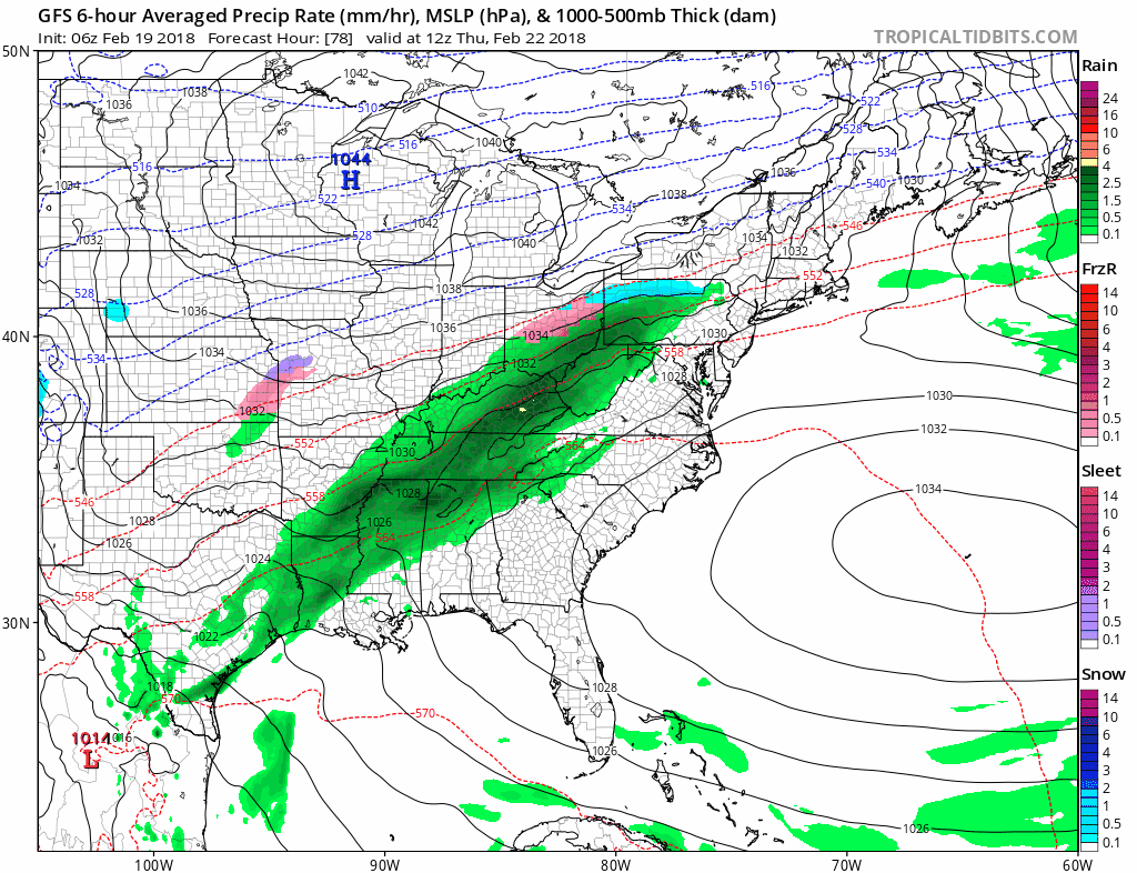
After Wednesday a cold front comes through and then a series of waves will be pushing east. This is going to put us in a 4 day stretch of on and off rain or showers along with cooler temperatures beginning later Thursday and lasting right through next weekend. It isn’t exactly nice around here when it warms up too early.
Longer range a blocking pattern sets up in the Atlantic which could make for a colder stormy start to March but it all depends on how all the chess pieces set up as JOESTRADAMUS illustrates in his long range outlook.
 GET JOE A CIGAR IF YOU LIKE

FiOS1 News Weather Forecast For Long Island
FiOS1 News Weather Forecast For New Jersey
FiOS1 News Weather Forecast For Hudson Valley