Showers Around Tonight Warmer Tuesday Late Week Mother’s Day Outlook

Weather in 5/Joe & Joe Weather Show Latest Podcast
Showers Around Tonight Warmer Tuesday Late Week Mother’s Day Outlook
After a day of struggling with a warm front to the south we are seeing scattered showers around this evening and there are more numerous showers to our south and west this evening along with a couple of heavier thunderstorms showing up on radar in parts of Central Pennsylvania south into Northern Virginia. The area is moving mostly to the northeast and we will see showers overnight into Tuesday morning as temperatures hold in the 50s along the coast and upper 50s and lower 60s inland.
SATELLITE

This warm front should move northward into Southern New England putting us in the “warm sector” of the next developing low. We will see some sunshine break through on Tuesday and this should send temperatures up into the 80s in most places except for Southern New England and Long Island where cooler 70s and even 60s are likely thanks to a bit of an ocean wind. There could be a scattered shower or thunderstorm Tuesday night.

The Storm Prediction Center continues to show a marginal risk of severe weather from Northern New Jersey (south of Route 78) southward including much of Eastern Pennsylvania and extending south down the East Coast. There has been no change in this outlook and Wednesday we will see showers and the chance for some thunderstorms until the cold front passes. Highs will be in the 70s in most places but again it will be lower in areas from Southern New England and Long Island.
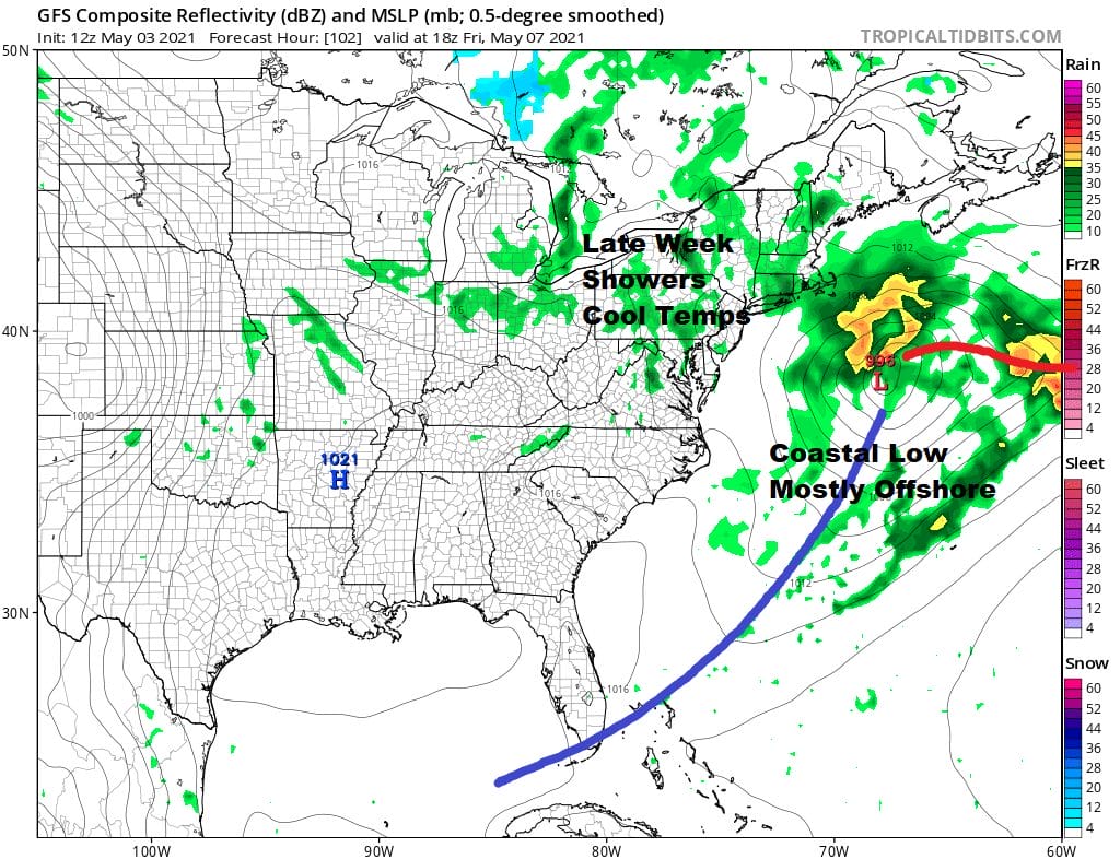
Thursday will be a cool day with some sunshine and clouds. Highs will be in the low to mid 60s. Then another wave develops on a stalled front to our south and intensifies offshore. All the models keep this low to the east but an upper trough will swing through across the Great Lakes putting us in clouds and some showers on Friday. Highs will be in the mid 50s to around 60.

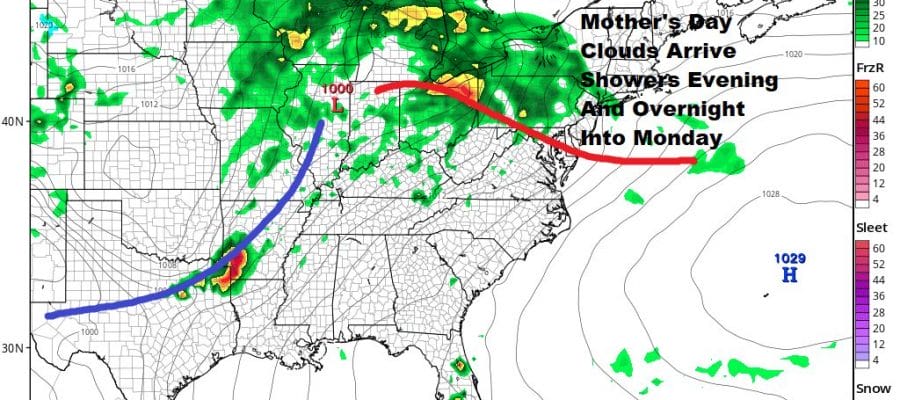
The weekend is shaping up okay but not perfect. Saturday looks a little better than Sunday with sun and clouds for Saturday with highs in the 60s. Sunday Mother’s Day brings another warm front battle so look for increasing clouds and there is the chance for showers developing Sunday evening but the dayside should be dry. Highs will be mostly in the 60s.

BE SURE TO DOWNLOAD THE FREE METEOROLOGIST JOE CIOFFI WEATHER APP &
ANGRY BEN’S FREE WEATHER APP “THE ANGRY WEATHERMAN!
MANY THANKS TO TROPICAL TIDBITS FOR THE USE OF MAPS
Please note that with regards to any severe weather, tropical storms, or hurricanes, should a storm be threatening, please consult your local National Weather Service office or your local government officials about what action you should be taking to protect life and property.


