Showers Around Today Rain Late Sunday Below Average Temps Week Ahead

Weather in 5/Joe & Joe Weather Show Latest Podcast
Showers Around Today Rain Late Sunday Below Average Temps Week Ahead
No doubt we are seeing a gloom and doom type of day today in much of the Northeast and Northern Mid Atlantic states. A storm to the east is moving very slowly toward Nova Scotia which is effectively slowing everything down. An upper trough over the Eastern Great Lakes is the player today keeping us in clouds. We are seeing bands of showers on the radar and that is the risk today in that we could see some scattered showers and for some areas to the south ( Southern Pa, Southern NJ southward) there might even be the odd thunderstorm.
SATELLITE

It will also be a day where temperatures struggle to go no nowhere as highs will be mostly in the 50s with a north or northeast wind in control. The storm to the east will pull away tonight as will the upper trough and we could partially clear out overnight with lows mostly in the 40s except for 30s well inland north and west of the coast.
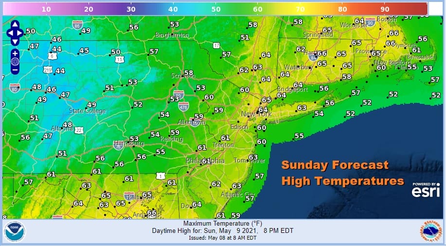
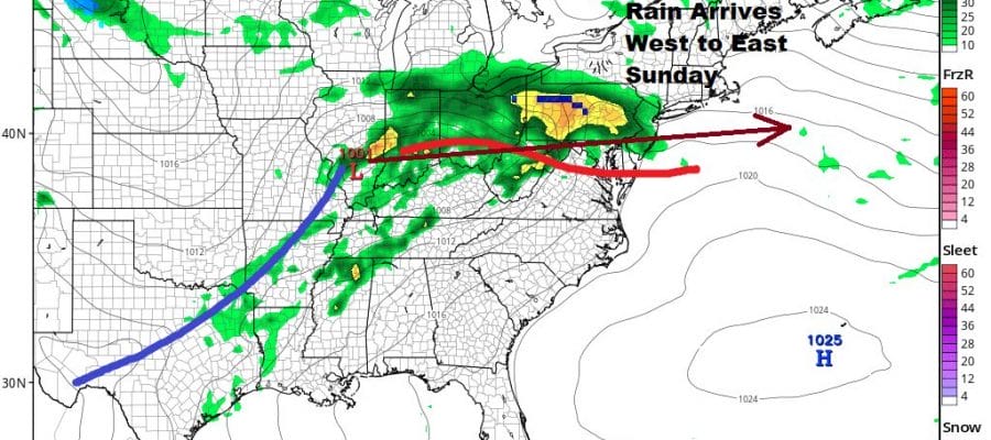
Notice the rather odd high temperature profile for Sunday. Highs from NYC eastward could reach the 60s while highs to the west are much cooler. This is because we could start the day with some sun along the coast and east to Southern New England but areas to the west will cloudy up rather quickly. Then there is the advancing area of rain which will cool things down further. Rain arrives from west to east from late morning to mid afternoon.
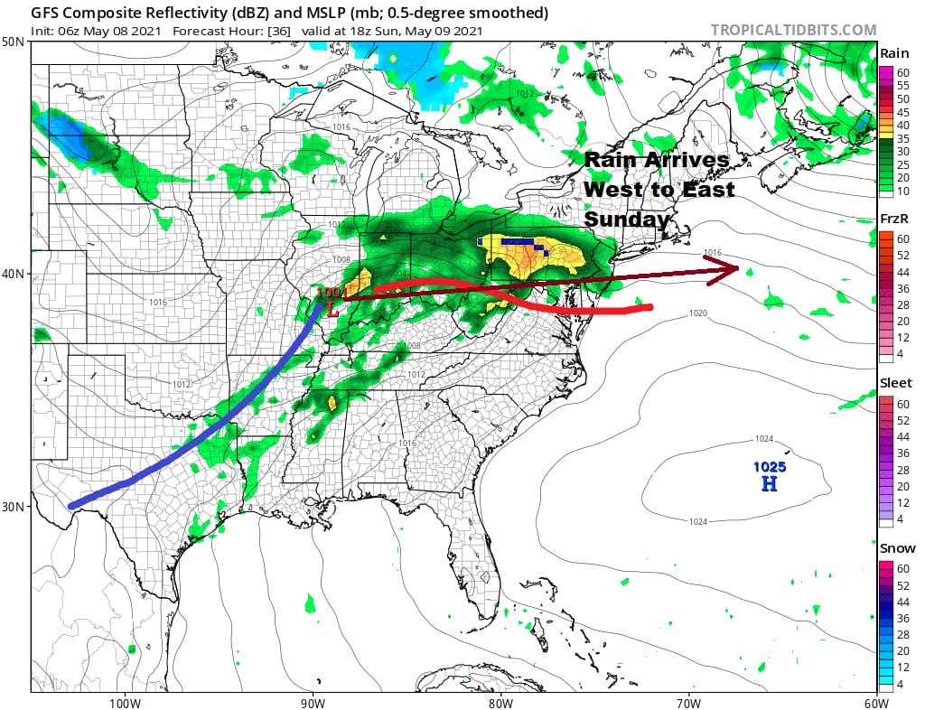
Low pressure moves east from Southern Illinois to the New Jersey Sunday night into Monday morning and the rain should end from west to east around or just after midnight. Weather conditions should improve Monday as the low moves away however we are left in a cooler than average weather pattern setting up for next week. Monday we should see leftover clouds giving way to some sun. It will be breezy with highs in the 60s. Tuesday looks to be the coolest day of the week with highs just in the lower 60s on average though we should see some sun. Wednesday look for sunshine with highs in the 60s. Nighttime lows will be in the 40s with 30s in cold spots inland. There should be enough wind early next week to prevent any kind of widespread frost but we will keep an eye on this.
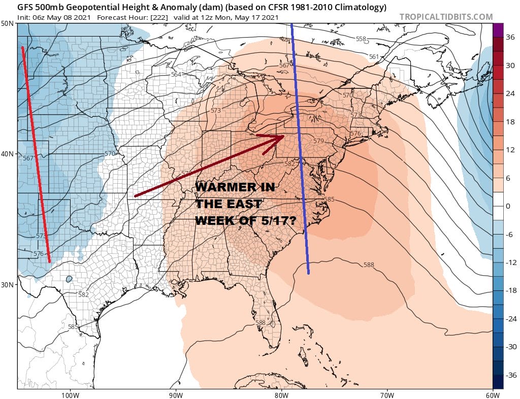
The end of next week will probably bring some rain into the East and it could linger into next weekend however I want to leave you with some hope of a warmer pattern setting up. Models are trying to pop a ridge in the East for the week of May 17th which would take temperatures above average for a few days. Whether that is just a blip or something more meaningful and lasting will depend on the persistent blocky pattern in the North Atlantic. There is disagreement in the models in the long range so I wouldn’t bet the house money on this just yet.

BE SURE TO DOWNLOAD THE FREE METEOROLOGIST JOE CIOFFI WEATHER APP &
ANGRY BEN’S FREE WEATHER APP “THE ANGRY WEATHERMAN!
MANY THANKS TO TROPICAL TIDBITS FOR THE USE OF MAPS
Please note that with regards to any severe weather, tropical storms, or hurricanes, should a storm be threatening, please consult your local National Weather Service office or your local government officials about what action you should be taking to protect life and property.


