Showers Around Today Nice Through Daytime Sunday Week Ahead Outlook

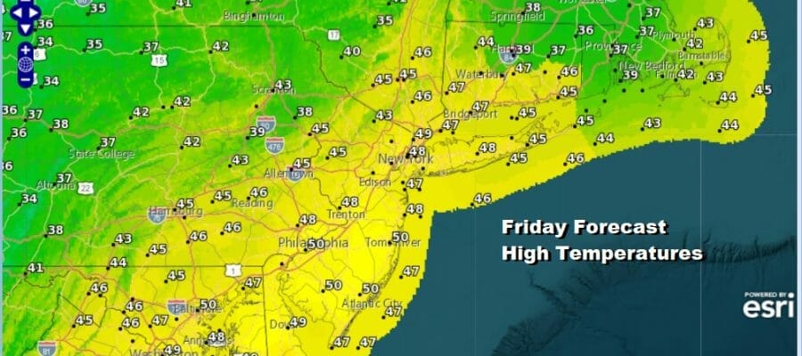
We haved moved away from the very warm weather of a few days ago and we will continue to slowly step down as far as temperatures go over the next few days. However we will still be seeing above average temperatures this weekend. An upper trough and a weak surface system are combining to produce a lot of clouds today and the radars are showing patchy areas of rain. Such is our day today with cloudy skies and we will see some rain from time to time and no rain from time to time as well. Highs today will be mostly in the low to middle 40s. Areas in Southern NJ will reach up into the lower 50s.
SATELLITE

WEATHER RADAR

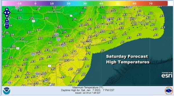
This system will be gone by tonight and that should leave us with leftover clouds with skies partially clearing out toward morning. Most lows will be in the 30s. The weekend is looking fine through the daytime Sunday. Saturday should be no worse than partly sunny with highs in the low to middle 40s
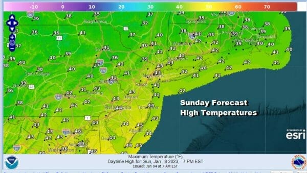
Sunday will be a little colder than Saturday with sunshine to start the day but clouds will likely start rolling in the next weak weather system heads our way from the Plains. Highs Sunday will be in upper 30s inland and most coastal and urban area highs will reach the lower 40s.
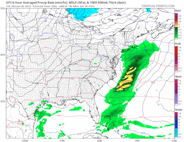
Sunday night into Monday we have this Plains system moving east and it will spread some precipitation northeastward from the Central Appalachians. We will probably see a cold rain develop near the coast and perhaps a mix of rain and wet snow inland. We have only marginal cold air around and even if were a little colder, this system would only have the potential to produce a slushy coating to maybe an inch or so on colder surfaces and that would be mainly well inland and in elevated areas.
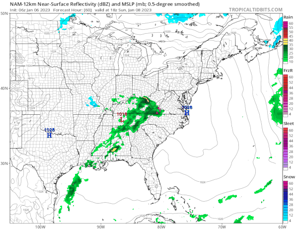
Other than that, this system will move along and we will see some rain or snow for the first part of Monday and then ending from west to east from midday to early afternoon. If it moves out a little faster then we could see some sun breaking through the clouds in the afternoon. Highs Monday will be in the low to mid 40s.

As we move through next week, we don’t see any issues through Thursday. Temperatures will still be running a little above average. There is a cold high that will be settling in Eastern Canada and that will probably bring temps down later in the week to near average for a couple of days. Also we don’t see anything precipitation wise through Thursday as another system passes to our south Tuesday night and Wednesday and heads out to sea.
Late in the week we will see a stronger system heading into the Eastern US with low pressure taking a more southern track and then perhaps making a turn up the coast. There is much uncertainty here as you would expect in the long range 7 days or more out. There is marginal cold air but how much if any is available is a big question. We have other systems ahead of this one that will impact the outcome here. We will be watching to see what roads the models take with this over the weekend.
BE SURE TO DOWNLOAD THE FREE METEOROLOGIST JOE CIOFFI WEATHER APP &
ANGRY BEN’S FREE WEATHER APP “THE ANGRY WEATHERMAN!
MANY THANKS TO TROPICAL TIDBITS & F5 WEATHER FOR THE USE OF MAPS
Please note that with regards to any severe weather, tropical storms, or hurricanes, should a storm be threatening, please consult your local National Weather Service office or your local government officials about what action you should be taking to protect life and property.


