
Slow Cool Down Begins Today Mostly Quiet Weather into Next Week
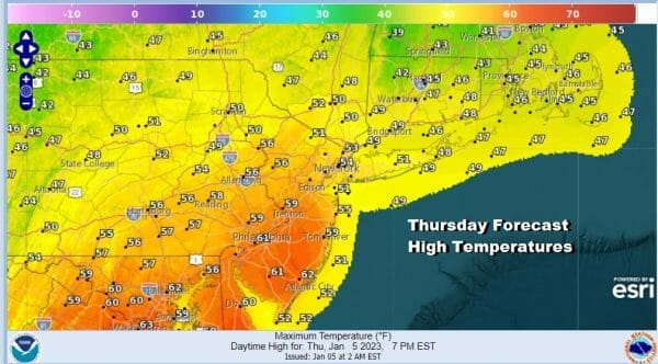
Yesterday’s cold front and the showers that went with it yesterday evening are now long gone and we begin a slow stair step decline to cooler temperatures over the next several days. Weak weather systems are moving along in the flow and they don’t have much in the way of moisture to work with. We still have some leftover warm air around from yesterday and while there will be some leftover clouds around early, we should see it give way to partly sunny skies today. Highs will range from the the low to middle 50s from Northeastern Pennsylvania to the Catskills, Hudson Valley, NYC and Long Island to upper 50s and lower 60s from Southeastern Pennsylvania to Southern New Jersey.
SATELLITE

WEATHER RADAR

During tonight an upper trough will approach and move through and that might trigger off a rain showers during the early morning hours in one or two spots but most places won’t see much overnight. Temperatures by morning will be in the upper 30s to lower 40s. Friday will be chillier with some sunshine and clouds and the outside chance there could be a rain shower. Highs will be generally in the low to middle 40s.

Two weak weather systems will be moving through over the weekend. The first is a weakening low coming out of the Plains and with that, an area of light snow that will move across Southern Ohio into West Virginia. That system basically falls apart. The second one will approach Sunday and it could bring a rain or snow shower or two Sunday night into Monday morning.
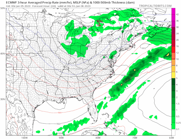
We are using the European model view here of what to expect going forward as the GFS is too horribly inconsistent and seems to have an unrealistic idea of what is happening. Note that this loop does not show precipitation type. That said snow is not really an issue in Eastern Pennsylvania to Southern New England from what I am seeing.
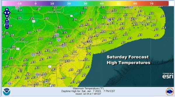
We will leave it dry Saturday and through the daytime Sunday with Saturday perhaps being the slightly better day. Temperatures will continue to slowly ease closer to normal but still above average for this time of year. Look for clouds and some sunshine for Saturday with highs in the low to mid 40s.
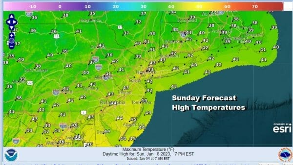
Sunday will start with sun but give way to clouds with most highs in the lower 40s. The second low we spoke of earlier will probably take an area of rain mostly to the south of our area. Perhaps the northern fringe of this system could bring a little rain as far north as Southern Pennsylania or Southern New Jersey and points south late Sunday or Sunday night but for most of the area this is an on event. Next week sees no major storms but we will likely see a cold front coming from Canada and that could bring a shot of cold air for late next week.
BE SURE TO DOWNLOAD THE FREE METEOROLOGIST JOE CIOFFI WEATHER APP &
ANGRY BEN’S FREE WEATHER APP “THE ANGRY WEATHERMAN!
MANY THANKS TO TROPICAL TIDBITS & F5 WEATHER FOR THE USE OF MAPS
Please note that with regards to any severe weather, tropical storms, or hurricanes, should a storm be threatening, please consult your local National Weather Service office or your local government officials about what action you should be taking to protect life and property.


