
Severe Weather Tornado Risks On A Saturday In December, Warm Next Week

Weather in 5/Joe & Joe Weather Show Latest Podcast
Severe Weather Tornado Risks On A Saturday In December, Warm Next Week
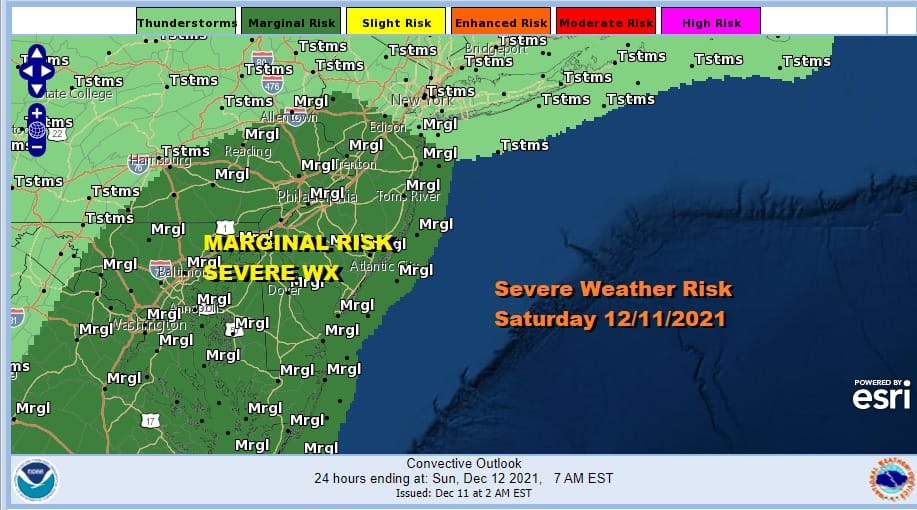
Considering the fact that we are having a potential severe weather day on a Saturday in December should not be a shock to anyone really. After the unprecedented severe weather outbreak back in November it is just par for the course in this very strange weather year. With that severe weather risk comes tornado risk.
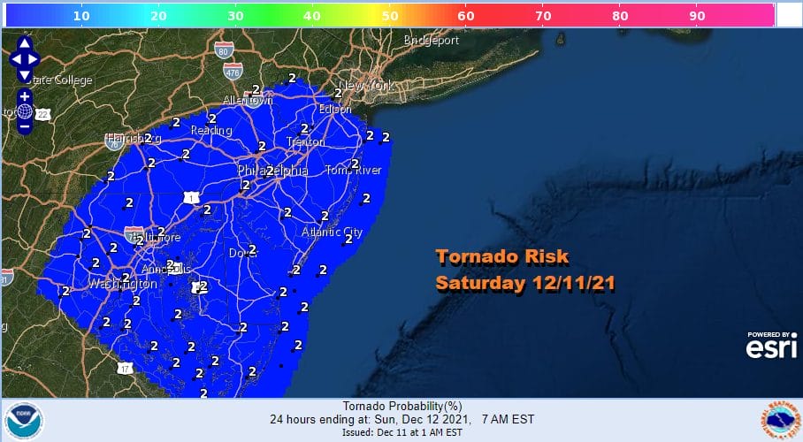
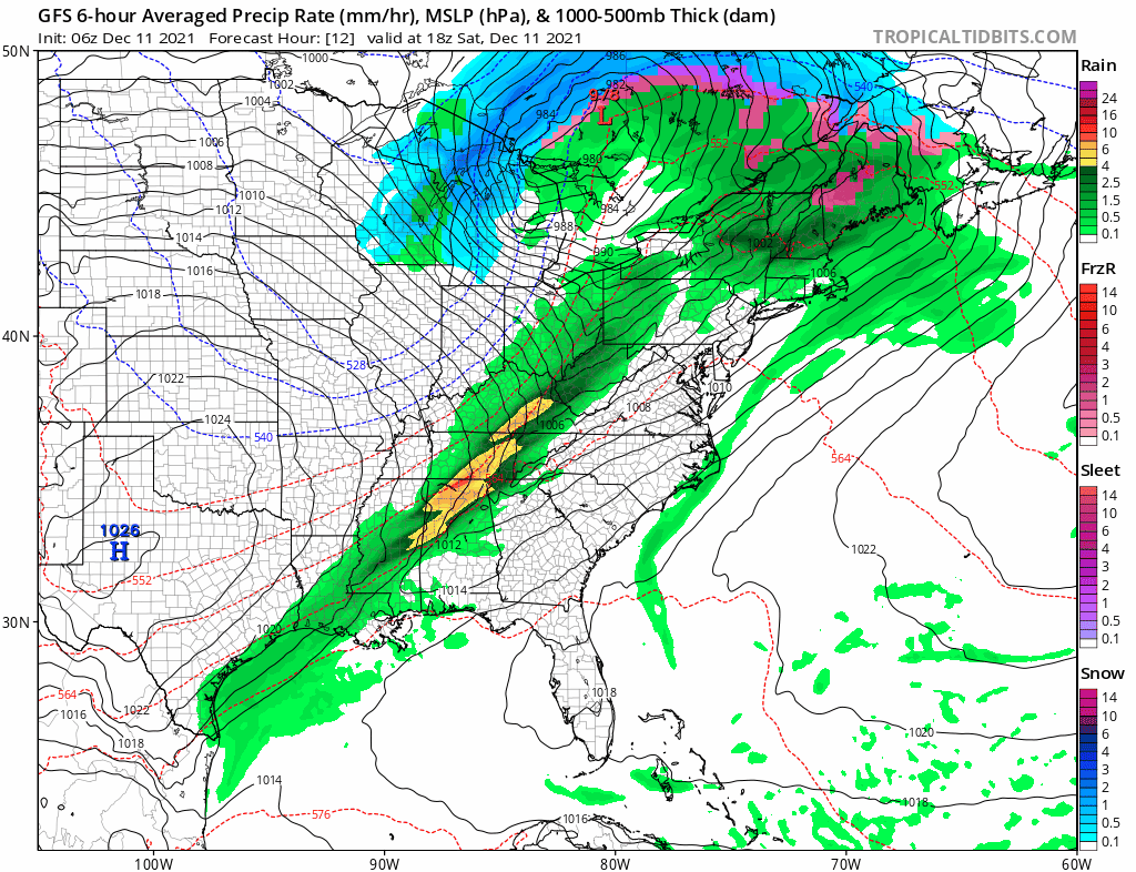
These 2 and even 5 percent tornado risk days have been so common this summer and falll it just seems ordinary at this point but given the sharp cold front and the strong upper trough swinging eastward, I don’t want to discount the chance of a spin up or two. Overnight there were numerous severe thunderstorms and tornado warnings in the Middle and Lower Mississippi Valley as well as the Deep South. We have already seen a few warnings pop up on radars to the west and south. New England is seeing rain and thunderstorms as a warm front pushes through while warm tropical air surges up the Eastern Seaboard.
SATELLITE

WEATHER RADAR

Warm and tropical conditions will continue into this evening. Some sun will produce some daytime heating and take highs up to the mid 60s to lower 70s and that means there will be some record highs this afternoon. Late today showers and some thunderstorms will move eastward out of Pennsylvania and move across New Jersey, the Hudson Valley, Southern New England and Long Island south to Delaware Maryland and Virginia.
Sunday will be colder with temperatures back down closer to average with highs in the 40s and some sunshine. Monday we will see sunshine with highs back into the 50s. A back door cold front moves south on Tuesday only to move back northward on Wednesday setting us up for another very warm day next Thursday with highs in the 60s. After that another cold front passes Thursday night leading to a cooler pattern next weekend and beyond. There are some pattern change hints showing up in the long range and we will take a closer look at them on the Joe & Joe Weather Show late today.
BE SURE TO DOWNLOAD THE FREE METEOROLOGIST JOE CIOFFI WEATHER APP &
ANGRY BEN’S FREE WEATHER APP “THE ANGRY WEATHERMAN!

MANY THANKS TO TROPICAL TIDBITS & F5 WEATHER FOR THE USE OF MAPS
Please note that with regards to any severe weather, tropical storms, or hurricanes, should a storm be threatening, please consult your local National Weather Service office or your local government officials about what action you should be taking to protect life and property.


