Severe Weather Tornado Risk Thunderstorms Later Today Wind Issues
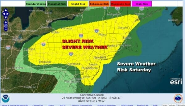
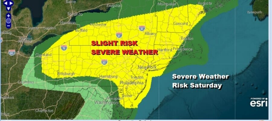
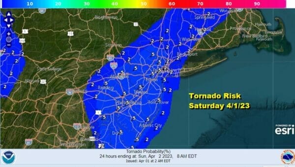
This is setting up to be a potentially wild weather day and it will be capped by the risk for severe weather late this afternoon and this evening as a strong upper trough moves through. This also comes with elevated tornado risk of 2 to 5 percent which for this area is rather high even during the warmer months.
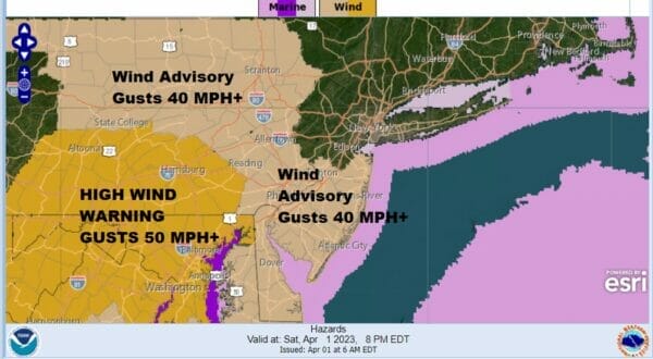
We also will have wind issues to deal with as southwest winds will pick up today and gust to over 40 mph in some areas and that has prompted wind advisories to be posted for Central and Southern New Jersey as well as Eastern Pennsylvania. Outside of the advisory area it will be windy with gusts in the 30 to 40 mph range which is just under wind advisory criteria.
Showers and heavier downpours that are rolling through this morning are showing up on the satellite and radar but notice on the satellite loop that the clouds are racing eastward as this weather front goes by. Behind it we are left with almost cloud free conditions that will move in during this afternoon.

With sunshine and a screaming southwest wind this afternoon, temperatures have no where to go but up and we will have readings reach into the low and middle 70s in many areas from the Hudson Valley and Southwest Connecticut south and west while to the northeast of there temperatures will reach the mid to upper 60s.
SATELLITE

WEATHER RADAR

The issue with thunderstorms and severe weather risk come late this afternoon into tonight. A very strong upper trough will move across Northern Pennsylvania and Southeast NY. It shows up as a rather sharp comma shape hook in Western Pennsylvania in early afternoon and then it races eastward reaching the coast between 6pm and 8pm tonight.
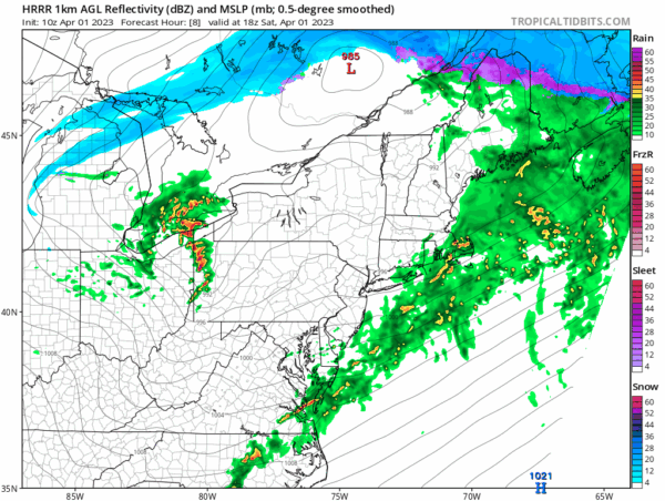
The fast rate of movement of this upper trough (50 mph or more) creates momentum and will encourage mixing of strong winds in the upper atmosphere down to the surface. A narrow squall line of thunderstorms develops and moves east and it is from this that we could see strong wind gusts and the potential for some rotation (tornadoes) as the line moves through. The HRRR model loop above shows it quite well from 2pm until midnight in hour by hour increments.

Once this upper trough moves through winds shift to northwest and remain strong and gusty into Sunday. Skies should clear out and Sunday will be a better day with sunshine. There will be a gusty wind however through the morning and early afternoon before winds subside. Sunday highs will be in the lower 50s in most places.
BE SURE TO DOWNLOAD THE FREE METEOROLOGIST JOE CIOFFI WEATHER APP &
ANGRY BEN’S FREE WEATHER APP “THE ANGRY WEATHERMAN!
MANY THANKS TO TROPICAL TIDBITS & F5 WEATHER FOR THE USE OF MAPS
Please note that with regards to any severe weather, tropical storms, or hurricanes, should a storm be threatening, please consult your local National Weather Service office or your local government officials about what action you should be taking to protect life and property.


