
Severe Weather This Afternoon Virginia to New England Ugly Weather Pattern Long Range
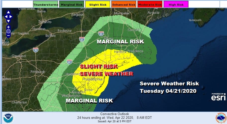
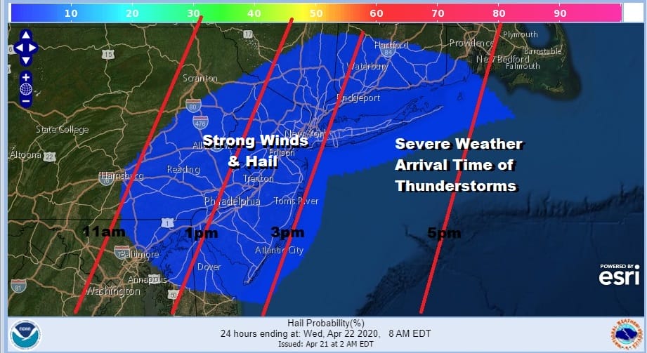
It is all about a strong cold front and thunderstorms this afternoon that will be coming through like a rocket ship. Thunderstorms will reach Central and Eastern Pennsylvania between now (9am) and noontime. Then it is on to New Jersey and the Hudson Valley, across NYC between 2 and 3pm and then eastward into New England. Arrival times are approximate and are displayed on the map below.
The satellite picture shows the well defined cold front creating clouds to the west. That arm of clouds will be swinging eastward and bringing showers and thunderstorms along with it. This is a strong upper trough with very cold air aloft that is moving across the Northeast and it is the trigger mechanism for these thunderstorms. This is not your typical cold front with warm tropical air ahead of it as you might see later in the spring or in the summer.
SATELLITE

Regional radar is revving up with showers and some thunderstorms developing as the line heads eastward. Local radars will be picking up on the activity in a few hours. The biggest risk will be from strong and potentially damaging winds of 60 mph or more and hail as the storms move through.
REGIONAL RADAR

LOCAL RADAR NEW YORK CITY

LOCAL RADAR PHILADELPHIA


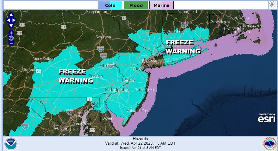
Temperatures will reach into the 60s today before the front passes and then drop into the upper 20s to mid 30s by Wednesday morning thanks to the cold air behind this. Freeze warnings are in effect for much of the region from Pennsylvania to Southern New England since the growing season has begun.
While weather conditions improve on Wednesday with sunshine it will be cold with highs in the mid to upper 50s. Then our weather goes downhill for the rest of the week and probably the weekend. The upper air pattern is active with a southern part of the jet stream that continues to shoot weather systems along from west to east while the northern part of the jet stream moves along in a more relaxed fashion, allowing these short waves to lift up northward enough to create issues here.
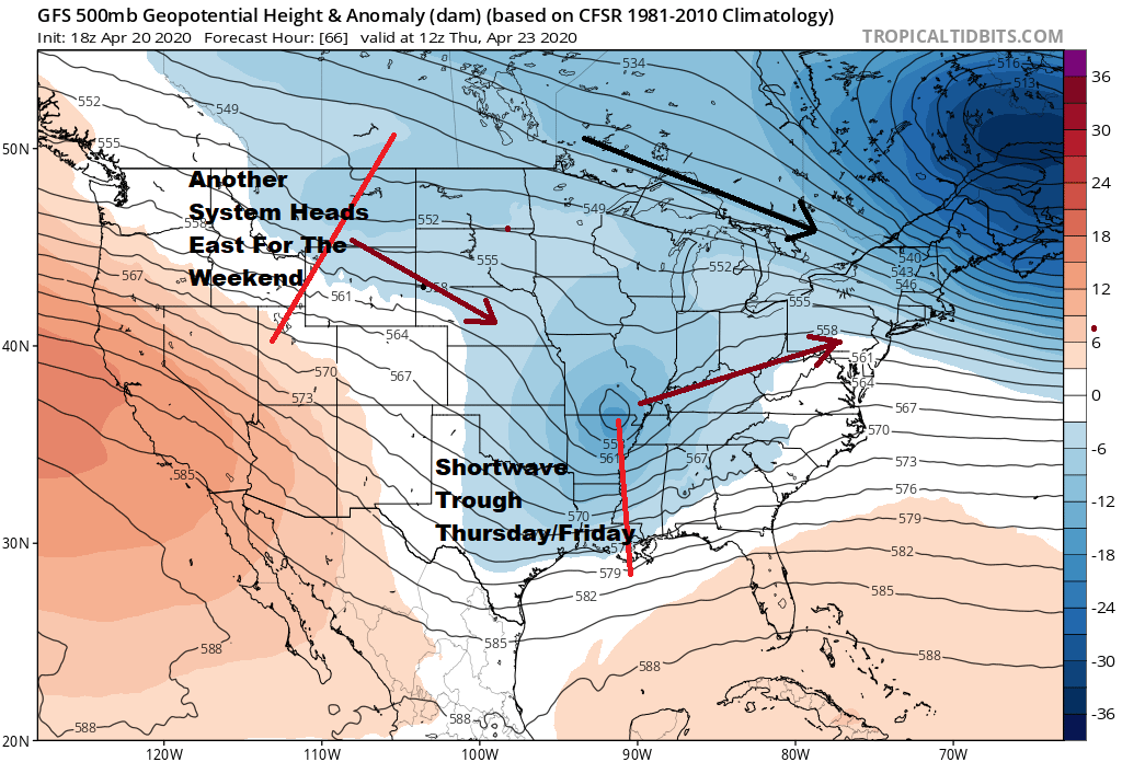
The first round of issues will be on Thursday. Low pressure comes out of the Southern Plains and heads east. High pressure builds south in Eastern Canada into the northeast. That spells onshore flow and rain late Thursday and lasting on and off through Friday. We may see temperatures much of the time in the 40s to lower 50s with the persistent onshore flow and rain.
Weather conditions should improve on Saturday but clouds come back in a hurry and rain could be here for Saturday and Sunday as another low heads east from the Ohio Valley and takes its time moving through the area. Still a third system could follow for the middle of next week. It is a wet miserable pattern that lies ahead of us.
BE SURE TO DOWNLOAD THE FREE METEOROLOGIST JOE CIOFFI WEATHER APP &
ANGRY BEN’S FREE WEATHER APP “THE ANGRY WEATHERMAN!
MANY THANKS TO TROPICAL TIDBITS FOR THE USE OF MAPS
Please note that with regards to any severe weather, tropical storms, or hurricanes, should a storm be threatening, please consult your local National Weather Service office or your local government officials about what action you should be taking to protect life and property.


