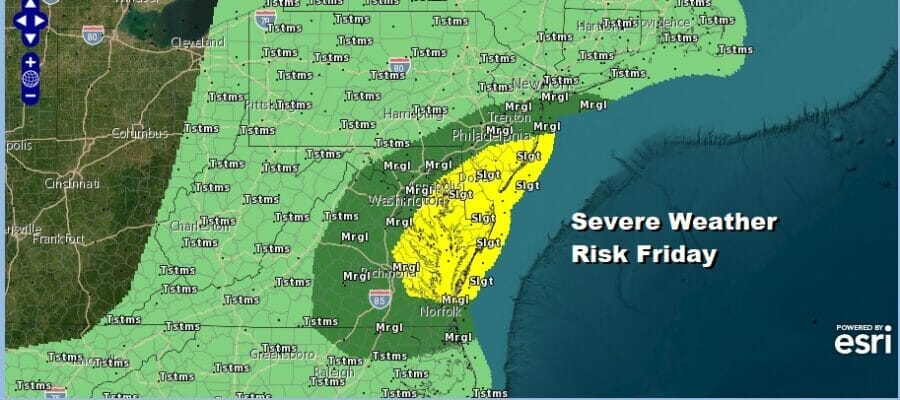
Severe Weather Risks New Jersey Southward Showers
Father’s Day Holiday Weekend Mostly Dry

Severe Weather Risks New Jersey Southward Showers
Father’s Day Holiday Weekend Mostly Dry
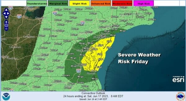
Today is getaway day for the Father’s Day holiday weekend and that includes Monday which is Juneteenth Day. Low pressure is heading out of of Mid Atlantic states which is along a cold front heading east, and an upper air storm that is dropping into the Northeast. This is setting us up for showers and thunderstorms later today and there is the potential for severe weather, mainly from New Jersey and Southeastern Pennsylvania southward into Virginia. The main risks from these thunderstorms are strong gusty winds and the potential for some hail.

Ahead of the thunderstorms we have clouds coming in from the west and we see the main threat for thunderstorms during the afternoon and evening. Temperatures today will be mostly in the 70s. There may be some sun through the clouds early in the day before the cold front gets closer this afternoon and this evening.
SATELLITE

WEATHER RADAR

Regional radar is picking up on showers and some heavier downpours to the west in Pennsylvania and West Virginia moving eastward. The loop below shows the movement of showers from 11am to 7pm Friday. This doesn’t appear to be a widespread severe weather producer but the risk remains until the front passes and low pressure forms offshore this evening.

Once the low develops showers will be offshore and we will have leftover clouds tonight into Saturday morning with most lows Saturday morning in the mid 50s to lower 60s. The low offshore will produce some scattered showers or thunderstorms over New England Saturday. We can’t completely rule out a shower or thunderstorm Saturday but on the whole most of the day should be dry with clouds and perhaps some breaks of sunshine developing. Saturday highs will be in the 70s.

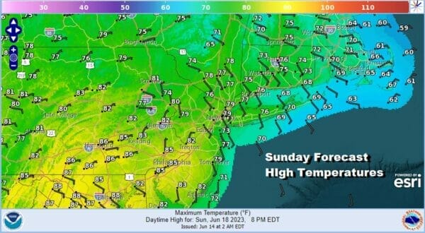
Moving on to Sunday, Father’s Day, we have weak high pressure that will be building in and that should hold on through Monday as the high shifts eastward into New England. I think Sunday will be no worse than partly sunny though there might be more clouds around in the afternoon as another weak upper trough moves through. For now we will leave any mention of an isolated shower or thunderstorm out of the forecast. High temperatures Sunday will be in the upper 70s to lower 80s.
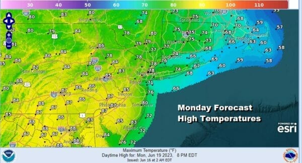
Monday is the Juneteenth holiday which right now looks to be a decent day of sunshine. Temperatures will be a little lower than average but it will still nice with most highs in the upper 70s and lower 80s. Winds will start to turn onshore during the afternoon and evening so temperatures will be cooler at the shore.
We should be dry through midweek but models are struggling about the end of next week as lower pressures will develop off the Southeast US coast. Models were trying to bring a low up the coast with a soaking rain late next week but this has come into question as a ridge may develop over the Northeast and suppress any rain well to the south. We will see how things evolve with this over the weekend but we should be dry at least through Wednesday and possibly Thursday before any adverse weather develops, if at all.
BE SURE TO DOWNLOAD THE FREE METEOROLOGIST JOE CIOFFI WEATHER APP &
ANGRY BEN’S FREE WEATHER APP “THE ANGRY WEATHERMAN!
MANY THANKS TO TROPICAL TIDBITS FOR THE USE OF MAPS
Please note that with regards to any severe weather, tropical storms, or hurricanes, should a storm be threatening, please consult your local National Weather Service office or your local government officials about what action you should be taking to protect life and property.
(Amazon is an affilate of Meteorologist Joe Cioffi & earns commissions on sales.)


