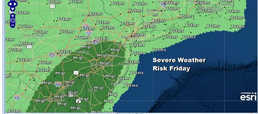
Severe Weather Risk Today Heat Humidity into Next Week
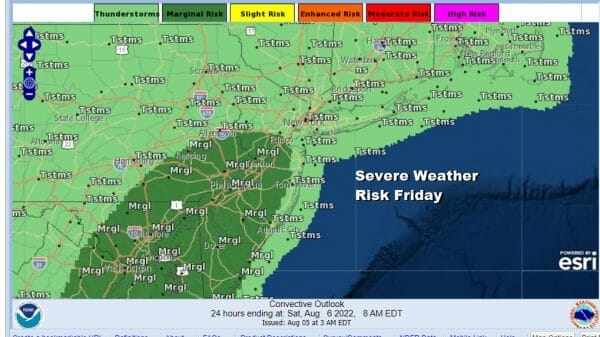
We have another hot humid day ahead of us but we will be about 5 to 7 degrees lower than yesterday. Clouds will hold the temperatures down. A cold front is approaching us from the west today and that could set off some scattered thunderstorms and isolated severe thunderstorms where the Storm Prediction Center has placed in the marginal risk.This area is Central and South Jersey & Southeast Pennsylvania southward.
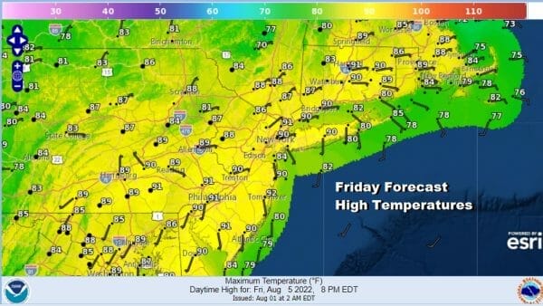
Highs this afternoon will reach up into the lower 90s. The dew points remain stubbornly high and unfortunately, this weather front will fall apart after it passes through and that means no relief from the 90 degree plus heat and the high levels of humidity. It is going to feel like your living inside a hot sponge through the weekend and probably through next Tuesday.
SATELLITE

WEATHER RADAR

Not everyone will see thunderstorms today so the need for a widespread soaking rain event continues. Once thunderstorms if any play through this evening we will have leftover clouds overnight with lows in the upper 60s to middle 70s.
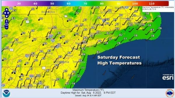
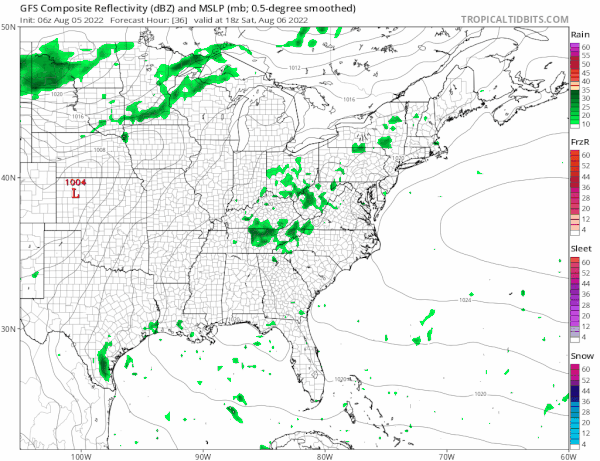
Saturday we are left with the corpse of the dying cold front. This will leave us in clouds and some sunshine. There will be some slight temperature relief with highs in the upper 80s to some lower 90s. Humdiity levels will be high and the air mass somewhat unstable could set off some scattered thunderstorms in the afternoon mostly inland.They should mostly disappear after sundown.

Sunday it is back to sunshine, high humidity, and only a low chance for an isolated downpour or thunderstorm. Temperatures will climb to a range of 90 to 95 though it will be a little coolerl along east and south facing shorelines.
Hot humid weather continues Monday with highs in the low to mid 90s. There is the chance for scattered thunderstorms in the afternoon and evening as another cold front arrives. That front will stall out and die off like tonight’s front so it remains hot and humid Tuesday with scattered thunderstorms. Highs will be in the lower 90s. Models are trying to figure out the latter part of next week. Another front approaches Wednesday with a chance for showers and thunderstorms. Highs will be in the 80s. A more robust cooler Canadian air mass will try and move into the Eastern Us for late next week and that will bring genuine relief to heat and humidity especially of the more robust solutions wind up becoming reality.
BE SURE TO DOWNLOAD THE FREE METEOROLOGIST JOE CIOFFI WEATHER APP &
ANGRY BEN’S FREE WEATHER APP “THE ANGRY WEATHERMAN!
MANY THANKS TO TROPICAL TIDBITS & F5 WEATHER FOR THE USE OF MAPS
Please note that with regards to any severe weather, tropical storms, or hurricanes, should a storm be threatening, please consult your local National Weather Service office or your local government officials about what action you should be taking to protect life and property.


