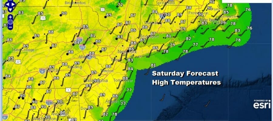
Hot Sponge Continues Into Next Week, Low Chance For Any Rain
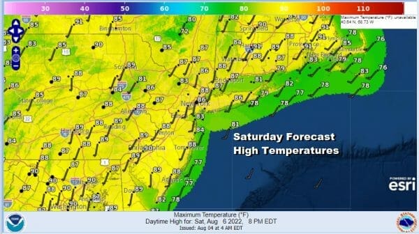
Yesterday’s weather front did nothing to bring down dew points and lower humidity even slightly. The corpse of that cold front is now along the coast and crumbling apart. High pressure offshore or the Bermuda high is building back westward keeping us in what I have been referring to as a hot sponge of heat and humidity. We will have some clouds in the mix today which will reduce the daytime heating somewhat but we will have enough sunshine to take temperatures to the upper 80s and lower 90s. For many areas this will be the 5th day in a row of highs of 90 or higher.
SATELLITE

WEATHER RADAR

You would think that with the high humidity and heat we could at least generate some thunderstorm activity and some much needed rain but unfortunately a dying front and a building high do not help the cause. Some widely scattered thunderstorms are possible but we do mean widely scattered.

Tonight will be very warm and humid with most lows in the 70s except for some 60s well inland. Sunday it will be a hot humid day with sunshine and little chance for a shower or thunderstorm. Highs will reach into the 90s. About the only places that will have some relief from the heat will be the beaches as the wind will be parallel to east facing shorelines and south facing shore lines will get the breeze directly. Even at the beaches temperatures will be in the 80s.

Next week starts of hot and humid Monday with sunshine and highs into the 90s. We have what has become routine around here this summer. An upper trough approaches followed by a cold front the next day. Look for a chance for showers and thunderstorms Monday afternoon and evening. They should be scattered in nature but perhaps more areas will get some rain from this.
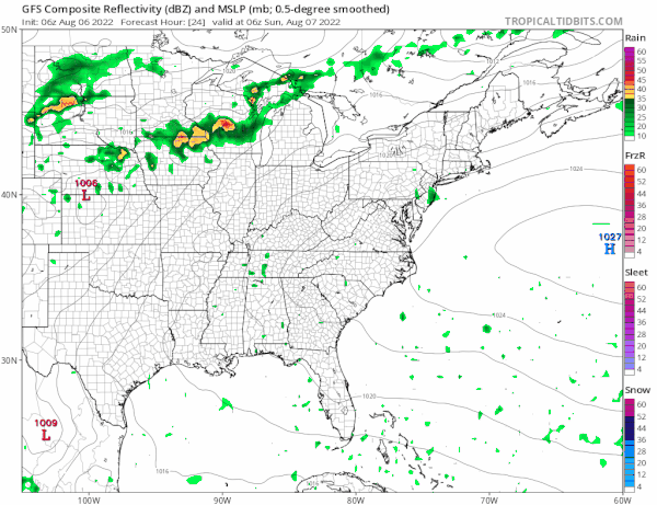
The cold front part of this equation will come later Tuesday into Tuesday evening with the chance for showers and thunderstorms. Highs will be in the upper 80s to around 90 or so. This front will then give way to another front and stronger upper trough with another chance for showers and thunderstorms Wednesday night and if the GFS is right we could see a wave with a period of much needed rain Thursday. Temperatures will continue to trend lower until finally we get into some lower humidity and temperatures just in the low to mid 80s for Friday and going into next weekend. Keep your fingers crossed on this idea.
BE SURE TO DOWNLOAD THE FREE METEOROLOGIST JOE CIOFFI WEATHER APP &
ANGRY BEN’S FREE WEATHER APP “THE ANGRY WEATHERMAN!
MANY THANKS TO TROPICAL TIDBITS & F5 WEATHER FOR THE USE OF MAPS
Please note that with regards to any severe weather, tropical storms, or hurricanes, should a storm be threatening, please consult your local National Weather Service office or your local government officials about what action you should be taking to protect life and property.


