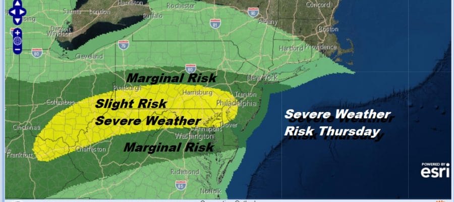
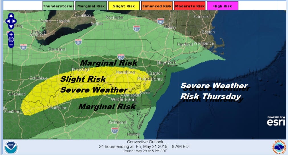
Severe Weather Risk Thursday A Bit Less Than Last Two Days
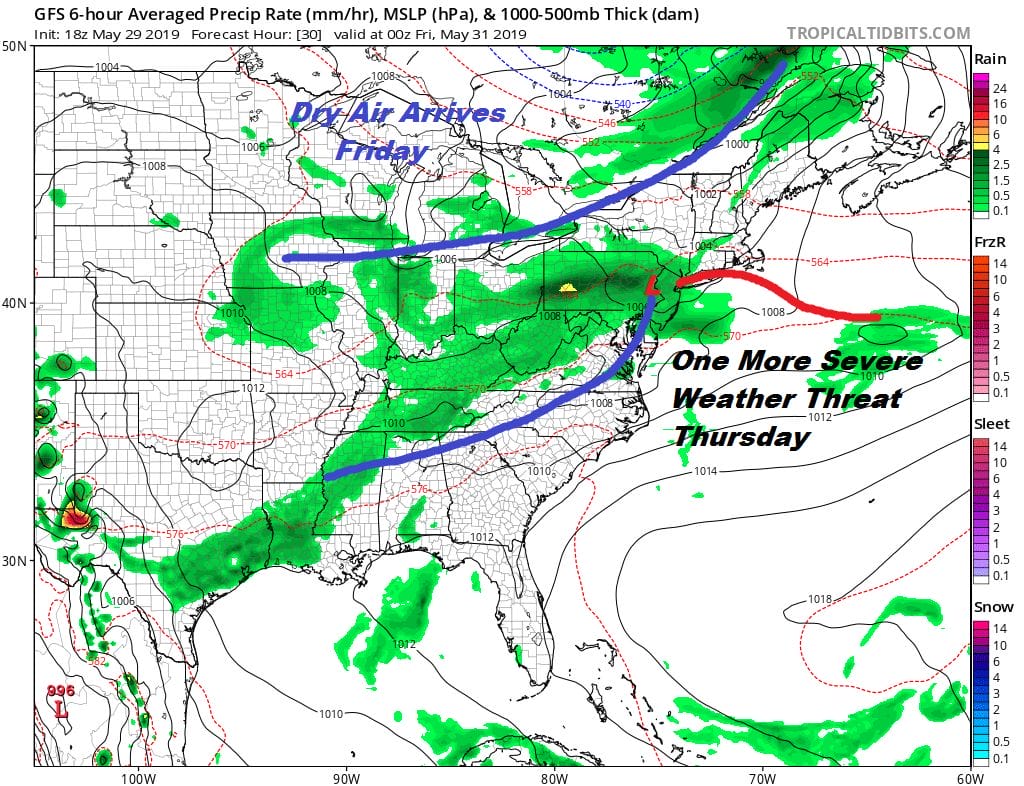
Two days of back to back severe weather outbreaks impacting Pennsylvania & New Jersey doesn’t happen too often around here (thankfully) however we aren’t done yet. Today’s buckling frontal boundary is winding down as thunderstorms move out to the east and rains subside. Weather conditions will improve during the overnight. However we are not done with this frontal boundary as it will produce one more wave moving eastward on Thursday and one more round of severe weather.
This is going to be another battle of where is the warm humid air verses the cool stable marine air. The Storm Prediction Center has a relatively small area of risk indicated for Friday and most of it across Southern Pennsylvania and South Jersey. We may see this adjusted a bit but Thursday’s potential seems to be the weakest of the three.
Tonight’s satellite picture shows us what is left of the thunderstorms as they move through South Jersey and Long Island soon to exit to the east. We see leftover clouds to the northwest and skies will be slow to clear but we may see some partial clearing of skies during the early morning hours. Lows will be in the 50s to near 60.
SATELLITE

REGIONAL RADAR

We still are seeing some leftover flash flood warnings over Southern New Jersey coupled with a few severe thunderstorm warnings and special marine warnings. North and west of the coast using NYC as a reference point, it is all done.
LOCAL RADAR NEW YORK CITY

LOCAL RADAR PHILADELPHIA


Let’s move on to Thursday which will play out in much the same way as the last two days. Clouds with some sun. Look for 60s to lower 70s over Long Island and Southern New England with upper 70s to mid 80s from Northern NJ southward. A round of downpours and thunderstorms late in the afternoon and evening. Hopefully we won’t make it 3 days in a row of tornado watches. Whatever is happening shower and thunderstorm wise moves out tomorrow evening and weather conditions will improve nicely overnight and for Friday. We look for sunshine with highs reaching into the 80s just about everywhere but with relatively low humidity.
As far as the weekend and long range go we have the latest JOESTRADAMUS long range post for your viewing & reading pleasure.
MANY THANKS TO TROPICAL TIDBITS FOR THE USE OF MAPS
Please note that with regards to any tropical storms or hurricanes, should a storm be threatening, please consult your local National Weather Service office or your local government officials about what action you should be taking to protect life and property.


