
Severe Weather Risk Saturday Evening
STORM PREDICTION CENTER SEVERE WEATHER RISK SATURDAY
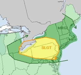
With regards to the weather over the next 5 days much of the time it will be fine. The only risk comes late Saturday afternoon in western areas of New Jersey and Eastern Pennsylvania where the Storm Prediction Center outlines an area of slight risk of severe with a larger area of marginal risk covering the Northern Middle Atlantic and Northeast.
Severe Weather Risk Saturday Evening NAM MODEL SATURDAY 1PM

Severe Weather Risk Saturday Evening GFS MODEL SATURDAY EVENING 8PM
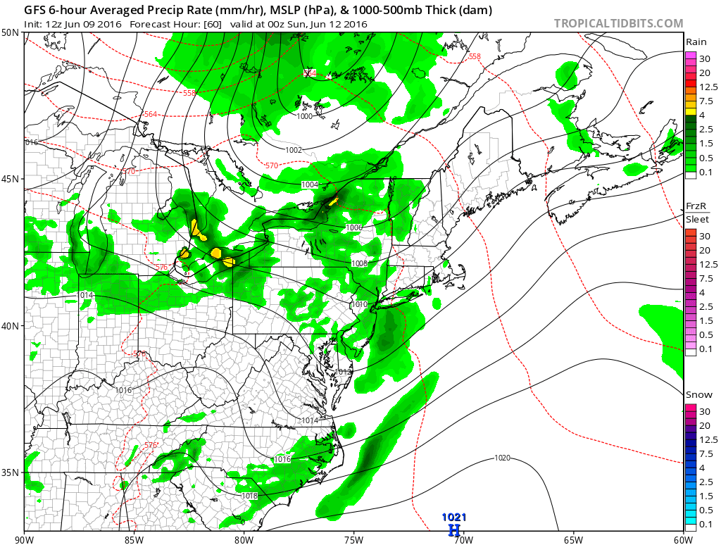
We have a cold front approaching Saturday night but weather models are all over the place on this. The NAM races an area of thunderstorms here Saturday morning into the afternoon. I don’t buy this idea at all. The GFS has something coming through in the evening but it seems like they would be more scattered in nature. The European model has absolutely nothing and keeps everything well inland and west. I think the best approach from a forecast standpoint is to allow for the possibility of thunderstorms and leave it at that.
Severe Weather Risk Saturday Evening GFS UPPER AIR MONDAY 2PM
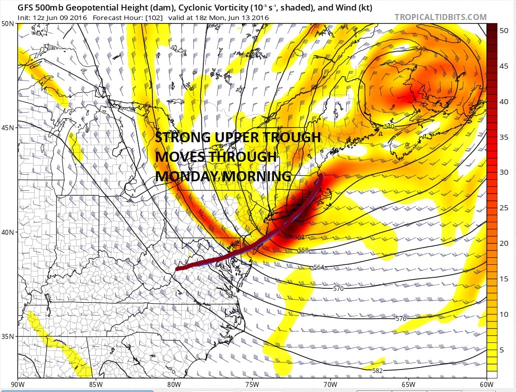
The only other issue I see is Monday morning with a strong upper air disturbance moving through. The difference between this system and yesterday’s is that the trough position is much further east so this might limit development when it comes through. I would consider the chance for a passing shower or two with this for the time being. Other than these 2 issues the weather looks good through the middle of next week. 70s to near 80 degrees on Friday. Saturday will be in the upper 70s to lower 80s. Sunday will be very warm with highs in the 80s..and then it turns cooler for the first part of next week with highs in the 70s.
JOESTRADAMUS HURRICANE SEASON GUEST FORECAST

MENTION JOE CIOFFI AND GET A 5% DISCOUNT
FiOS1 News Weather Forecast For Long Island
FiOS1 News Weather Forecast For New Jersey
FiOS1 News Weather Forecast For Hudson Valley
NATIONAL WEATHER SERVICE SNOW FORECASTS
LATEST JOESTRADAMUS ON THE LONG RANGE
Weather App

Don’t be without Meteorologist Joe Cioffi’s weather app. It is really a meteorologist app because you get my forecasts and my analysis and not some automated computer generated forecast based on the GFS model. This is why your app forecast changes every 6 hours. It is model driven with no human input at all. It gives you an icon, a temperature and no insight whatsoever.
It is a complete weather app to suit your forecast needs. All the weather information you need is right on your phone. Android or I-phone, use it to keep track of all the latest weather information and forecasts. This weather app is also free of advertising so you don’t have to worry about security issues with your device. An accurate forecast and no worries that your device is being compromised.
Use it in conjunction with my website and my facebook and twitter and you have complete weather coverage of all the latest weather and the long range outlook. The website has been redone and upgraded. Its easy to use and everything is archived so you can see how well Joe does or doesn’t do when it comes to forecasts and outlooks.
Just click on the google play button or the apple store button on the sidebar for my app which is on My Weather Concierge. Download the app for free. Subscribe to my forecasts on an ad free environment for just 99 cents a month.
Get my forecasts in the palm of your hand for less than the cost of a cup of Joe!
![]()

