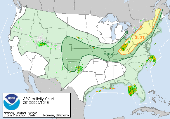
With an approaching cold front into this hot air we have today one could consider the risk for severe weather however the front timing is more for late tonight and I think thunderstorm activity will stay well west of us today..Mainly from the New Jersey/Pennsylvania border westerward and only getting there in the late afternoon at the earliest. Storm threat time will be from 6pm to midnight from west to east and I suspect storms will be in a weakening phase by the time they reach the coastline. Slight risk for severe weather from Eastern Pennsylvania westward as indicated by the map from the Storm Prediction Center.
Once the front passes through Tuesday morning lower humidity will gradually take over and I think the thunderstorm risk on Tuesday is minimal at best and in some cases non existant.