
Severe Weather Risk Late Today Warm Humid Weekend Hot Early Next Week

Here we are at the doorstep of the weekend and we have a cold front that will be approaching late this afternoon and evening. This front could set off a few scattered thunderstorms this evening and one or two of those cells could be severe. The Storm Prediction Center has much of the Northeast at risk for severe weather and they have also expanded the area of slight risk a little further south.
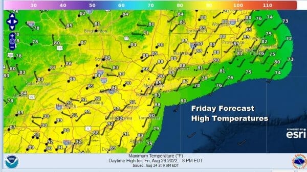
There will be enough sunshine to take highs to the upper 80s and lower 90s. The thunderstorm risk time will be from 4pm to 9pm tonight as the front passes. That will leave us in warm humid conditions overnight with lows in the mid 60s to lower 70s.

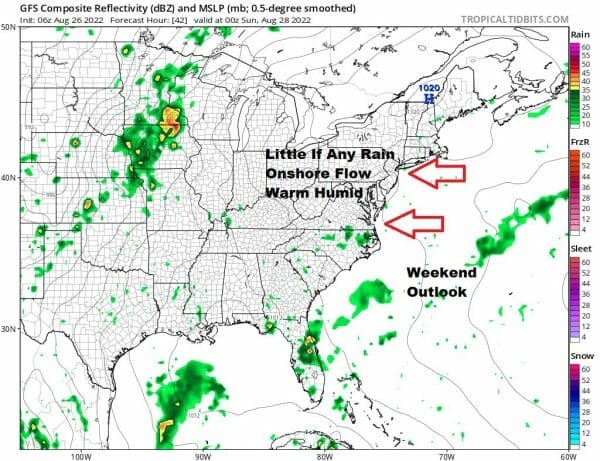
Saturday and Sunday we will be in rather dry set up in the Northeast and Mid Atlantic from the standpoint of rain. There won’t be any rain to speak of unless there is an isolated shower or thunderstorm. High pressure will build into New England and that puts us in an onshore flow for both Saturday and Sunday. Highs Saturday will be in the mid to upper 80s inland and upper 70s and lower 80s along the coast. Skies should be no worse than partly sunny.
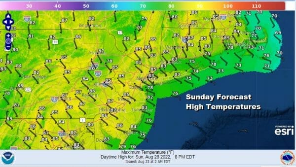
Sunday we will see more of the same with no worse than partly sunny skies. Highs will again be in the mid to upper 80s with readings about 10 degrees or so cooler at the shore.
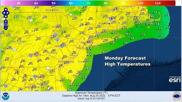
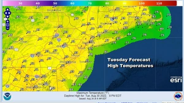
The onshore flow will turn southwest Monday and Tuesday leading us to 2 hot days. Both days will feature sunshine. There might be a late shower or thunderstorm Monday and agani Tuesday as a weak upper trough moves through. Monday highs will reach the upper 80s and lower 90s. Tuesday we will see highs reach between 90 and 95 degrees inland. Temperatures both days will be a little cooler at the shore.
Wednesday of next week brings a stronger cold front and that should be the last hot and humid day. Highs will reach the upper 80s to lower 90s with partly sunny skies and the chance for late thunderstorms. Cooler less humid weather should move in for the end of next week.
BE SURE TO DOWNLOAD THE FREE METEOROLOGIST JOE CIOFFI WEATHER APP &
ANGRY BEN’S FREE WEATHER APP “THE ANGRY WEATHERMAN!
MANY THANKS TO TROPICAL TIDBITS & F5 WEATHER FOR THE USE OF MAPS
Please note that with regards to any severe weather, tropical storms, or hurricanes, should a storm be threatening, please consult your local National Weather Service office or your local government officials about what action you should be taking to protect life and property.


