Very Warm Humid Weekend No Rain, Hot Humid Monday & Tuesday

The weekend is here and after a cold front passed offshore last night we are left with a very warm and somewhat humid air mass for the weekend. The wind will be coming in from off the ocean which will hold the temperatures down to an extent but not by much. Skies will be no worse than partly sunny. There is little to no chance for an isolated shower or thunderstorm. Highs today will be in the mid 80s to near 90 well inland while it will be in the upper 70s and lower 80s along the shore.
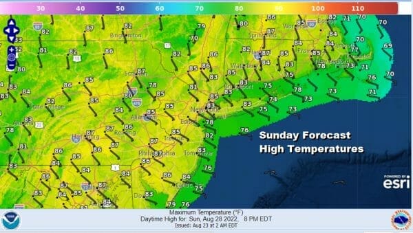
There are no issues overnight other than it will be warm and humid with most lows in the mid 60s to lower 70s. Sunday will be a repeat performance of today with sunshine and an onshore wind again. Highs once again will be in the mid 80s to near 90 degrees inland while along the shore temperatures will be in the upper 70s and lower 80s. Also there is little to no chance for any rain other than an isolated shower or thunderstorm.
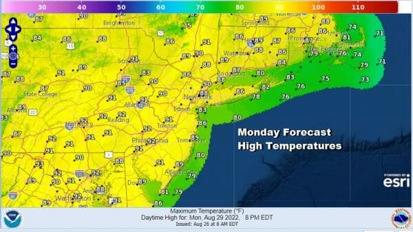
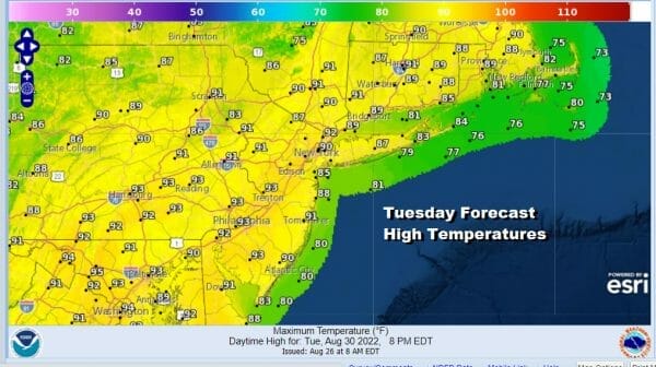
Starting Monday the onshore flow becomes a southwest flow and that will lead to two hot days for Monday and Tuesday. We see partly sunny conditions Monday and Tuesday. Highs both days will reach the upper 80s and lower 90s.
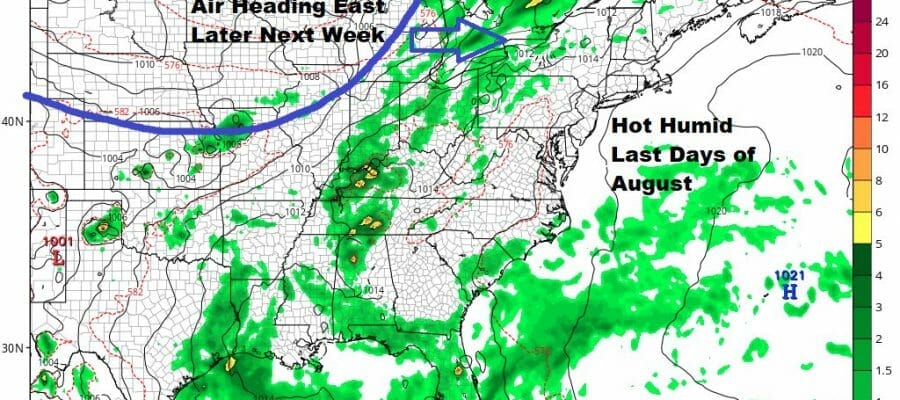
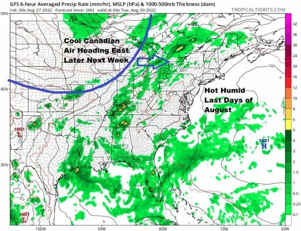
There could be a scattered shower or thunderstorm Monday but a higher chance is likely Tuesday as a cold front moves its way across the East. This should put an end to the hot weather on Wednesday as the front moves offshore and a dry cool Canadian air mass builds in for the second half of next week.
BE SURE TO DOWNLOAD THE FREE METEOROLOGIST JOE CIOFFI WEATHER APP &
ANGRY BEN’S FREE WEATHER APP “THE ANGRY WEATHERMAN!
MANY THANKS TO TROPICAL TIDBITS & F5 WEATHER FOR THE USE OF MAPS
Please note that with regards to any severe weather, tropical storms, or hurricanes, should a storm be threatening, please consult your local National Weather Service office or your local government officials about what action you should be taking to protect life and property.


