
Severe Weather Risk Late Today & Tonight Eastern Pennsylvania
New Jersey Hudson Valley Connecticut
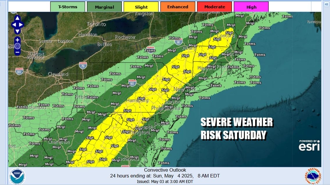
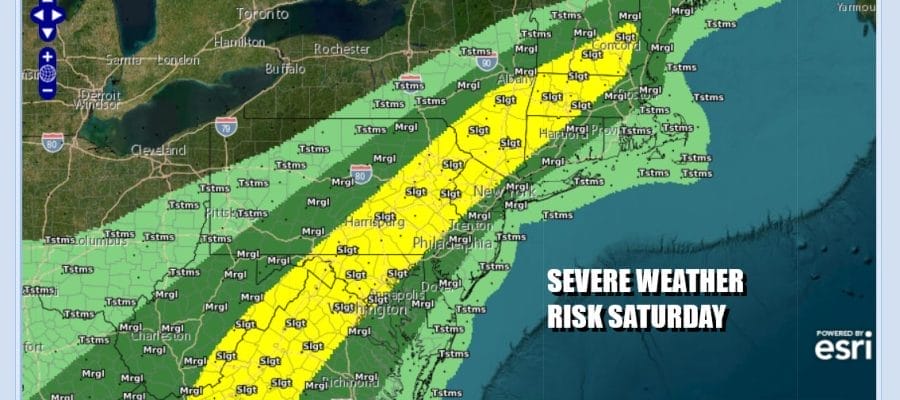
We are in the throws of a very warm and very unstable atmosphere. Add some daytime heating to the mix and you have the recipe for thunderstorms and severe weather potential The Storm Prediction Center is indicating a risk for severe thunderstorms for much of Eastern Pennsylvania, Northern New Jersey, the Hudson Valley and Connecticut. A slight risk or 15 percent chance is indicated with lower risk for isolated severe thunderstorms further to the east and near the coast.
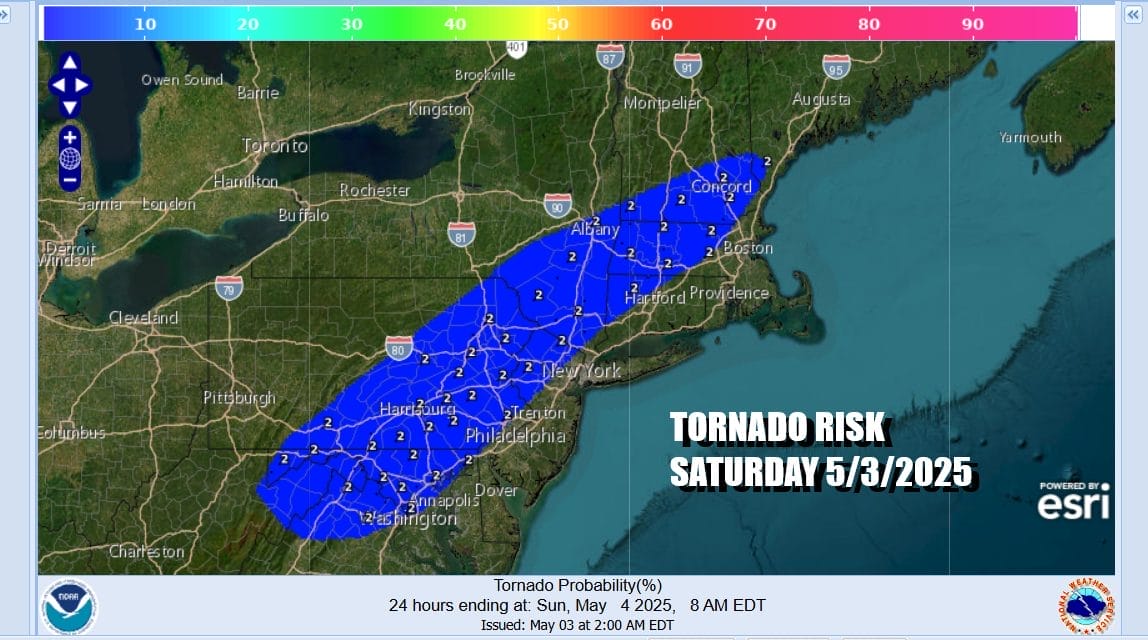
We also have the possibility of a tornado or two spinning up in the region of slight risk. The risk value is a relative low 2 percent chance. In the midst of all this we await the arrival of clouds, showers and thunderstorms. Some could pop up around midday and then become more numerous later this afternoon and this evening especially inland areas. Most highs today will be in the 80s except for upper 60s and lower 70s along the immediate coast.
SATELLITE WITH LIGHTNING STRIKES

WEATHER RADAR

Weather models are showing showers and thunderstorms this evening and into the first part of tonight. The low basically stalls out in the Ohio Valley and you can see the surface low just spin in a counter clockwise rotation through early Monday. Showers and thunderstorms will develop to the south and like an arm, rotate north and northwestward during the day Sunday.

We will probably see downpours develop later Sunday morning into the afternoon and continue Sunday night into early Monday morning. Low pressure will remain to the west with a stalled cold front in the Appalachians. You can expect more downpours and possible thunderstorms Monday and also Tuesday. Temperatures Monday and Tuesday will be mostly in the 70s. It may not be until later Wednesday or possibly Thursday that we see real improvement in weather conditions. Showers will still be an issue Wednesday but by Thursday we should be dry. High temperatures both Wednesday and Thursday will be in the 70s.
BE SURE TO DOWNLOAD THE FREE METEOROLOGIST JOE CIOFFI WEATHER APP &
ANGRY BEN’S FREE WEATHER APP “THE ANGRY WEATHERMAN!
MANY THANKS TO TROPICAL TIDBITS FOR THE USE OF MAPS
Please note that with regards to any severe weather, tropical storms, or hurricanes, should a storm be threatening, please consult your local National Weather Service office or your local government officials about what action you should be taking to protect life and property.


