
Weekend Brings Thunderstorm & Severe Weather Risk Saturday
Rounds of Rain Later Sunday
We are finishing up the week with very warm temperatures. A warm front passed through overnight and some areas had a downpour or thunderstorm with that front going by. Now we are left in a warmer and eventually a more humid air mass. We will see sunshine today and that will send temperatures up into the 80s in most inland places with 70s along south and east facing shorelines. Radars should remain mostly quiet locally during the day and into this evening.
SATELLITE WITH LIGHTNING STRIKES

WEATHER RADAR

Warm & humid conditions tonight means that most lows will be in the upper 50s to mid 60s. This isg oing to set us up for a very warm and humid Saturday. A cold front will be approaching as low pressure in the Ohio Valley becomes the center of attention weatherwise over the weekend and next week. Warm tropical moist air will be funneling up the East Coast which sets up for rounds of showers, thunderstorms and eventually a soaking rain early next week.

The set up for Saturday involves lots of efficient daytime heating and an increasingly unstable atmosphere. Later in the afternoon and evening Saturday as the European model shows we will see areas of showers and thunderstorms develop across New York State Pennsylvania, Maryland, and Virginia and the eventually spreading into New Jersey, Southeastern NY and Long Island as well as Southern New England.
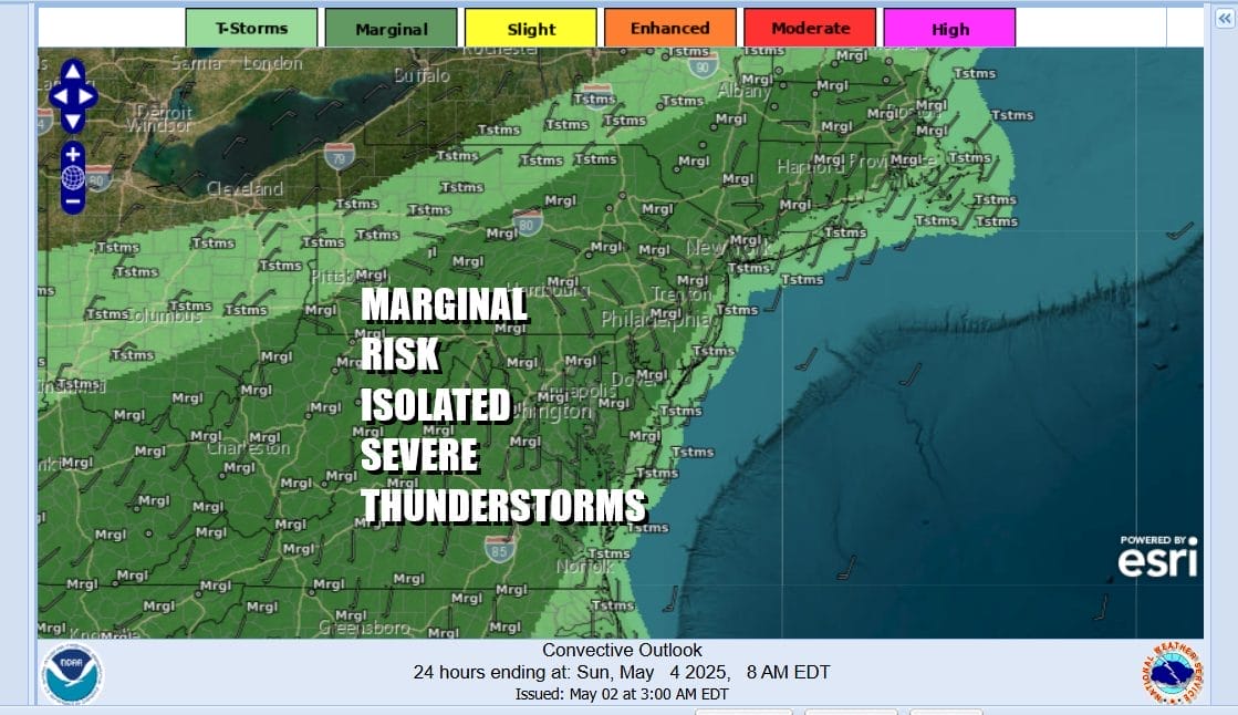
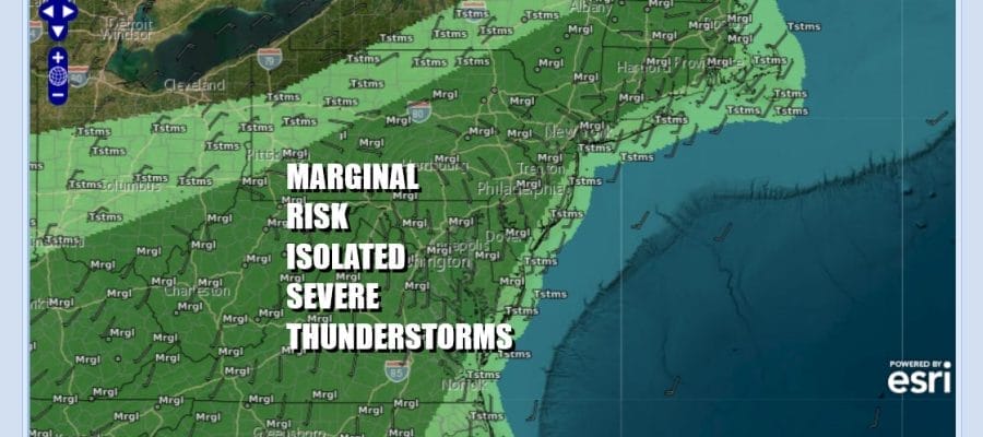
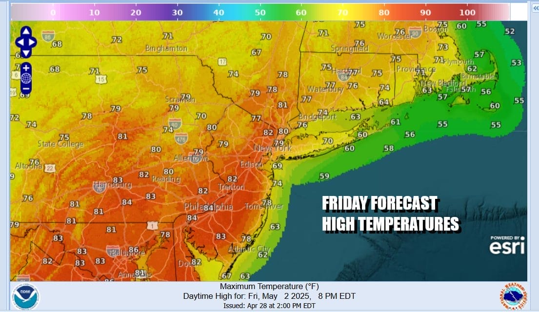
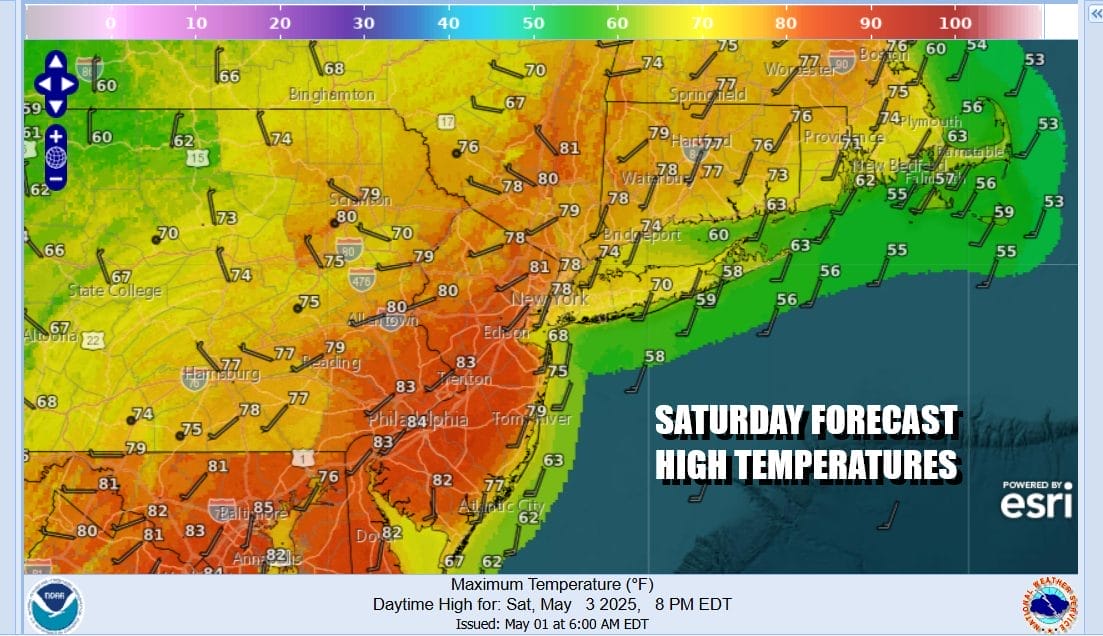
The Storm Prediction Center is indicating a large geographic area of marginal risk which means the potential for isolated severe thunderstorms. However it is likely that the Storm Prediction Center will add an area of slight risk somewhere in the Northern Mid Atlantic once the forecast becomes clearer. Temperatures Saturday will be in the 80s away from the coast and 70s along south and east facing shorelines.
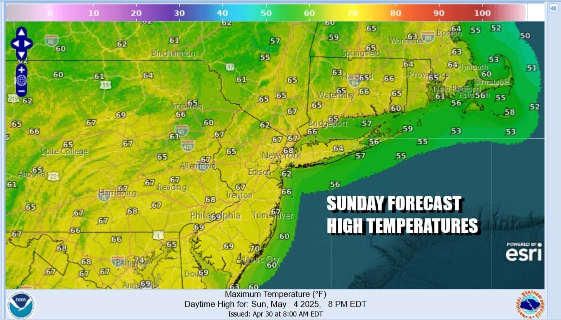
There will be some sunshine Saturday before storms develop. A frontal boundary will stall to our west in the Appalachians and will make very little eastward progress. Sunday will be cloudy with lower temperatures but rain and some heavier downpours will develop from south to north later in the day and continue on and off into Monday. Temperatures Sunday will be in the upper 60s to mid 70s.
The stalled weather front will likely remain stalled through Tuesday before making a move to the east and offshore. Rounds of rain and thunderstorms will continue across the Mid Atlantic to New England through Tuesday before the front finally passes offshore. Weather conditions are likely to improve Wednesday. These rounds of rain could be substantial, totaling several inches or more especially for areas inland. This should relieve dry conditions that are still in place for much of the area from Eastern Pennsylvania to Southern New England.
BE SURE TO DOWNLOAD THE FREE METEOROLOGIST JOE CIOFFI WEATHER APP &
ANGRY BEN’S FREE WEATHER APP “THE ANGRY WEATHERMAN!
MANY THANKS TO TROPICAL TIDBITS FOR THE USE OF MAPS
Please note that with regards to any severe weather, tropical storms, or hurricanes, should a storm be threatening, please consult your local National Weather Service office or your local government officials about what action you should be taking to protect life and property.


