Severe Weather Risk Late Today Into Tonight
For Much fo Eastern Pennsylvania to Southern New England

Severe Weather Risk Late Today Into Tonight
For Much fo Eastern Pennsylvania to Southern New England
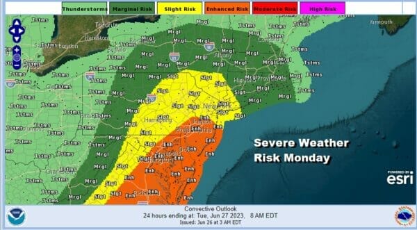
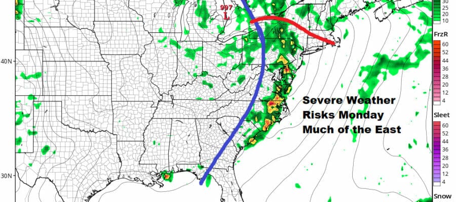
Today is going to be an interesting day along the East Coast as we have the potential for a rather busy afternoon and evening. Thunderstorms and severe weather will be moving eastward ahead of a strong upper trough and cold front. The result is we have enhanced risk for severe weather from Central NJ southward and slight risk reaching up into Southern New England and Long Island. Marginal risk zones are further north into Upstate NY and New England.

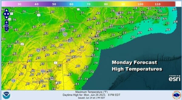
Ahead of the thunderstorms you an expect very humid conditions today with highs in the 80s. Ample daytime heating and high dew points plus the dynamics of the cold front will likely set off multiple lines of thunderstorms later today and into this evening as the HRRR model shows.
SATELLITE

WEATHER RADAR

Satellites and radars aren’t showing much this morning but activity will pick up as the day wears on. Scattered thunderstorms will start to cluster after lunchtime and then we will monitor where more potent lines of thunderstorms develop. Peak time for thunderstorms will be this evening and into the first part of tonight.
This front is not going to be moving far offshore and we have the upper trough over the Great Lakes moving very little over the next couple of days. This is going to lead to some more showers and thunderstorms late Tuesday and some of those storm could potentially be strong. Marginal risk for Tuesday from Southern New England to the Coastal Mid Atlantic means a 5% chance for isolated severe thunderstorms.
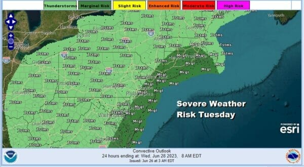
As for the weather Tuesday it will be another muggy day with sunshine and clouds, high humidity and highs in the upper 70s and lower 80s. We need to see the upper air system move along to the East in order to see some genuine improvement in weather conditions overall.

We probably will have to get through Wednesday when another trough moves through the Northeast giving us the chance for late thunderstorms. Otherwise it will be a warm and somewhat humid day with highs in the upper 70s and lower 80s. We could see some improvement Thursday and Friday with minimal shower and thunderstorm risk and more in the way of sunshine. Highs both days will be into the 80s.
BE SURE TO DOWNLOAD THE FREE METEOROLOGIST JOE CIOFFI WEATHER APP &
ANGRY BEN’S FREE WEATHER APP “THE ANGRY WEATHERMAN!
MANY THANKS TO TROPICAL TIDBITS FOR THE USE OF MAPS
Please note that with regards to any severe weather, tropical storms, or hurricanes, should a storm be threatening, please consult your local National Weather Service office or your local government officials about what action you should be taking to protect life and property.
(Amazon is an affilate of Meteorologist Joe Cioffi & earns commissions on sales.)


