Severe Weather Gives Way To Plunging Temperatures
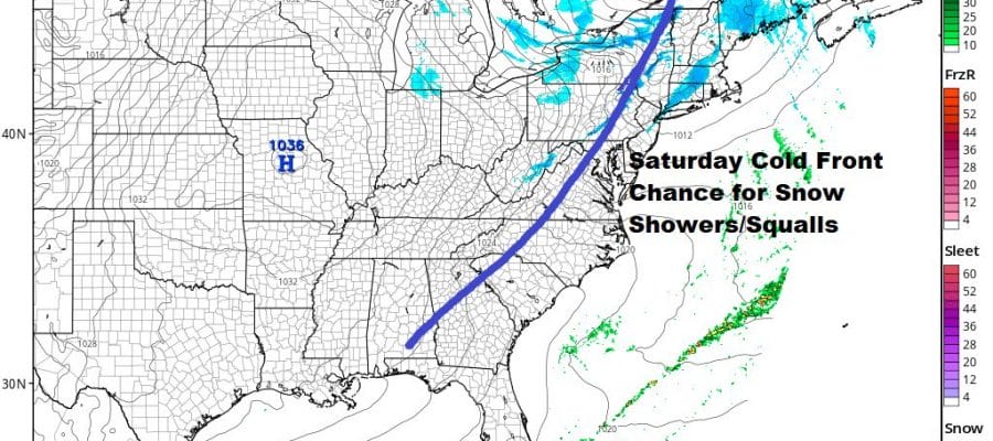
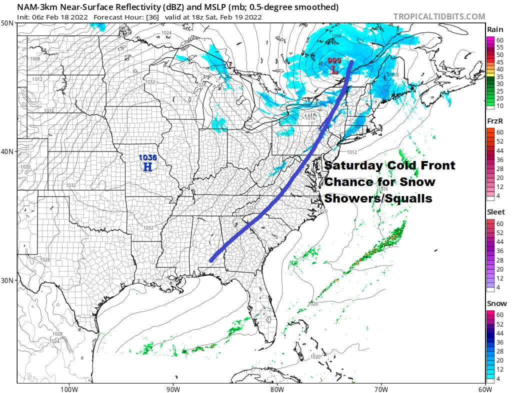
Snow Showers Snow Squalls Saturday

Severe Weather Gives Way To Plunging Temperatures
Snow Showers Snow Squalls Saturday
After a night of howling winds and rain, we have severe weather that moved through this morning. Once the cold front moves offshore temperatures will take a nose dive as skies become partly to mostly sunny. It will remain breezy through the rest of the day and temperatures which started out the day close to 60, will finish off in the middle to upper 30s by late afternoon and evening. The satellite shows the back edge of the clouds and that is sliding to the east while the radar shows the last of the rain and thunderstorms moving east and offshore.
SATELLITE

WEATHER RADAR

Tonight will be a very cold night as skies clear out and winds will still continue to be gusty at times. Lows will be in the teens to lower 20s.Saturday we have another cold front coming through in the afternoon along with a sharp upper trough. This sets us up for the possibility of snow showers and perhaps a heavier snow squall that could whiten up the ground up in some places. Highs will be in the upper 30s and lower 40s. Not all of you will see these snow showers and snow squalls but the upper trough is impressive enough to put it in the forecast.
Sunday will be a cold and sunny day with highs mostly in the 30s. Next week sees the same pattern continue. Last night’s storm was the first of three in this series. Each one will track out of the Plains and head northeast. Each one will make a dent in the ridge off the southeast coast. The second will arrive on Tuesday so Monday looks good with sunshine and perhaps some late day clouds. Highs Monday will be back into the 50s with a southwest wind.

Tuesday brings rain and warm temperatures again with highs im the 50s. The track of this low will be further to the east than last night’s storm system. The third comes at the end of the week. Cold air will be spreading across all of Southern Canada from west to east and some of that cold air will drain southward as the next wave comes out of the southwest. This one could have some cold air to play with so we will be watching the developments of the weather pattern going forward for next week and beyond.
BE SURE TO DOWNLOAD THE FREE METEOROLOGIST JOE CIOFFI WEATHER APP &
ANGRY BEN’S FREE WEATHER APP “THE ANGRY WEATHERMAN!
MANY THANKS TO TROPICAL TIDBITS & F5 WEATHER FOR THE USE OF MAPS
Please note that with regards to any severe weather, tropical storms, or hurricanes, should a storm be threatening, please consult your local National Weather Service office or your local government officials about what action you should be taking to protect life and property.


