Self Destructive Sunshine Next 4 Days As Cold Unstable Pattern Holds Firm

Self Destructive Sunshine Next 4 Days As Cold Unstable Pattern Holds Firm
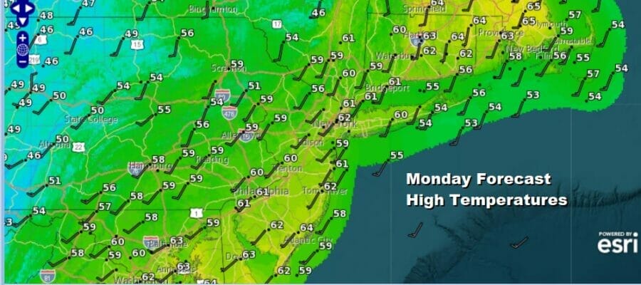
Yesterday’s storm system is now to our north and we have seen some improvement as the rains have come to an end. We have a gusty wind to deal with today and we will also see sunshine developing. However some clouds will develop this afternoon especially inland. The air over head is going to be very cold and unstable and there could be a few scattered showers that develop in areas away from the coast. As for temperatures today we will be in the 50s to around 60 degrees. This will be the theme this week as we will experience below average temperatures all week long.
SATELLITE

WEATHER RADAR

Tonight skies should partially clear and it will remain breezy with lows mostly in the 40s. Tuesday and Wednesday we are going to experience what I call self destructive sunshine. This is where days start out with some sun or some breaks of sun and then as the morning wears on clouds develop and take over the sky. Add to this a gusty wind and temperatures will be struggling.

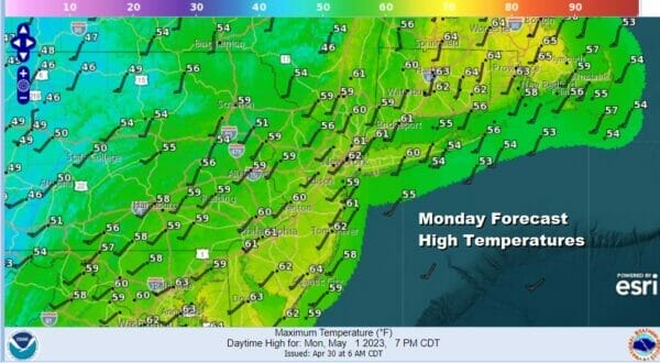
Afternoon highs Tuesday will not get out of the 50s. There will also be some rain showers that will develop and there might even be the odd thunderstorm that produces small hail. This is again thanks to very cold unstable air aloft. The same story holds for Wednesday as this storm system aloft in Eastern Canada begins a move southeastward.
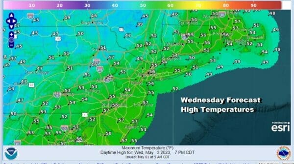
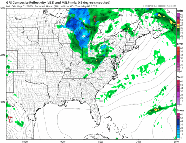
The blocking upper low moving southeastward and off the New Jersey coast will force a storm to form offshore and move slowly east. We will basically continue with the ideal of self destructive sun and showers for Wednesday and Thursday. It will continue to be breezy and on the cold side of average. Highs Wednesday again will be just in the 50s. Nights in a pattern like this usually see the atmosphere stabilize and showers tend to weaken and disappear. Most nighttime lows will be in the 40s with 30s inland.
Thursday and Friday we see more of the same with sun to clouds and some scattered showers with highs both days in the 50s but finally we will see higher pressures and a more stable atmosphere for this coming weekend. We see sunshine for Saturday and Sunday and highs should be able to edge back into the 60s.
BE SURE TO DOWNLOAD THE FREE METEOROLOGIST JOE CIOFFI WEATHER APP &
ANGRY BEN’S FREE WEATHER APP “THE ANGRY WEATHERMAN!
MANY THANKS TO TROPICAL TIDBITS & F5 WEATHER FOR THE USE OF MAPS
Please note that with regards to any severe weather, tropical storms, or hurricanes, should a storm be threatening, please consult your local National Weather Service office or your local government officials about what action you should be taking to protect life and property.


