Scattered Thunderstorm Risk Today & Wednesday
Otherwise Mostly Dry Through Friday

Scattered Thunderstorm Risk Today & Wednesday
Otherwise Mostly Dry Through Friday
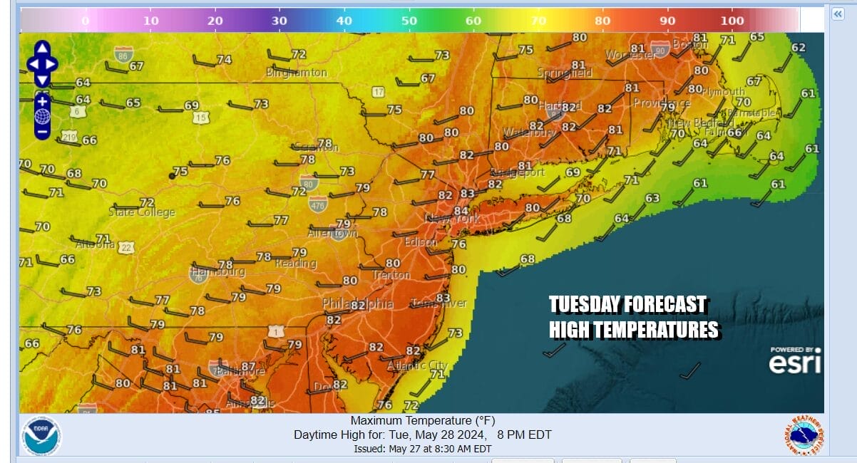
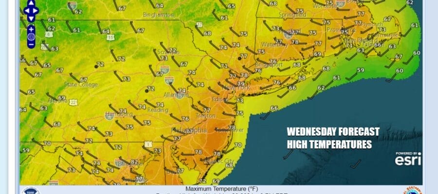
The holiday weekend is over and so is the risk for widespread severe weather but we will see thunderstorm risk the next couple of days and there is always the chance for isolated severe thundertorms. Storms however will be scattered in nature and not everyone will see storms. In fact most of you will likely see mainly dry conditions. That said satellite loops show us under the influence of several upper troughs that will be in play this week with one moving through today, the other late Wednesday and the third Thursday night into Friday. As for today we see sunshine mixing with developing clouds especially inland and we will through in the chance for a shower or thunderstorm in the afternoon and evening. High temperatures will be into the 80s with temperatures a little lower near the coast with local sea breezes.
SATELLITE WITH LIGHTNING STRIKES

WEATHER RADAR

Most lows tonight will be in the upper 50s to mid 60s. Any showers or storms around this evening will disappear and we will have a mix of clear skies and leftover clouds overnight. Wednesday we see the next upper trough approach and an associated cold front move southeast from the Great Lakes and Upstate NY and New England. There is probably a higher chance for showers and thunderstorms scattered around. Again the best chances will be inland.

Wednesday will be another day which starts with some sunshine only to see clouds building and the risk for afternoon and evening scattered showers and thunderstorms. Temperatures will take a stair step down by a few degrees but we will still see most highs reach the 70s to around 80 degrees or so.

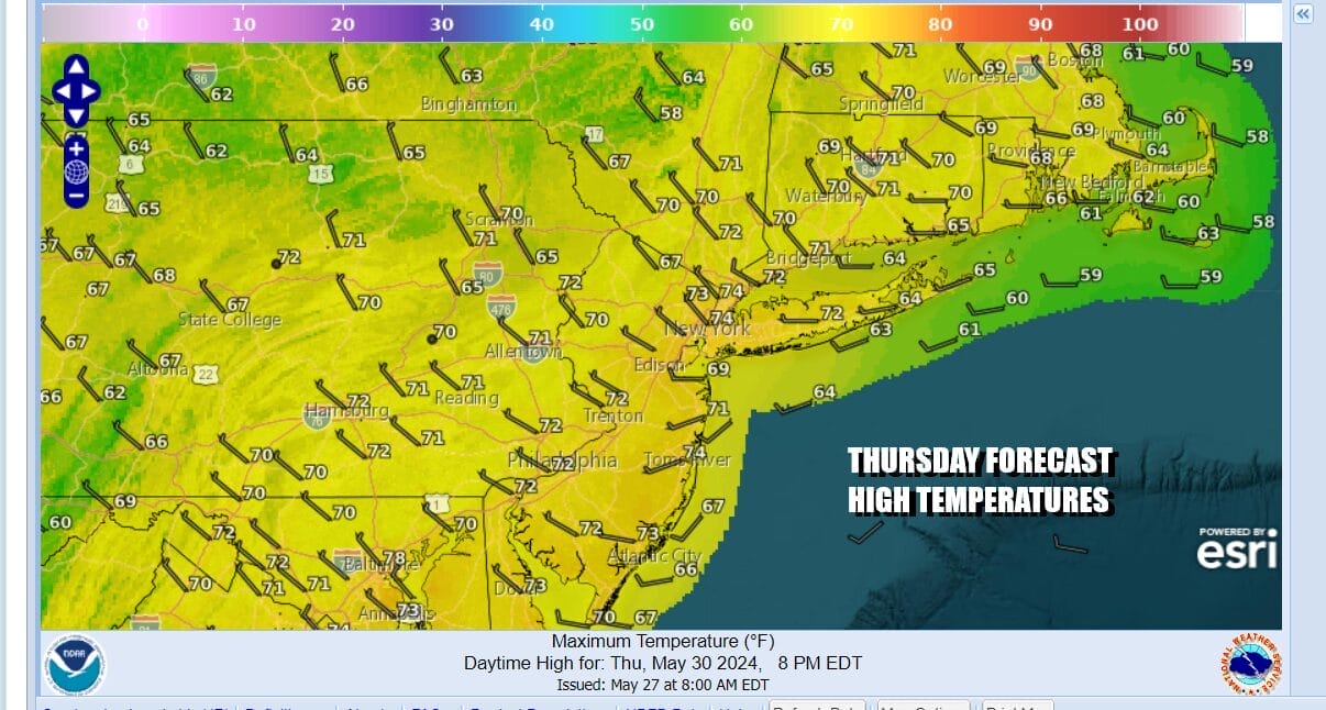
Thursday and Friday we will cool off some more. While there is another upper trough that will drop southward from New England it really won’t have much impact on weather other than a few clouds. It will help to bring in the coolest air of the week. Thursday as a whole should be no worse than partly sunny and the same holds for Friday. Highs both days will be in the low to mid 70s.
We have seen rain on at least one of the weekend days for 16 weekends in a row. Will this be 17? Well there actually is a chance we could have a weekend where it doesn’t rain on either day! That will depend on high pressure along the coast holding firm and the next front to the west being delayed. There is a reasonable chance this weekend could be a dry one from start to finish.
BE SURE TO DOWNLOAD THE FREE METEOROLOGIST JOE CIOFFI WEATHER APP &
ANGRY BEN’S FREE WEATHER APP “THE ANGRY WEATHERMAN!
MANY THANKS TO TROPICAL TIDBITS FOR THE USE OF MAPS
Please note that with regards to any severe weather, tropical storms, or hurricanes, should a storm be threatening, please consult your local National Weather Service office or your local government officials about what action you should be taking to protect life and property.
(Amazon is an affilate of Meteorologist Joe Cioffi & earns commissions on sales.)


