Severe Weather & Tornado Risk Memorial Day Week Ahead Looks Cooler & Drier

Severe Weather & Tornado Risk Memorial Day Week Ahead Looks Cooler & Drier
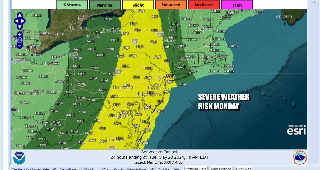
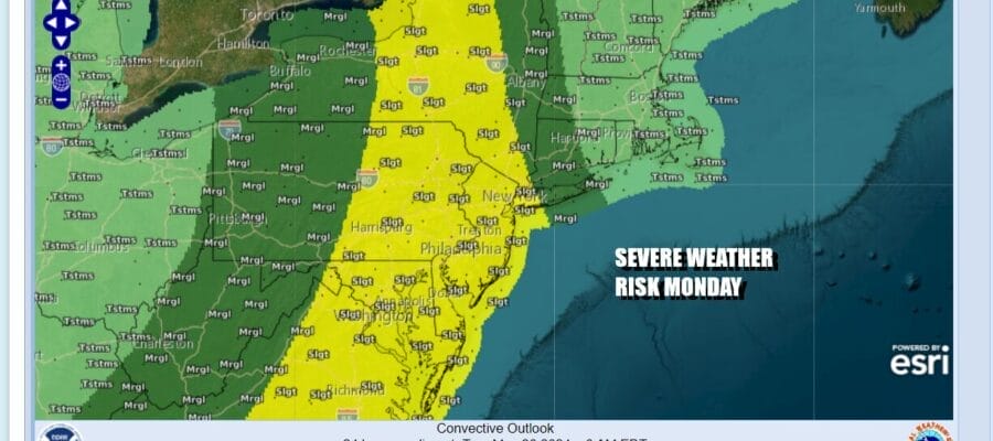
This is going to be a rather busy Memorial Day weatherwise up and down the Eastern Seaboard and this includes Eastern Pennsylvania to Southern New England. The Storm Prediction Center has areas from NY State including NYC, Long Island, Philadelphia and Washington DC in a “slight risk” for severe weather this afternoon and evening as a strong cold front approaches the East Coast.
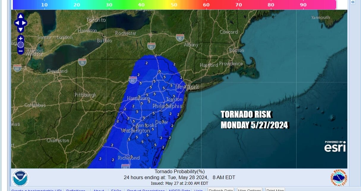
We also have elevated tornado risk of 2 to 5 percent covering areas from Western Long Island, the Hudson Valley, NYC, and west into New Jersey and Eastern Pennsylvania southward to the Middle Atlantic states. Warm humid air is surging up the East Coast ahead of a cold front and the atmosphere will become increasing unstable as the day wears on. Wind direction and daytime heating will be key to the strengthening thunderstorms and what happens when they near the coast.
SATELLITE WITH LIGHTNING STRIKES

WEATHER RADAR

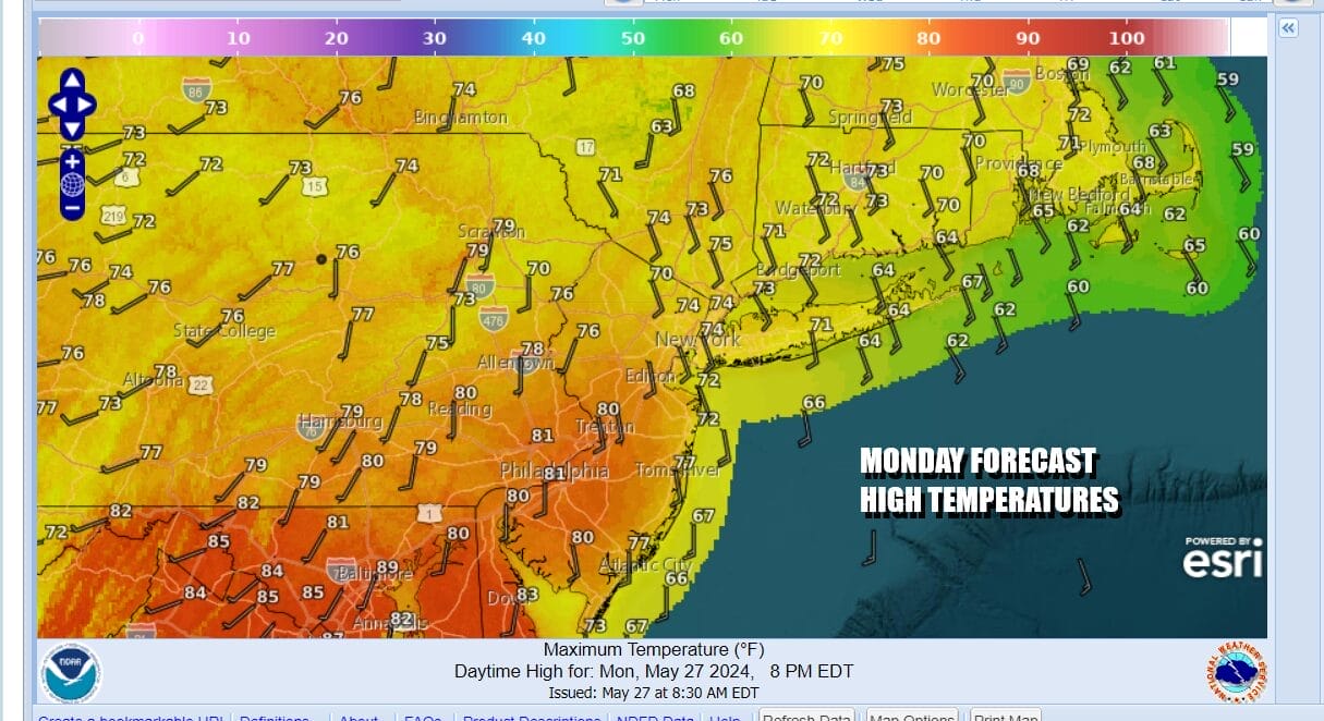
A warm front is pushing eastward with a dying area of clouds and showers from the Hudson Valley down to off the New Jersey coast. Satellite loops show breaks in the cloud cover to the west before we see the beginnings of a what will be several bands of thunderstorms that will develop in Pennsylvania later today. In the meantime as we wait, clouds give way to sunshine and temperatures will rise to the mid 70s to some lower 80s this afternoon.
As always when it comes to cold fronts and convection, it becomes a matter of watching developments on the radar and recognizing that the risk is there for severe weather but it doesn’t necessarily materialize for every geographic point in the area. The HRRR and some of the other short range models show 2 distinct lines of storms, one during the mid and late afternoon from west to east and a second one behind it this evening with the actual cold front.

It is not out of the question that these thunderstorms could spin up an isolated tornado or two but the main risk is likely to be straight line winds of 50 mph or more in some stronger cells. Once the storms move through weather conditions will improve overnight. Tuesday brings the beginnings of a stair step down in temperatures and also a more stable atmosphere for the most part for the rest of the week.
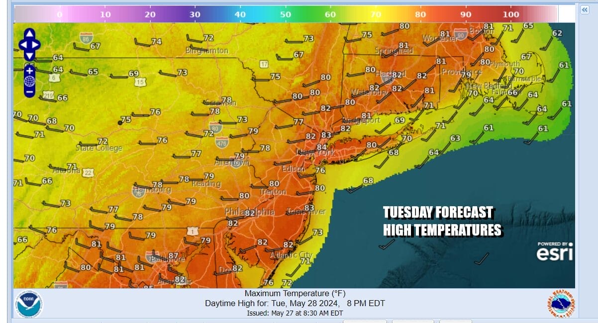
Some sunshine returns Tuesday with lower humidity and temepratures reaching the upper 70s and lower 80s. We will be under a northwest flow in the Eastern US all this week. We have a secondary front that will move through Wednesday so look for a mix of sun and clouds and perhaps an isolated shower or thunderstorm as that front passes. Temperatures will be in the 70s.

Thursday and Friday should be mostly dry days with some sunshine. They will also be cool days relative to the time of year with most highs in the upper 60s and lower 70s both days. Perhaps it might be a shade higher Friday but overall it should be a nice finish to the week. We have seen some rain for the last 16 weekends but next weekend could turn out to be the first dry weekend in nearly 4 months. Keep your fingers crossed on this.
BE SURE TO DOWNLOAD THE FREE METEOROLOGIST JOE CIOFFI WEATHER APP &
ANGRY BEN’S FREE WEATHER APP “THE ANGRY WEATHERMAN!
MANY THANKS TO TROPICAL TIDBITS FOR THE USE OF MAPS
Please note that with regards to any severe weather, tropical storms, or hurricanes, should a storm be threatening, please consult your local National Weather Service office or your local government officials about what action you should be taking to protect life and property.
(Amazon is an affilate of Meteorologist Joe Cioffi & earns commissions on sales.)


