Round 1 Over Round 2 Rain Sunday Cold Shot of Air Arrives Later Monday

Weather in 5/Joe & Joe Weather Show Latest Podcast
Round 1 Over Round 2 Rain Sunday Cold Shot of Air Arrives Later Monday
The overnight and morning rain has moved out to the east. Well inland we saw some snow at the start before it changed to rain. Some elevated areas got a coating to a few inches but here too we saw the cold air pull out. Now we see lots of leftover clouds around but the rains are done. Temperatures for the rest of the day will remain in the upper 40s to mid 50s.
SATELLITE

Both regional radars show the rain has moved out to the east with not much activity left. We will watch the Mid Atlantic regional radar load up with rain overnight and that rain will move northeastward on Sunday. Tonight just look for clouds to hang around. Most lows will be in the 30s to near 40.
F5 WEATHER RADARS


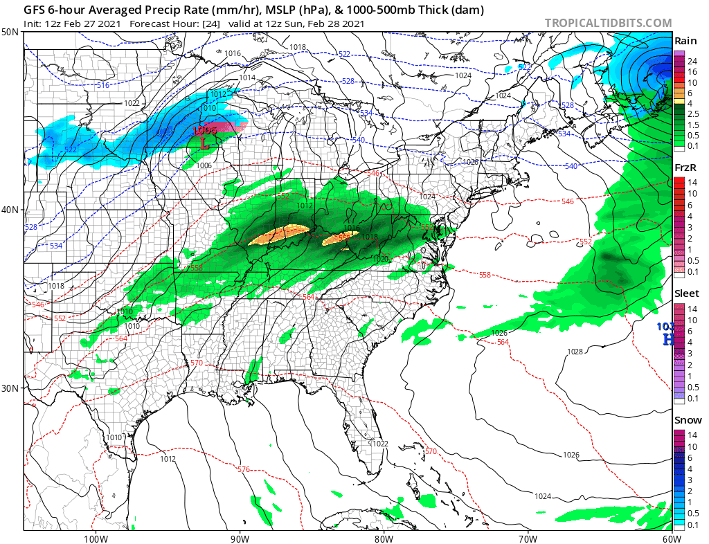
Round 2 comes Sunday with low pressure going by to the west and a warm front to the south. Rain develops during the morning from south to north. The cold front passes Monday morning with lingering rain into midday before it moves out. Temperatures Sunday will be in the 40s and then rise into the 50s in many locations before the cold front passes.
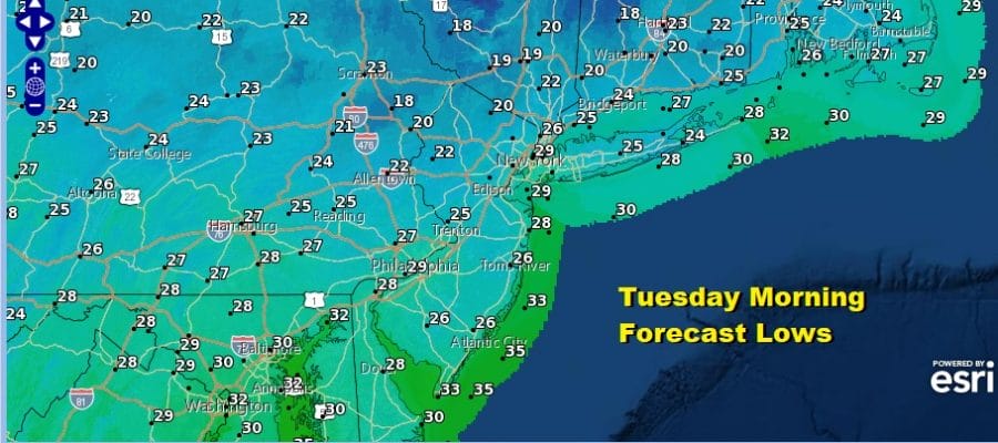
Behind the front is a shot of cold air that will come into the Northeast and Middle Atlantic states beginning Monday afternoon. Winds pick up from the northwest. Leftover clouds will gradually give way to some clearing of skies. Temperatures will top out early in the day in the 50s in many areas and then ease as the day wears on, hitting bottom Tuesday morning in the cold upper teens and lower 20s.

Tuesday brings a cold day of sunshine with most highs just in the 30s. Then we head down into the 20s Tuesday night. Wednesday we should be back into the 40s with sunshine and some high clouds as a wave of low pressure goes by well to the south.
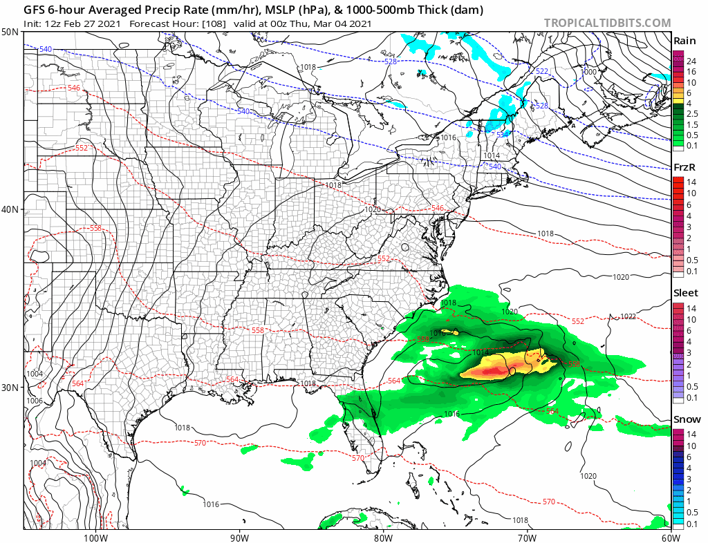
It should remain dry for late week but another cold high is forecast to build into Eastern Canada. At the same time low pressure moves across the Southern US and then makes a turn up the East Coast next weekend. The upper air would suggest that this system develops into a strong storm but that it passes to the south and east of us. However I would be cautious at this early stage dismissing this system entirely.
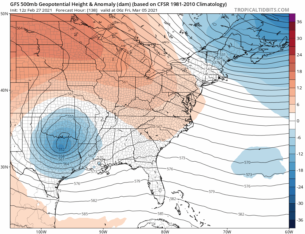
Both the GFS and the Parallel GFS (soon to be the regular operational GFS) show how it could happen as northern stream energy drops southward and phases with the southern stream pulling it northward. I would rate this a long shot for now but since models have had a tendency to go left (west) this winter, I would not rule it out at this early stage.
BE SURE TO DOWNLOAD THE FREE METEOROLOGIST JOE CIOFFI WEATHER APP &
ANGRY BEN’S FREE WEATHER APP “THE ANGRY WEATHERMAN!

MANY THANKS TO TROPICAL TIDBITS & F5 WEATHER FOR THE USE OF MAPS
Please note that with regards to any severe weather, tropical storms, or hurricanes, should a storm be threatening, please consult your local National Weather Service office or your local government officials about what action you should be taking to protect life and property.


