
Risks Grow For Major Storm System
Impacting Florida To Maine Weekend Into Next Week

Risks Grow For Major Storm System
Impacting Florida To Maine Weekend Into Next Week
We continue to move along in a quiet period of weather. A cold front moved through last night and that is going to bring in some colder air for today and Thursday but we aren’t talking about anything super cold. Today will be a partly sunny day or no worse than that. It will be breezy at times with a northwest winds and most highs will be in the low to mid 40s. Radars are quiet locally and we have no rain or snow in the forecast probably lasting through the daytime Sunday.
SATELLITE WITH LIGHTNING STRIKES

WEATHER RADAR

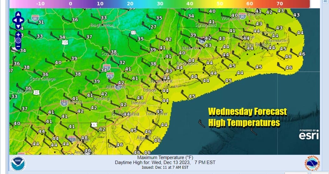
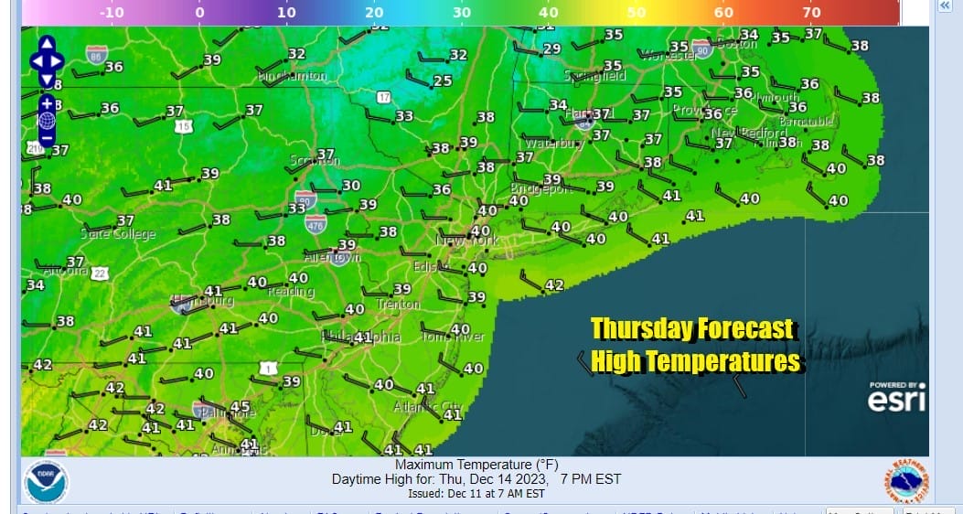
A cold clear night lies ahead with lows in the 20s inland and lower 30s in warmer urban centers. Thursday will be a nice day with sunshine but it will be somewhat breezy again and it will be on the cold side with highs generally in the upper 30s and lower 40s.
We will see temperatures bounce higher Friday as highs reach the middle to upper 40s with sunshine. And the weekend starts off fine with another weak cold front coming through Saturday. Again it will be a weather front with not much with it. Saturday will likley be a nice sunny day with highs in the 40s as a colder high pressure cell begins to build in across Southeastern Canada and Eastern New England.
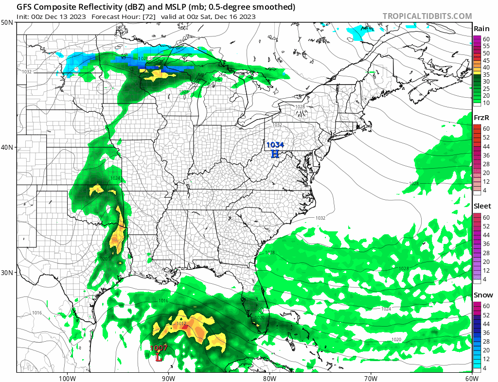
While the weather is quiet much of the Eastern and Southern US we are seeing moisture gathering across the Gulf of Mexico and Northwest Caribbean. All the global weather models show a storm system developing in the Eastern Gulf of Mexico Friday and moving northeast across Florida Saturday. Gales will overspread both coasts of Florida and eventually work their way up the Southeast US coast Saturday. Heavy rain of several inches or more will also impact Florida, Georgia, and the Carolinas. As the GFS shows, the low moves up the coast along or just inland of the coast. We still have to work that part out. Weather conditions will deteriorate during the day Sunday from south to north with increasing clouds and rain arriving late afternoon or evening. Sunday night into Monday will be windy along the coast with rain, heavy at times. The pattern along the East Coast and out into the Central Atlantic is somewhat blocky so this system may hang around for awhile early next week. Lots of details are still to be worked out so in the meantime enjoy the calm that should last at least through Saturday and probably the first part of Sunday.
BE SURE TO DOWNLOAD THE FREE METEOROLOGIST JOE CIOFFI WEATHER APP &
ANGRY BEN’S FREE WEATHER APP “THE ANGRY WEATHERMAN!
MANY THANKS TO TROPICAL TIDBITS FOR THE USE OF MAPS
Please note that with regards to any severe weather, tropical storms, or hurricanes, should a storm be threatening, please consult your local National Weather Service office or your local government officials about what action you should be taking to protect life and property.
(Amazon is an affilate of Meteorologist Joe Cioffi & earns commissions on sales.)


