Quiet Weather Week Continues No Major Storms Through Sunday

Quiet Weather Week Continues No Major Storms Through Sunday
We roll along in what is a dry weather week with no major issues, possibly through this coming Sunday afternoon. Today we have high pressure to the south and an northwest flow of chilly air. We have a weather front moving southeast from the Great Lakes that will move through tonight with little or no consequence other than it re-enforces the chilly air we have. Skies to day should be no worse than partly sunny and high temperatures will be in the low to mid 40s. There are no issues on the radar from what we are seeing.
SATELLITE WITH LIGHTNING STRIKES

WEATHER RADAR

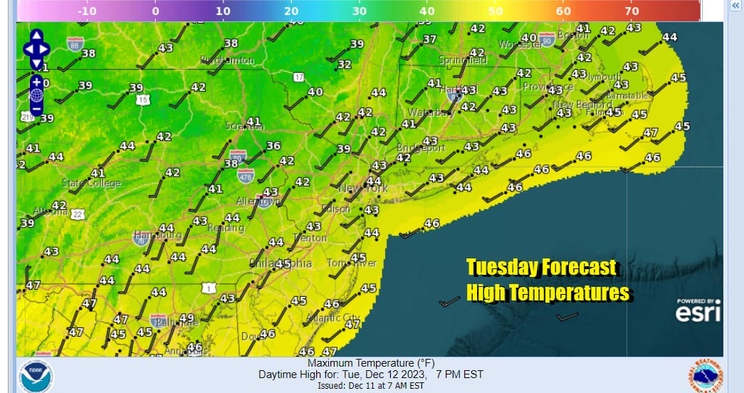
Most lows tonight will be in the upper 20s to mid 30s with just some passing overnight clouds. Wednesday another high builds in from the northwest and we will again have no worse than partly sunny skies. Wednesday highs will generally be in the range of 40 to 45 and then we head down into the 20s and low 30s Thursday morning.
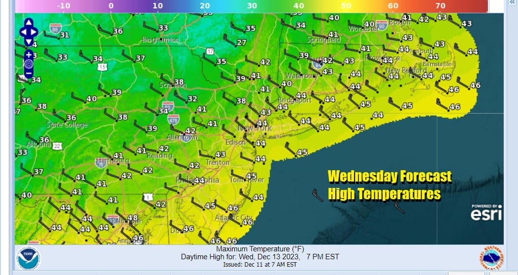
Thursday will likely be the coldest day of the week with sunshine but highs will be in a range from the mid 30s to around 40 degrees. Then we will start to warm up again Friday into Saturday before another cold front moves through and turns the winds back to the north and eventually to the northeast. Friday highs will be in the upper 40s to near 50 and we will be close to that range Saturday.

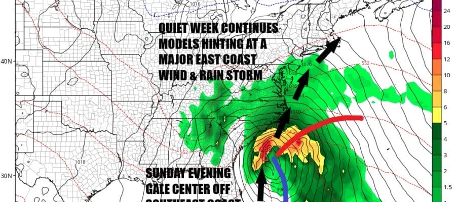
All models are hinting at the idea of low pressure developing in the Gulf of Mexico crossing Florida and moving up the East Coast in some fashion as a major wind and rain storm for Sunday night and Monday of next week. This will not be a snow issue even for inland areas as there is no real cold air. All weather models have this storm in some form with the European the most aggressive of the bunch. Right now we will see how things come in but it does seem that the Southeast US especially the coast will have some rain and wind to deal with this weekend as the low moves northward. From there it moves through at least the coastal Northern Mid Atlantic, Southern and Southeastern New England. Our attention will be on this system in the coming days.
BE SURE TO DOWNLOAD THE FREE METEOROLOGIST JOE CIOFFI WEATHER APP &
ANGRY BEN’S FREE WEATHER APP “THE ANGRY WEATHERMAN!
MANY THANKS TO TROPICAL TIDBITS FOR THE USE OF MAPS
Please note that with regards to any severe weather, tropical storms, or hurricanes, should a storm be threatening, please consult your local National Weather Service office or your local government officials about what action you should be taking to protect life and property.
(Amazon is an affilate of Meteorologist Joe Cioffi & earns commissions on sales.)


