Improving Weather Conditins In a Quiet Weather Week Overall

Improving Weather Conditins In a Quiet Weather Week Overall

The nasty weather from yesterday and overnight is now beginning to pull away. The cold front is offshore and we have a wave of low pressure that is strengthening in Eastern New England. This should lead to improving weather conditions as we go through the day. Radars show rain which was heavy overnight is now making an exit to the east.
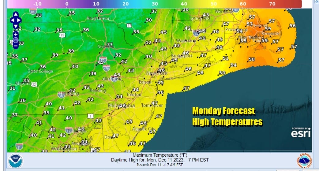
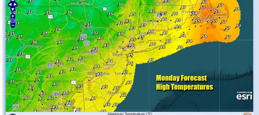
We should see leftover clouds giving way to some developing afternoon sunshine. Winds will be strong and gusty from the northwest as we get that “colder” air behind the front. Temperatures this afternoon will likely hover in the low to mid 40s. Then tonight we will have clear skies with Tuesday morning lows in the mid 20s inland and upper 20s and lower 30s coast and normally warmer urban locations.
SATELLITE WITH LIGHTNING STRIKES

WEATHER RADAR

Looking ahead to the rest of the week we see no major issues and for that matter, no minor issues either. The flow of air is generally coming in from Eastern Canada which is cold air technically speaking but it isn’t what I would describe as “quality” cold air. It is enough to keep temperatures close to average for this time of year. In fact there is no arctic cold air anywhere in the US to speak of and even in Canada we do not see a connection to bring cold air into North America on a large scale.
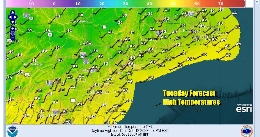
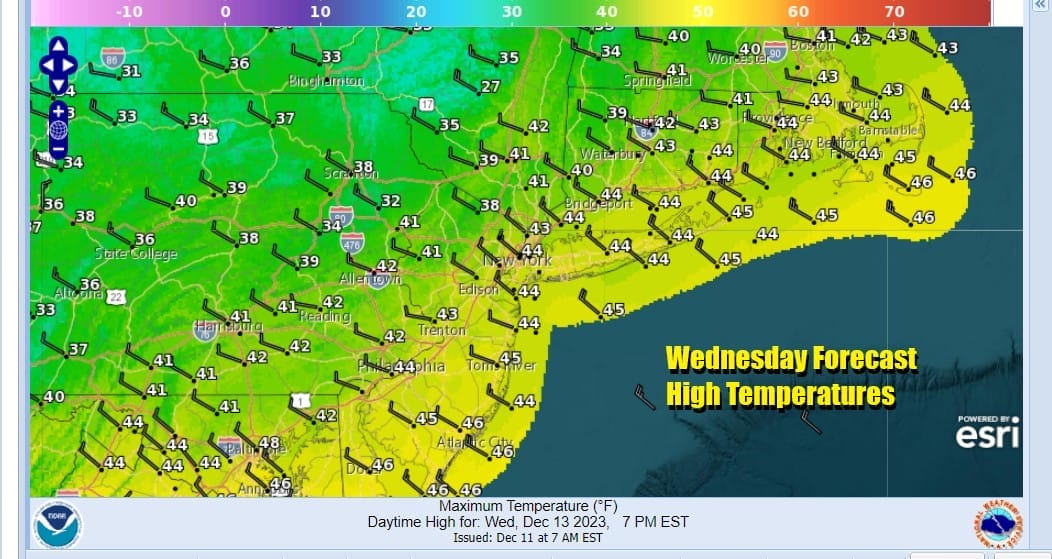
This leaves us dry. No storms for the week and no cold fronts of consequence. Tuesday will be probably no worse than partly sunny with highs in the low to mid 40s. Wednesday will be pretty much the same with no worse than partly sunny skies and highs in the low to mid 40s.
Thursday is more of the same with partly sunny skies and highs in the upper 30s to lower 40s. Friday the cold air pulls out and we will see temperatures bounce higher with some sunshine and highs reaching the upper 40s and lower 50s. Models are showing low pressure developing in the Gulf of Mexico and there is doubt about whether this low turns northward up the East Coast or just meanders in the Gulf of Mexico and over Florida and the Southeast US. That will be the next puzzle to solve but for now we will be optimistic on a dry weekend.
BE SURE TO DOWNLOAD THE FREE METEOROLOGIST JOE CIOFFI WEATHER APP &
ANGRY BEN’S FREE WEATHER APP “THE ANGRY WEATHERMAN!
MANY THANKS TO TROPICAL TIDBITS FOR THE USE OF MAPS
Please note that with regards to any severe weather, tropical storms, or hurricanes, should a storm be threatening, please consult your local National Weather Service office or your local government officials about what action you should be taking to protect life and property.
(Amazon is an affilate of Meteorologist Joe Cioffi & earns commissions on sales.)


