Major Coastal Storm Brings Strong Winds Heavy Rains
Late Sunday Into Monday

Major Coastal Storm Brings Strong Winds Heavy Rains
Late Sunday Into Monday
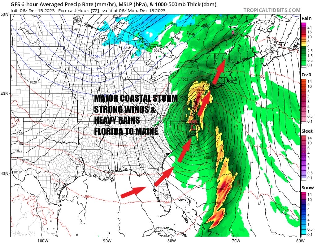
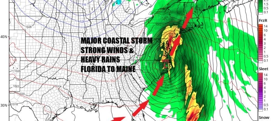
We have a major storm that will be developing in the Gulf of Mexico and moving up the East Coast Sunday and impacting everyone from Florida to Maine with strong winds along the coast, heavy rains and the potential for flooding, and even severe weather risks in Florida and the Carolinas. Rains of 2 to 3 inches across the Southeast US will go a long way to break the drought conditions that exist there. The one thing missing from this storm is snow as there won’t be any snow anywhere do to the lack of cold air.
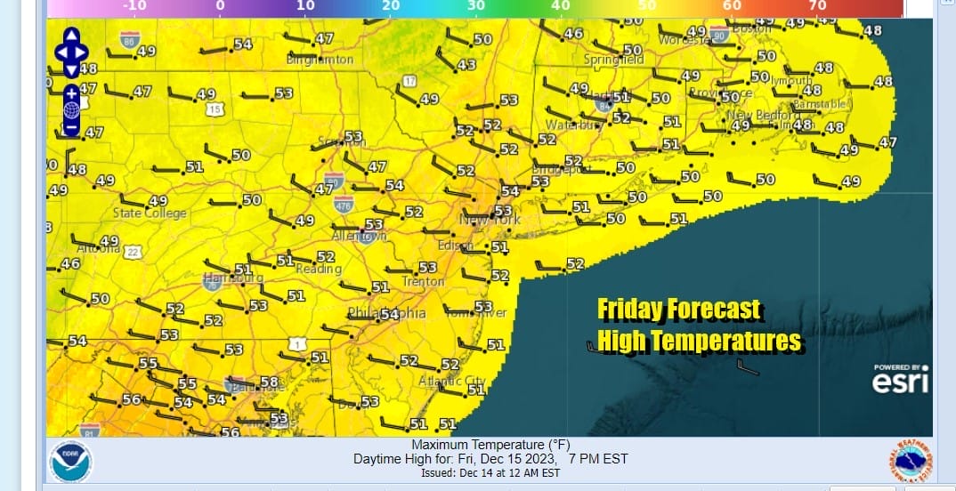
Meanwhile we have today and Saturday where we have no weather issues to speak of. Sunshine will dominate today as the satellite loop shows mostly cloud free conditions in the Eastern US. Highs today will be into the 50s in many locations. Skies will be clear tonight with most lows in the 20s inland and 30s to near 40 in warmer urban settings.
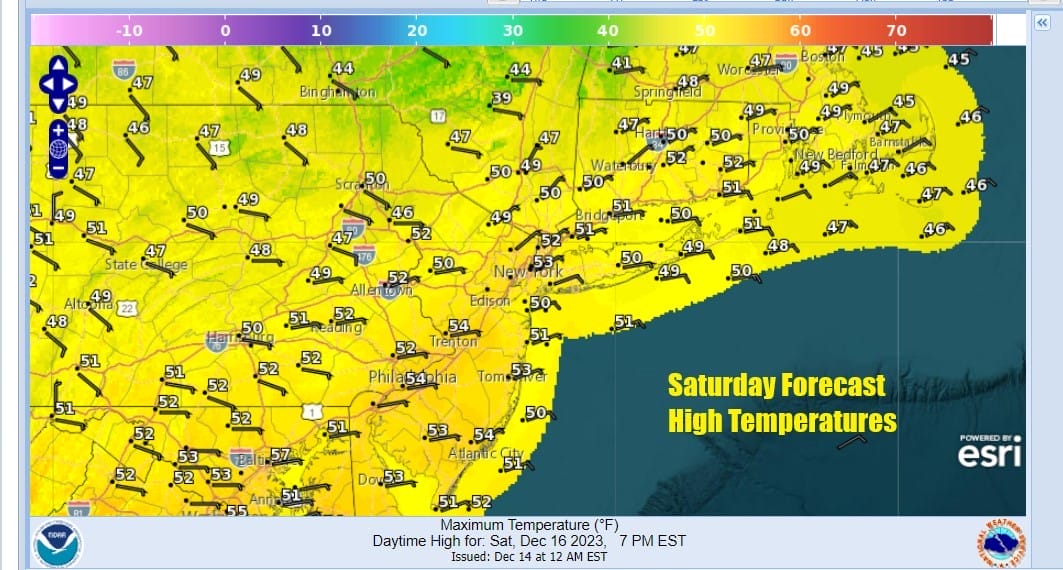
We have no issues for Saturday either as it should be a mainly sunny day though some high clouds might come into the mix later in the day. Highs Saturday will be in the upper 40s to lower 50s. High Pressure will be building into Southeastern Canada and New England which will start the process of priming the atmosphere for this major storm coming up the coast Sunday.
SATELLITE WITH LIGHTNING STRIKES

WEATHER RADAR

Now we will move on to Sunday. Low pressure is going to develop today in the Central Gulf of Mexico. A strong subtropical jet stream that extends from the Pacific, across Mexico to Florida is creating a solid moisture feed. We also have a strong upper trough moving along in the southern part of the jet stream that is causing this surface low to form. That low will then track northeast and cross Florida Saturday night. Heavy rain, thunderstorms, and severe weather will occur across much of the state.

Sunday the low moves up the coast spreading heavy rain northward. Rain will develop from south to north in Eastern Pennsylvania to Southern New England as the day wears on and winds will increase by evening to 20 to 30 mph with some gusts to 40 mph along the New Jersey shore and then we will see those winds increase area wide to 40 tp 50 mph or higher. The strongest winds will be from 1am to 7am Monday with the highest gusts along the immediate coast. Temperatures Sunday will be in the 50s.
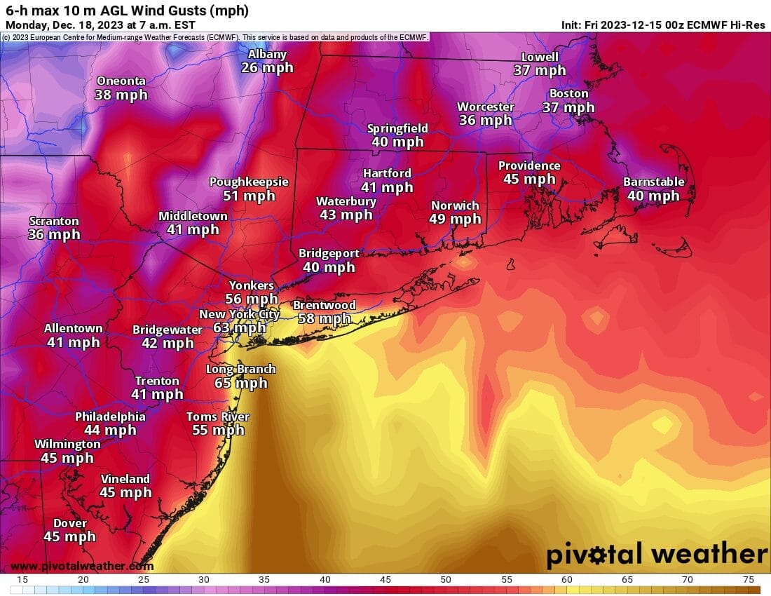
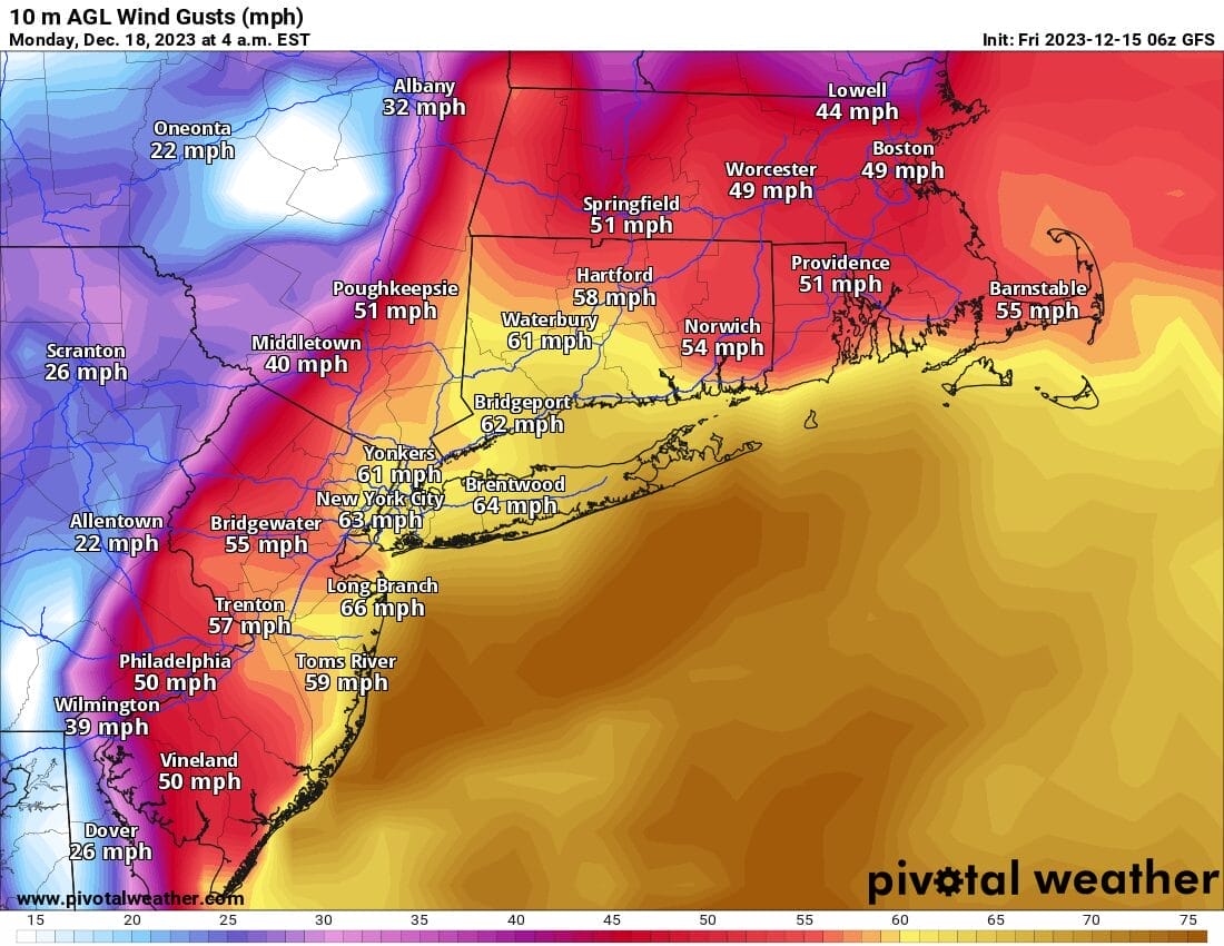
Heavy rains will move up the coast Sunday night into Monday morning followed by what could be a dry slot after daybreak Monday. Depending on the track of the low (just offshore or just inland) rainfall amounts will likley be in a 1.50 to 3 inch rain from east to west. Rain and wind will slowly wind down as the low moves into Northern New England Monday afternoon. Monday night into Tuesday will be windy and colder with some snow showers possible especially inland.
BE SURE TO DOWNLOAD THE FREE METEOROLOGIST JOE CIOFFI WEATHER APP &
ANGRY BEN’S FREE WEATHER APP “THE ANGRY WEATHERMAN!
MANY THANKS TO TROPICAL TIDBITS FOR THE USE OF MAPS
Please note that with regards to any severe weather, tropical storms, or hurricanes, should a storm be threatening, please consult your local National Weather Service office or your local government officials about what action you should be taking to protect life and property.
(Amazon is an affilate of Meteorologist Joe Cioffi & earns commissions on sales.)


