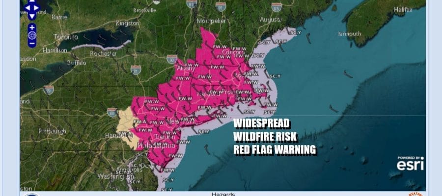
Red Flag Warnings Widespread Wildfire Risk All of Eastern Pennsylvania to Southern New England Today & Sunday

Red Flag Warnings Widespread Wildfire Risk All of Eastern Pennsylvania to Southern New England Today & Sunday
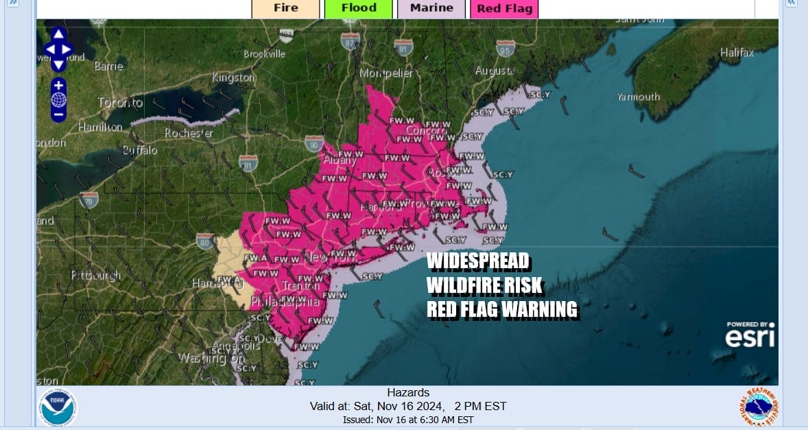
Eastern Pennsylvania, New Jersey, the entire Hudson Valley of New York, Connecticut, Rhode Island, Massachusetts, Southern Vermont & New Hampshire are all in a zone of elevated fire risk from the Storm Prediction Center. Red Flag Warnings are posted for this entire region which has been suffering moderate to severe drought conditions. The drought conditions are likely to get worse as no rain is forecast for this region over the next 5 days.
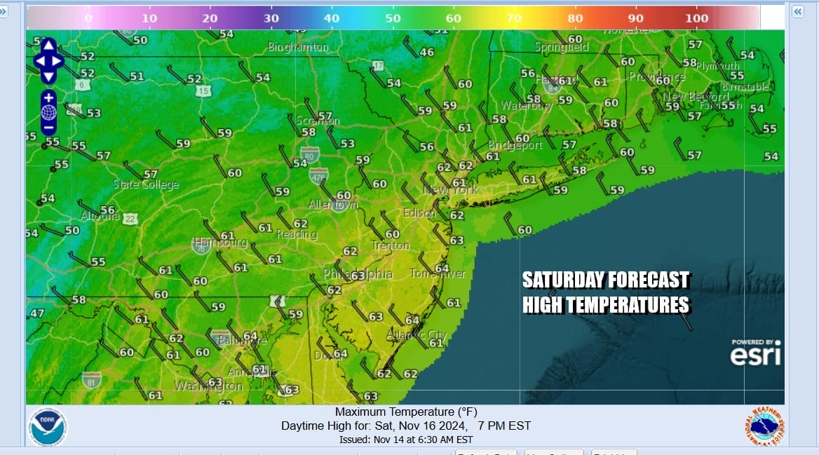
At least this is not like the Western US where dry thunderstorms and lightning strikes set off widespread blazes. Be extra cautious outdoors as the area has become somewhat of a tinder box. If you can get through the smell of burning in the air, we will see plenty of sunshine today as any low clouds burn off. Gusty winds will be an issue along the coast thanks to a storm offshore and high pressure just to the west creating a tight pressure gradient. Highs today will be in back into the 60s.
SATELLITE WITH LIGHTNING STRIKES

WEATHER RADAR

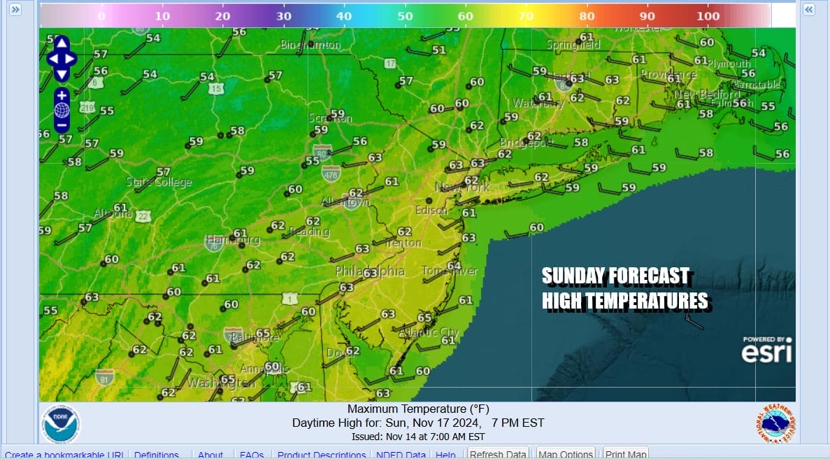
Moving along tonight under a clear sky, most lows will be in the 30s inland and low to mid 40s coast and warmer urban locations. Fire risk continues Sunday and it will be another day of sunshine though the wind should be a bit less. Highs Sunday will also reach into the 60s in most places.
We do see weather pattern changes ahead as the door opens for some rain this coming week. However bear in mind that a change in the overall weather pattern doesn’t necessarily mean that we are going get tons of rain. We may still wind up staying drier than normal. We do have a storm that will develop in the Ohio Valley and Midwest Thursday and that will send a cold front eastward.

At least initially what we see is heavy rain and thunderstorms marching up the Mississippi Valley and Plains which we miss out on. Also the southern feature brings rain and thunderstorms across the Deep South. We miss out on that as well. However the low does redevelop and a front generates an area of rain and possible thunderstorms that will sweep up from the Southwest Thursday, It will be quick, perhaps lasting only about 6 hours or so and with a little luck we could get an inch of rain of this.
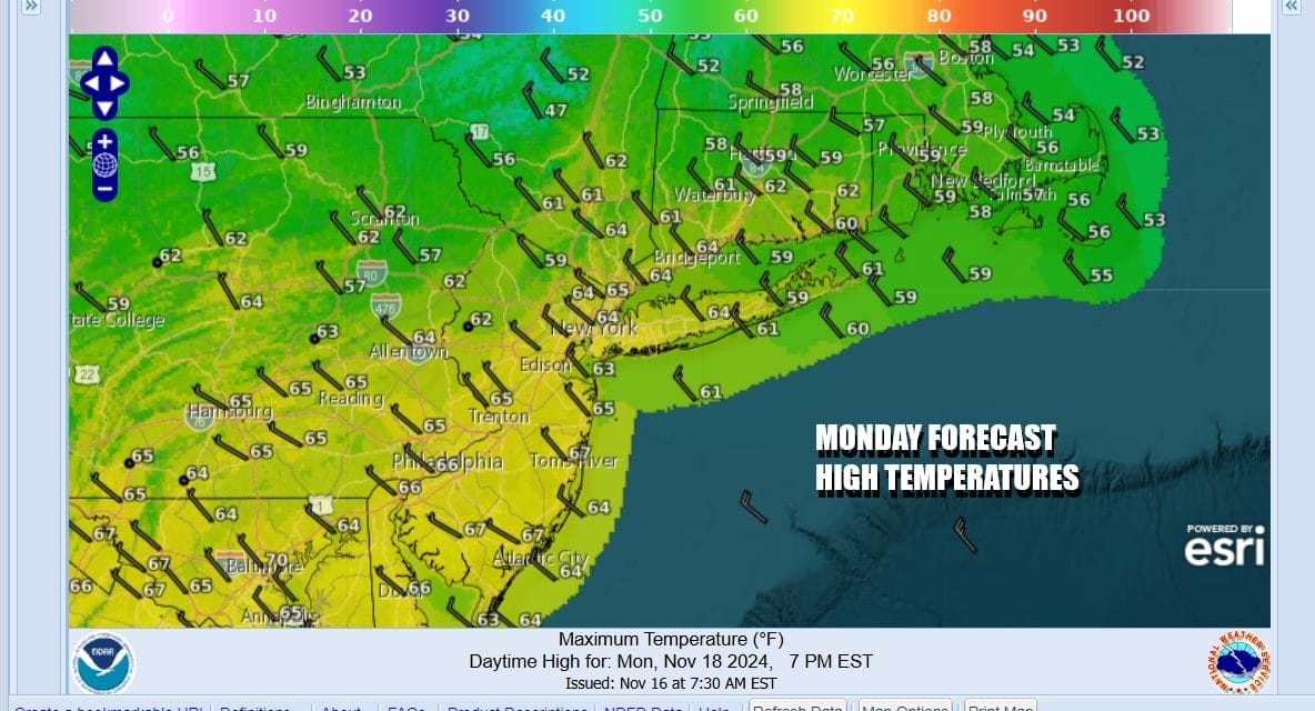
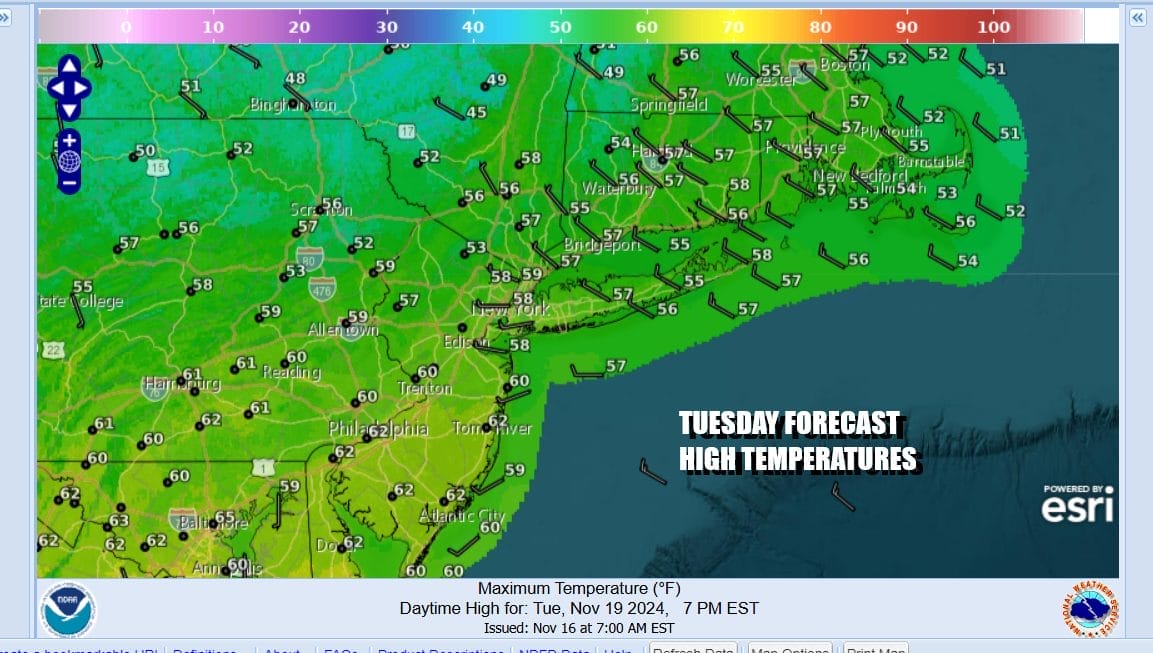
A weak weather front passes Monday and all the showers with that front dry up before the front gets here so it will be a day of clouds mixed with sun and highs in the low to mid 60s. Tuesday it will be a little cooler behind the weather front and we will have sunshine with most highs in the mid to upper 50s. Of course fire risk continues both Monday and Tuesday.
A developing east wind Wednesday coupled with sun and arriving clouds will take highs back into the 60s. Then we see that stronger weather front sweeping eastward with rain and maybe some thunderstorms in the mix Wednesday night into Thursday morning with windy and colder weather conditions to follow later Thursday and Friday.
BE SURE TO DOWNLOAD THE FREE METEOROLOGIST JOE CIOFFI WEATHER APP &
ANGRY BEN’S FREE WEATHER APP “THE ANGRY WEATHERMAN!
MANY THANKS TO TROPICAL TIDBITS FOR THE USE OF MAPS
Please note that with regards to any severe weather, tropical storms, or hurricanes, should a storm be threatening, please consult your local National Weather Service office or your local government officials about what action you should be taking to protect life and property.


