Elevated Fire Risk Continues Across Eastern Pennsylvania to New England
Rain May Finally Arrive Wednesday Night & Thursday

Elevated Fire Risk Continues Across Eastern Pennsylvania to New England
Rain May Finally Arrive Wednesday Night & Thursday
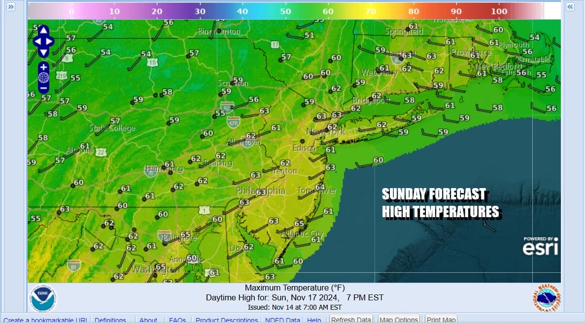
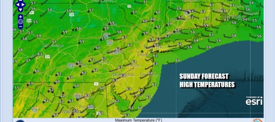
The dry pattern rolls along but there is at least a break in sight later this week. We will get to that in a bit. In the meantime it is a Sunday of sunshine, some gusty winds along the coast, and of course elevated fire risk. That is going to be an issue probably through at least Tuesday. Numerous wildfires continue across Eastern Pennslvania to Southern New England putting that smokey smell in the air from time to time. Highs this afternoon will be in the low to mid 60s. Obviously there isn’t much going on satellite and radar wise. We should mention that coastal flooding at high tide continues to be an issue today thanks to days of northeast winds piling water on the coast into a full moon a few days ago. That should ease in the coming days and only minor to isolated areas of moderate coastal flooding is forecast.
SATELLITE WITH LIGHTNING STRIKES

WEATHER RADAR

Across the Great Lakes and points south and southwest we have a cold front moving eastward with some showers. Guess what? All those showers are going to dry up long before the front gets here during the day Monday so other than a few clouds coming into the mix there will be no rain unless there is the odd isolated sprinkle that barely even makes the ground moist let alone wet.

The next weather front for Wednesday night and Thursday is associated with a developing low over the Great Lakes and a stronger trailing cold front. This front will generate rain and perhaps a thunderstorm or two and we can only hope that the European is correct with 1 to 2 inches of rain for most of the area out of this front. The Gfs model is a little less builish on rainfall but it still suggest 3/4 inch to 1 inch in most places. In a dry pattern it is wise to expect less but we will continue to hope for more.
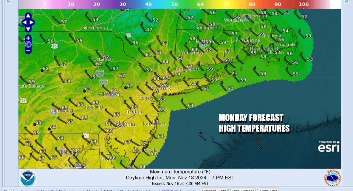
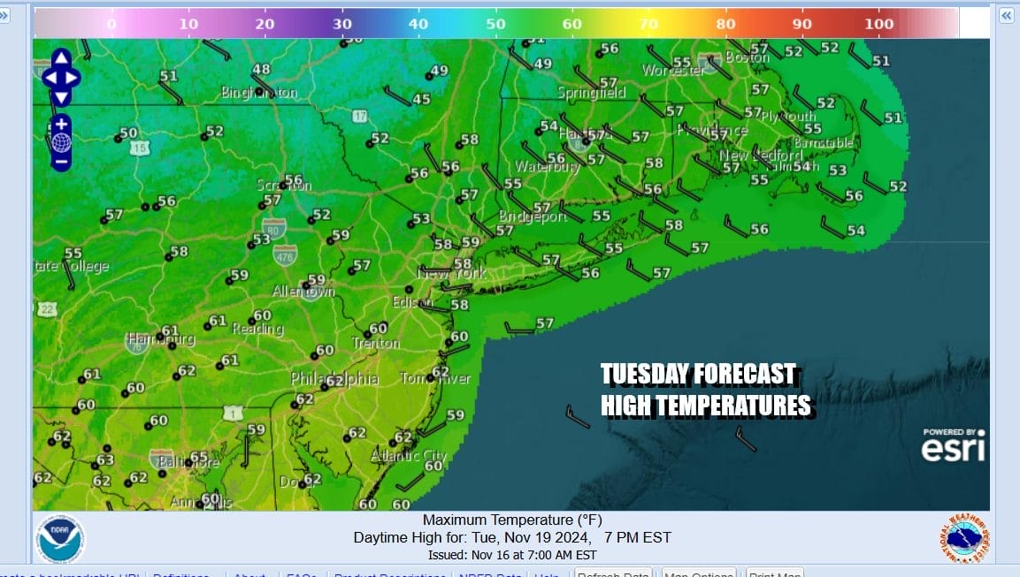
Monday will be no worse than a mix of sun and clouds with highs mostly in the middle 60s thanks to a west northwest wind. Then it will turn cooler Monday night behind the front as any clouds move out and skies clear. Tuesday dayside will be mainly sunny and cooler with most highs in the mid to upper 50s.
Wednesday we see arriving clouds and an east wind so highs will be in the 50s and perhaps on the low in as clouds gradually take over. The cold front will swing around with rain and maybe a thunderstorm or two Wednesday night into Thursday. Then we could see some lingering showery rains later Thursday into at least part of Friday as a strong upper low and trough linger in the Eastern US for a day or two. It will turn noticeably colder especially Friday into Saturday where both days we could see temperatures not out of the 40s for daytime highs.
BE SURE TO DOWNLOAD THE FREE METEOROLOGIST JOE CIOFFI WEATHER APP &
ANGRY BEN’S FREE WEATHER APP “THE ANGRY WEATHERMAN!
MANY THANKS TO TROPICAL TIDBITS FOR THE USE OF MAPS
Please note that with regards to any severe weather, tropical storms, or hurricanes, should a storm be threatening, please consult your local National Weather Service office or your local government officials about what action you should be taking to protect life and property.


