Finally Rain Is Coming Later In The Week
As Weather Pattern Changes Short & Long Range

Finally Rain Is Coming Later In The Week
As Weather Pattern Changes Short & Long Range

This is going to be a pivotal week in the weather world as we are seeing the pattern changing in an important way. Gone is the Southeast US ridge and that should finally allow weather systems to move along from west to east on a regular basis. We have rain in the forecast for the second half and while it doesn’t break the drought it is a start. We are going to see the most rain in 2 plus months as low pressure develops over the Eastern US. The Northeast to the Central Appalachians will see their first accumulating snows especially in elevated areas from West Virginia and Western Virginia to New England.
SATELLITE WITH LIGHTNING STRIKES

WEATHER RADAR

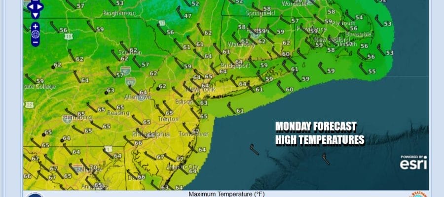
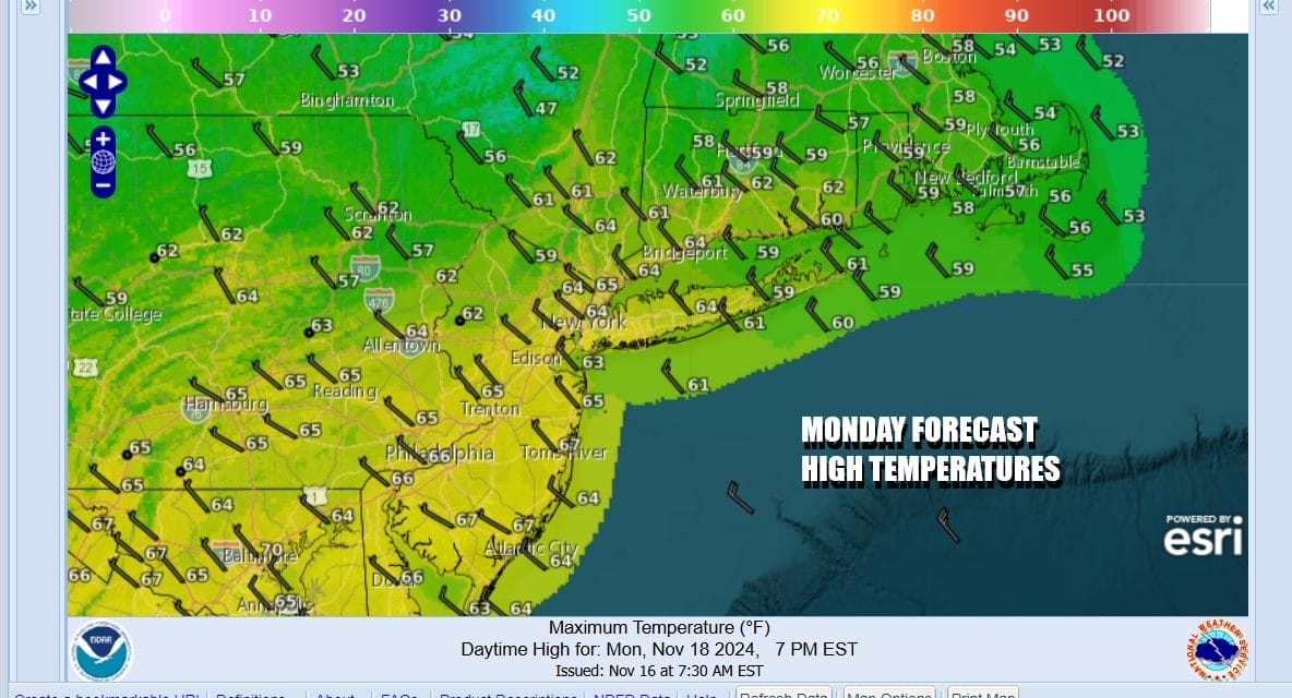
A cold front is moving offshore this morning and once again it didn’t produce anything other than a few sprinkles. Today we will see a mix of sun and clouds developing and temperatures will be mostly into the 60s for highs. Winds will be more west and northwest and that should also relieve coastal flooding issues that have been ongoing for the last several days.
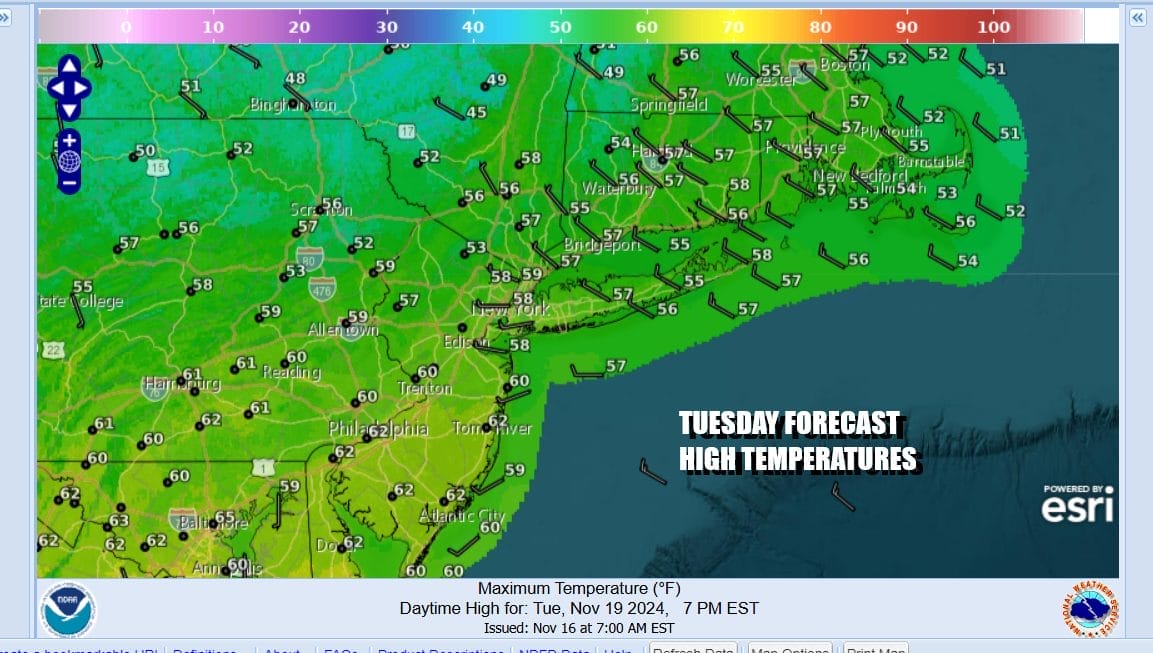
This new air mass isn’t especially cool but we will see temperatures trend downward for Tuesday. Skies will be mainly clear tonight with most lows across the region in the 30s inland and low to mid 40s coast and urban areas. Tuesday will be a mainly sunny day with highs mostly in the 50s to around 60 degrees.
Wednesday we begin to set up for our cold front that will moving eastward as low pressure heads to the Great Lakes. Winds will turn to the east Wednesday and we will also see any early sun give way to increasing clouds. No rain is forecast for the daytime Wednesday as highs will be mostly in the 50s.

Wednesday night we will see a band of rain and maybe even a thunderstorm or two in the mix move in from the southwest. It will be a narrow band of rain that will last maybe about 6 hours or so. Most of it falls Wednesday night into early Thursday morning as low pressure redevelops virtually right overhead. Depending on how that redevelopment takes place, it could bring some heavier rain from Northern New Jersey northward into New England with less to to the south. Still it will be something and the thinking is a half to three quarters of an inch with perhaps one inch amounts inland and north. A strong upper air storm system will be over the Eastern US into the weekend. The first round of rain ends but then we will see showery rains on and off later Thursday and probably through Friday. We may even have some showers lingering into Saturday It will also turn colder with 50s Thursday and 40s for daytime highs Friday and Saturday.
BE SURE TO DOWNLOAD THE FREE METEOROLOGIST JOE CIOFFI WEATHER APP &
ANGRY BEN’S FREE WEATHER APP “THE ANGRY WEATHERMAN!
MANY THANKS TO TROPICAL TIDBITS FOR THE USE OF MAPS
Please note that with regards to any severe weather, tropical storms, or hurricanes, should a storm be threatening, please consult your local National Weather Service office or your local government officials about what action you should be taking to protect life and property.


