Increasing Sunshine Gusty Winds Dry Weather Continues As Drought Worsens

Increasing Sunshine Gusty Winds Dry Weather Continues As Drought Worsens
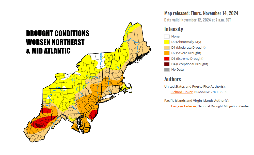
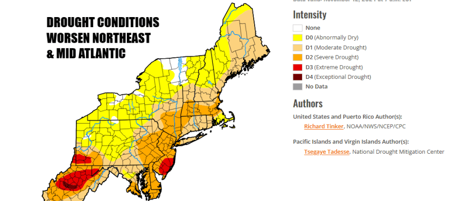
Drought conditions across the Northeast and Mid Atlantic states continues to worsen. 88 percent of the US is seeing conditions ranging from abnormally dry to extreme drought. The drought situation continues to deteriorate as rainfall has been non existent for the most part since early September. Less than a half inch has fallen in the last 8 weeks in much of this region and it appears that we will see no widespread rain until next Thursday at the earliest. Moderate drought conditions cover much of Eastern Pennsylvania to Southern New England with Southern New Jersey sits in extreme drought.
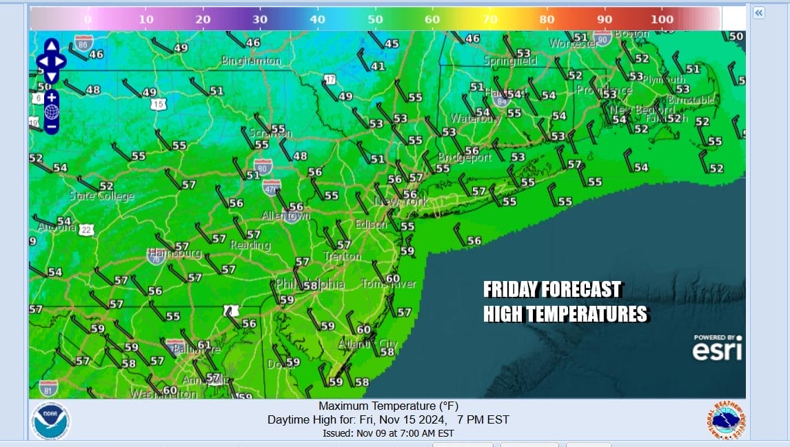
We missed out on yesterday’s rain which stayed mainly to the west and to the south. Low pressure is moving offshore and it is going to re-enforce an Atlantic Ocean storm system that has been sitting there blocked from moving. We will see decreasing clouds and increasing amounts of sunshine today. Gusty winds will develop from the north northeast and that means wild fire risk for much of this region yet again. Temperatures this afternoon will top out in the middle to upper 50s.
SATELLITE WITH LIGHTNING STRIKES

WEATHER RADAR

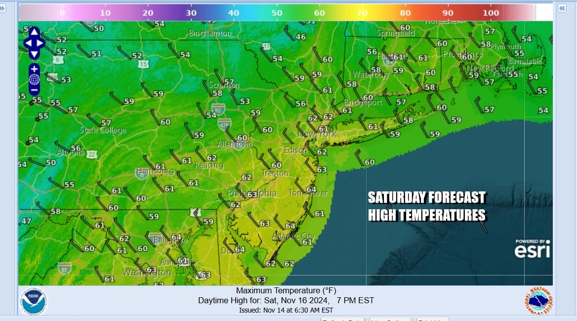
Most lows tonight will be in the 30s to around 40 degrees with a clear sky and a gusty wind. Low pressure to the east and higher pressures to the west will keep things breezy to windy at times through Saturday so wildfire risk continues. Sunshine should boost highs in the the lower 60s.
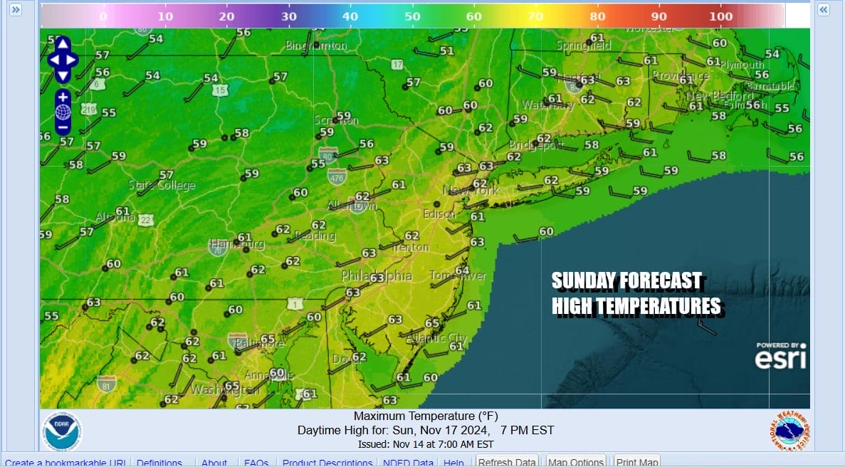
Saturday night will be nice and clear with lows in the 30s inland and lower 40s coast and warmer urban areas. There will be enough wind to hold temperatures up in most places though some areas well inland could drop into the 20s. Sunday will be sunny and nice with highs in the low 60s and the wind should ease somewhat.
The dry rainless pattern continues into the start of next week. Monday sees a weak weather front moving through and there is the outside chance for a shower. Temperatures will be in the mid to upper 60s for highs. The front passes and we see temperatures easing slightly for Tuesday and Wednesday and both days will be sunny. Obviously the risk for wildfires will continue next week

The upper air pattern is going to be changing to a colder one over the longer term. Unfortunately it may still remain unusually dry. We do have one chance for rain and that is ahead of the changes, low pressure will form over the Great Lakes and Upper Ohio Valley midweek and that will sweep a cold front through the Eastern US Thursday. It won’t be moisture starved but the upper air feature is energetic enough to produce some rain, though it won’t last long, and right now does not look to be a significant rain producer. This front comes through Thursday and then it will be followed by dry windy and colder conditions for the end of next week. Tropical Storm Sara in the Southern Caribbean is so far south that even if it were to survive as it eventually heads into the Gulf of Mexico, there won’t be much lefto to it. Unless it suddenly moves further north, there is no chance for tropical moisture to get involved with the cold front.
BE SURE TO DOWNLOAD THE FREE METEOROLOGIST JOE CIOFFI WEATHER APP &
ANGRY BEN’S FREE WEATHER APP “THE ANGRY WEATHERMAN!
MANY THANKS TO TROPICAL TIDBITS FOR THE USE OF MAPS
Please note that with regards to any severe weather, tropical storms, or hurricanes, should a storm be threatening, please consult your local National Weather Service office or your local government officials about what action you should be taking to protect life and property.


