A Chilly Gray Day Across Eastern Pennsylvania to Southern New England
As Rain Misses Yet Again

A Chilly Gray Day Across Eastern Pennsylvania to Southern New England
As Rain Misses Yet Again
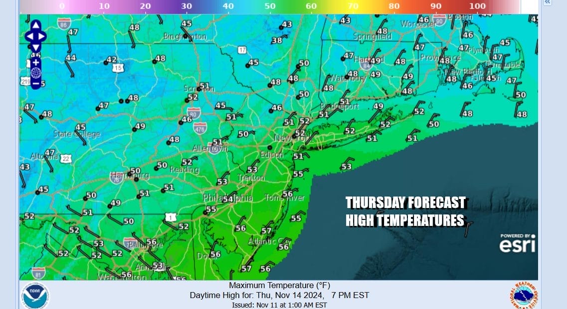
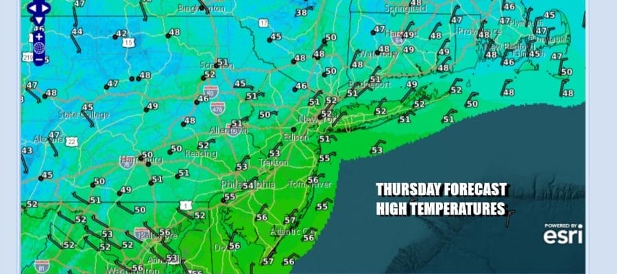
It is hard to believe that with a vigorous weather system moving east out of the Ohio Valley that we are not going to see a drop of rain. Yet that is exactly the case. An ocean storm in the Atlantic south of Atlantic Canada is not moving so the weather system to the west instead gets shoved to the southeast. Rain falls in Maryland and Delmarva south to the Carolinas but not a drop for Eastern Pennsylvania to Southern New England. Instead we will see a cloudy day with the sun dimly visible at times and temperatures just in the lower 50s at best. Some places especially inland and north probably won’t get out of the 40s.
SATELLITE WITH LIGHTNING STRIKES

WEATHER RADAR

There is a chance that the northern edge of the rain could briefly skim Southern New Jersey and Southeast Pennsylvania but other than that we will just see lots of clouds tonight with temperatures mostly in the 30s. If skies should clear out inland areas especially north of NYC in Northern New Jersey and the Hudson Valley could see lows back in the 20s.
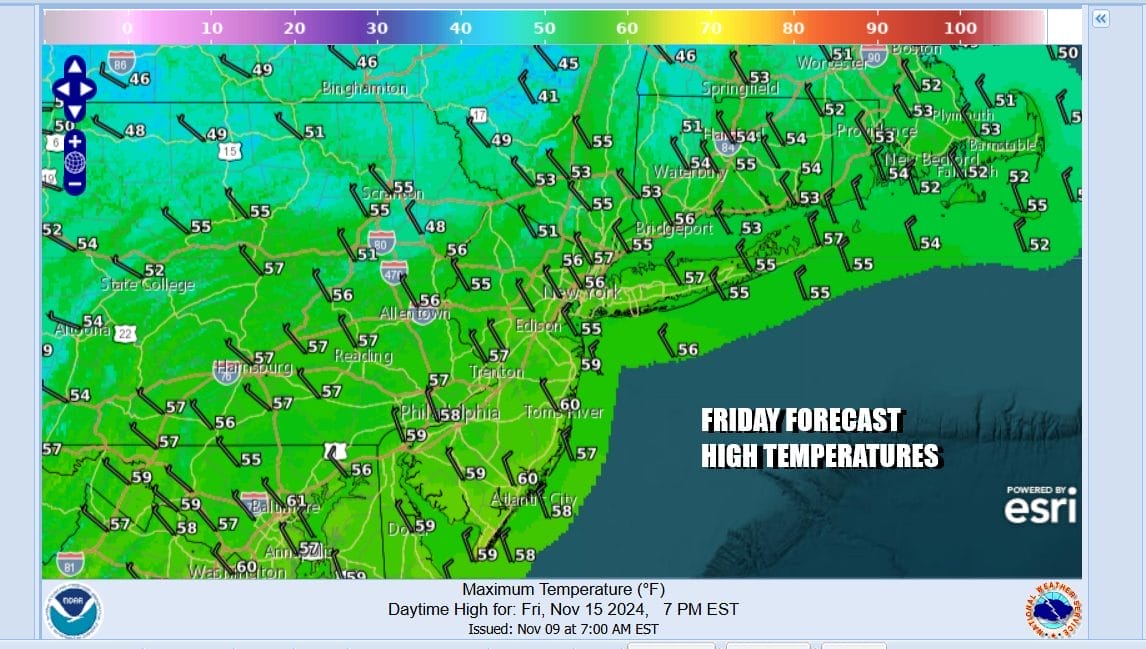
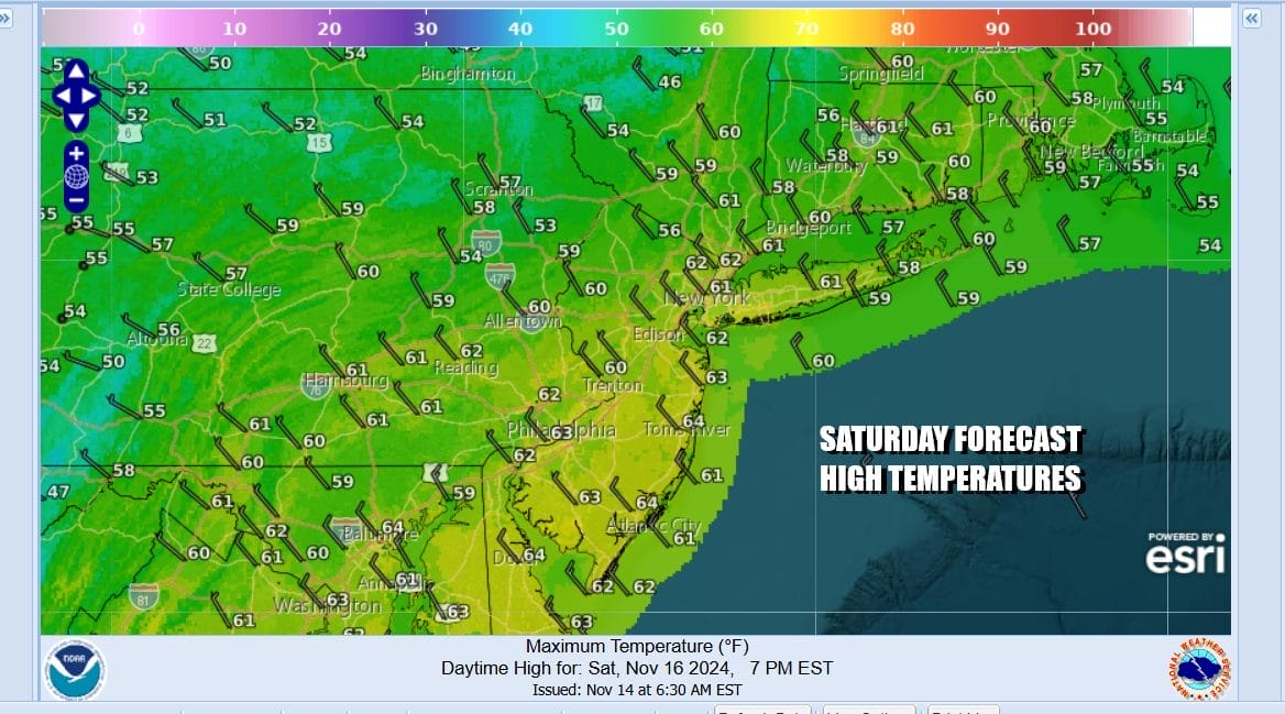
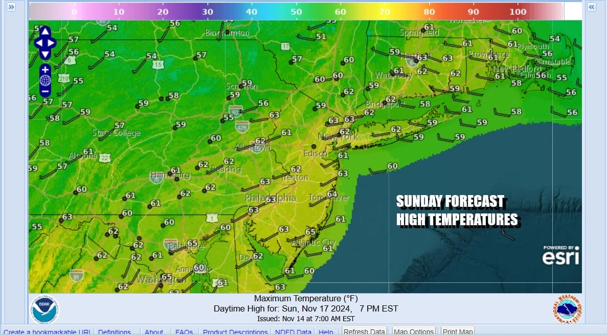
Over the weekend we will see dry conditions and mainly sunny skies for both Saturday and Sunday. Finally the traffic jam in the Atlantic will break down and weather systems will start to move from west to east again so we will have high pressure settling to the south of us. Winds will turn more westerly over the weekend and that should allow highs to reach the upper 50s and lower 60s Saturday and mostly lower 60s Sunday.
Next week we will finally see an important change that kills the Southeast ridge once and for all and we begin to see energy and colder air coming out of Canada. We also will see some moisture as another tropical cyclone makes its way into the Gulf of Mexico. The first half of the week will be fine with dry conditions and mainly sunny skies. A weak front and upper trough will come through Monday and perhaps produce some scattered to isolated showers that don’t amount to much at all.

Midweek we see low pressure heading for the Great Lakes and a strong front will be swinging eastward. The Gulf of Mexico and the Atlantic should open up with some moisture and perhaps we get a little help from whatever moisture we can get out of this tropical cyclone I mentioned earlier. This should bring a solid rain for Thursday as the front approaches. Behind the front will be a genuine shot of colder air that will carry us into the weekend and Thanksgiving week. I’m a little hesitant regarding the rain because dry begets dry and we have seen several systems that look promising a week out only to have rain hopes dashed. Perhaps this time it will hold together and bring a solid widespread rainfall.
BE SURE TO DOWNLOAD THE FREE METEOROLOGIST JOE CIOFFI WEATHER APP &
ANGRY BEN’S FREE WEATHER APP “THE ANGRY WEATHERMAN!
MANY THANKS TO TROPICAL TIDBITS FOR THE USE OF MAPS
Please note that with regards to any severe weather, tropical storms, or hurricanes, should a storm be threatening, please consult your local National Weather Service office or your local government officials about what action you should be taking to protect life and property.


