
Record Highs Reaching Lower 80s
Record Highs Reaching Lower 80s This Afternoon
Even though we are seeing a good deal of sunshine across the entire area, temperatures are not moving up all that quickly since this is not July or August. The low sun angle and the limited amount of daylight really cut down on the daytime heating.
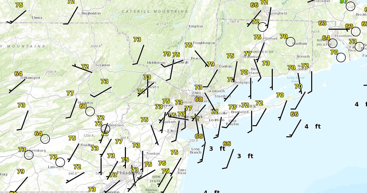
For coastal areas the wind is going to be a big deal. It is more south southwest than west southwest which is going to severely limit how high temperatures go especially if the wind picks up to 10 or 15 mph this afternoon. For now most temperatures as of 11am are in the low to mid 70s with sunny skies.


There are no changes in the forecast outlook from earlier. We will see one more day of temperatures in the 80s on Wednesday before we cool off. The presence of a back door front moving southward Wednesday night and Thursday will put us in the 60s with clouds all day Thursday and there is even the chance for some showers later in the day and Thursday night. Friday we see a cold front approach and move through Following this is rather chilly air for the weekend and into early next week as the pattern switches to a colder look. We will discuss this further later today along with the latest on any tropical development to the south.
MANY THANKS TO TROPICAL TIDBITS FOR THE WONDERFUL USE OF THE MAPS
WINTER WEATHER OUTLOOK VIDEOS
In case you missed them I’ve been previewing the upcoming winter in a series of posts and videos. Here are the first 2. More will be coming along. Links to the latest posts are below.
NEW JERSEY
LONG ISLAND AND NEARBY
WINTER 2016-2017 PART 3 NEW JERSEY
WINTER 2016-2017 PART 1 OCEAN WATER TEMPERATURES
WINTER 2016-2017 PART 2 ARCTIC SEA ICE AND SIBERIAN SNOW COVER
FiOS1 News Weather Forecast For Long Island
FiOS1 News Weather Forecast For New Jersey
FiOS1 News Weather Forecast For Hudson Valley
NATIONAL WEATHER SERVICE SNOW FORECASTS
LATEST JOESTRADAMUS ON THE LONG RANGE

Weather App

Don’t be without Meteorologist Joe Cioffi’s weather app. It is really a meteorologist app because you get my forecasts and my analysis and not some automated computer generated forecast based on the GFS model. This is why your app forecast changes every 6 hours. It is model driven with no human input at all. It gives you an icon, a temperature and no insight whatsoever.
It is a complete weather app to suit your forecast needs. All the weather information you need is right on your phone. Android or I-phone, use it to keep track of all the latest weather information and forecasts. This weather app is also free of advertising so you don’t have to worry about security issues with your device. An accurate forecast and no worries that your device is being compromised.
Use it in conjunction with my website and my facebook and twitter and you have complete weather coverage of all the latest weather and the long range outlook. The website has been redone and upgraded. Its easy to use and everything is archived so you can see how well Joe does or doesn’t do when it comes to forecasts and outlooks.
Just click on the google play button or the apple store button on the sidebar for my app which is on My Weather Concierge. Download the app for free. Subscribe to my forecasts on an ad free environment for just 99 cents a month.
Get my forecasts in the palm of your hand for less than the cost of a cup of Joe!

MENTION JOE CIOFFI AND GET A 5% DISCOUNT