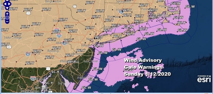
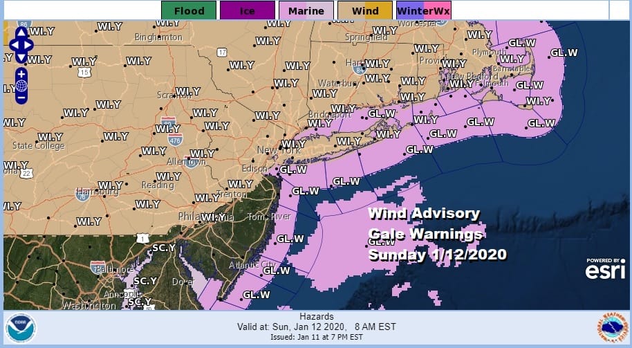
Record Highs Possible Wind Advisory Sunday
It was quite the day today with record highs and NYC hitting 69 which set a new record high for the date. We saw upper 60s to around or just over 70. Philadelphia hit the 70 degree mark late this afternoon. We at least saw some sun in the mix today and a gusty southwest wind. Now it is on to a cold front tonight that is coming in from the west with showers and even 1 or 2 thunderstorms in the mix.
SATELLITE

REGIONAL RADAR

As of this evening nothing is close to us on the regional or local radars but late tonight into day break Sunday we will see a line of showers pass through. It will be a minor interruption as most of it will be gone by 7am or so.
LOCAL RADAR NEW YORK CITY

LOCAL RADAR PHILADELPHIA


Winds are going to be an issue on Sunday from the southwest and then shifting to the west later in the day. Wind Advisories and Gale Warnings are posted. Winds will be blowing 25 to 35 mph with gusts over 50 mph at times. Once the front passes we should break out into some sunshine. It will be another very warm day of record or near record temperatures until cooler air arrives Sunday night and for Monday.

Winds will turn to the north and then to the northeast for Monday and Tuesday as high pressure goes to our north. The cold front will stall offshore to the Southeast US coast. There will be an area of rain with this front but it should stay out of here on Monday. Clouds will be mixed with some sun. Monday morning we will be down in the 30s and highs Monday will be in the 40s.
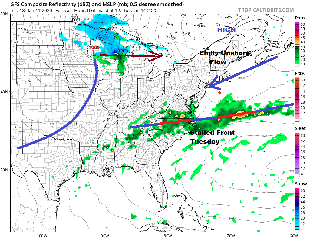
Tuesday sees a stalled front to our south and a little weak wave moves along it with no real consequence. There is the chance we could see some showers later Tuesday or Tuesday night. The next i system is the one moving into the Western Great Lakes Tuesday that moves into Southeastern Canada Tuesday night into Wednesday morning. This should bring improvement on Wednesday but then another low follows into the Great Lakes and Southern Canada with a trailing cold front on Thursday. We will see showers from that. Much colder air follows for the end of the week. Then another stronger system follows after that for next weekend. That system could set us up for snow to ice changing to rain which is the early look at this stage. The upper air pattern that brought in the warm air this weekend will be long gone and more wintry pattern will replace it late this week and going forward in the long range.
BE SURE TO DOWNLOAD THE FREE METEOROLOGIST JOE CIOFFI WEATHER APP &
ANGRY BEN’S FREE WEATHER APP “THE ANGRY WEATHERMAN!
MANY THANKS TO TROPICAL TIDBITS FOR THE USE OF MAPS
Please note that with regards to any severe weather, tropical storms, or hurricanes, should a storm be threatening, please consult your local National Weather Service office or your local government officials about what action you should be taking to protect life and property.


