Record Highs One More Time
Record Highs One More Time
A weak cold front will be moving slowly through the area on Wednesday and there will be some clouds with it. However the front essentially falls apart as it gets here. Given the launching pad of overnight lows in the warm 60s, you can expect another round of record highs into the 80s this afternoon.


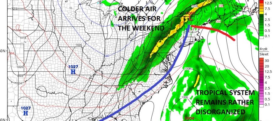
This however will be the last day of record highs as a weak high builds to our north and sets up an onshore flow for Thursday. We should cool off into the 50s tonight and highs Thursday will only be in the 60s. There may be some showers developing Thursday afternoon as low pressure from the west pushes a warm front slowly through. Then we wait for the front to swing east on Friday with more showers.
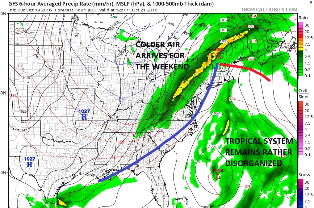
The tropical or subtropical system east of the Bahamas looks rather disorganized. While conditions are favorable for development something seems to be missing at the moment. It could still become a tropical or subtropical storm however the system to the north will organize into a strong storm near Cape Cod and absorb it all. We will wait and see how the rains set up but right now it appears New England will do well with this in terms of rain but our area will miss most of it.
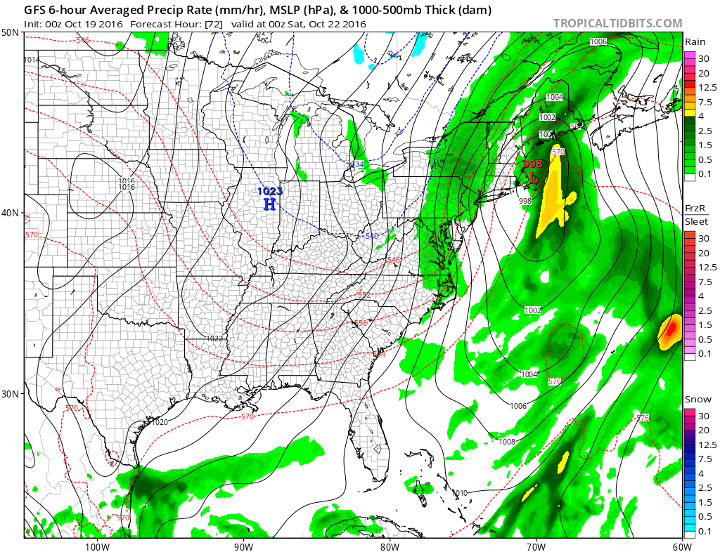
Any rain will be long gone by Saturday morning and the weekend will be dry and rather chilly. The storm intensifies in Eastern Canada driving cold air southward. Parts of upstate NY and Northern New England could wind up seeing their first snow showers of the season. We will spend the weekend with clouds and some sunshine, a gusty wind and temperatures struggling to get out of the 50s for daytime highs.
MANY THANKS TO TROPICAL TIDBITS FOR THE WONDERFUL USE OF THE MAPS
WINTER WEATHER OUTLOOK VIDEOS
In case you missed them I’ve been previewing the upcoming winter in a series of posts and videos. Here are the first 2. More will be coming along. Links to the latest posts are below.
NEW JERSEY
LONG ISLAND AND NEARBY
WINTER 2016-2017 PART 3 NEW JERSEY
WINTER 2016-2017 PART 1 OCEAN WATER TEMPERATURES
WINTER 2016-2017 PART 2 ARCTIC SEA ICE AND SIBERIAN SNOW COVER
FiOS1 News Weather Forecast For Long Island
FiOS1 News Weather Forecast For New Jersey
FiOS1 News Weather Forecast For Hudson Valley
NATIONAL WEATHER SERVICE SNOW FORECASTS
LATEST JOESTRADAMUS ON THE LONG RANGE

Weather App

Don’t be without Meteorologist Joe Cioffi’s weather app. It is really a meteorologist app because you get my forecasts and my analysis and not some automated computer generated forecast based on the GFS model. This is why your app forecast changes every 6 hours. It is model driven with no human input at all. It gives you an icon, a temperature and no insight whatsoever.
It is a complete weather app to suit your forecast needs. All the weather information you need is right on your phone. Android or I-phone, use it to keep track of all the latest weather information and forecasts. This weather app is also free of advertising so you don’t have to worry about security issues with your device. An accurate forecast and no worries that your device is being compromised.
Use it in conjunction with my website and my facebook and twitter and you have complete weather coverage of all the latest weather and the long range outlook. The website has been redone and upgraded. Its easy to use and everything is archived so you can see how well Joe does or doesn’t do when it comes to forecasts and outlooks.
Just click on the google play button or the apple store button on the sidebar for my app which is on My Weather Concierge. Download the app for free. Subscribe to my forecasts on an ad free environment for just 99 cents a month.
Get my forecasts in the palm of your hand for less than the cost of a cup of Joe!

MENTION JOE CIOFFI AND GET A 5% DISCOUNT


