Rainy Weekend Underway Fat Tuesday Ash Wednesday Valentine’s Day Outlook
Rainy Weekend Underway Fat Tuesday Ash Wednesday Valentine’s Day Outlook
Clouds are continuing to increase and thicken up though at least as far as rain is concerned we have some dry time today until later this afternoon. At the point the Gulf and Atlantic moisture will converge and rain will overspread the area from southwest to northeast. At the moment there are a few widely scattered areas of rain showing up on local radars below. The satellite shows the extent of the clouds and moisture which extend south into Florida and west to the Mississippi River.
US SATELLITE

REGIONAL RADAR

The regional radar shows the rain building in Virginia and West Virginia as it continues to march along to the northeast.
LOCAL RADAR NEW YORK CITY

LOCAL RADAR PHILADELPHIA


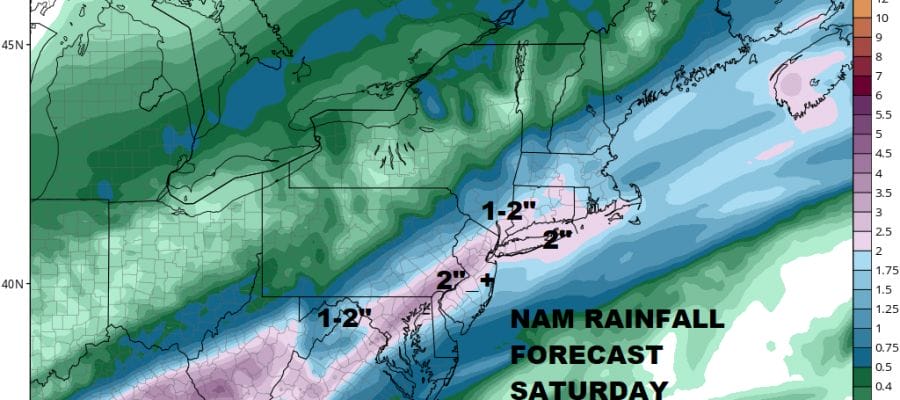
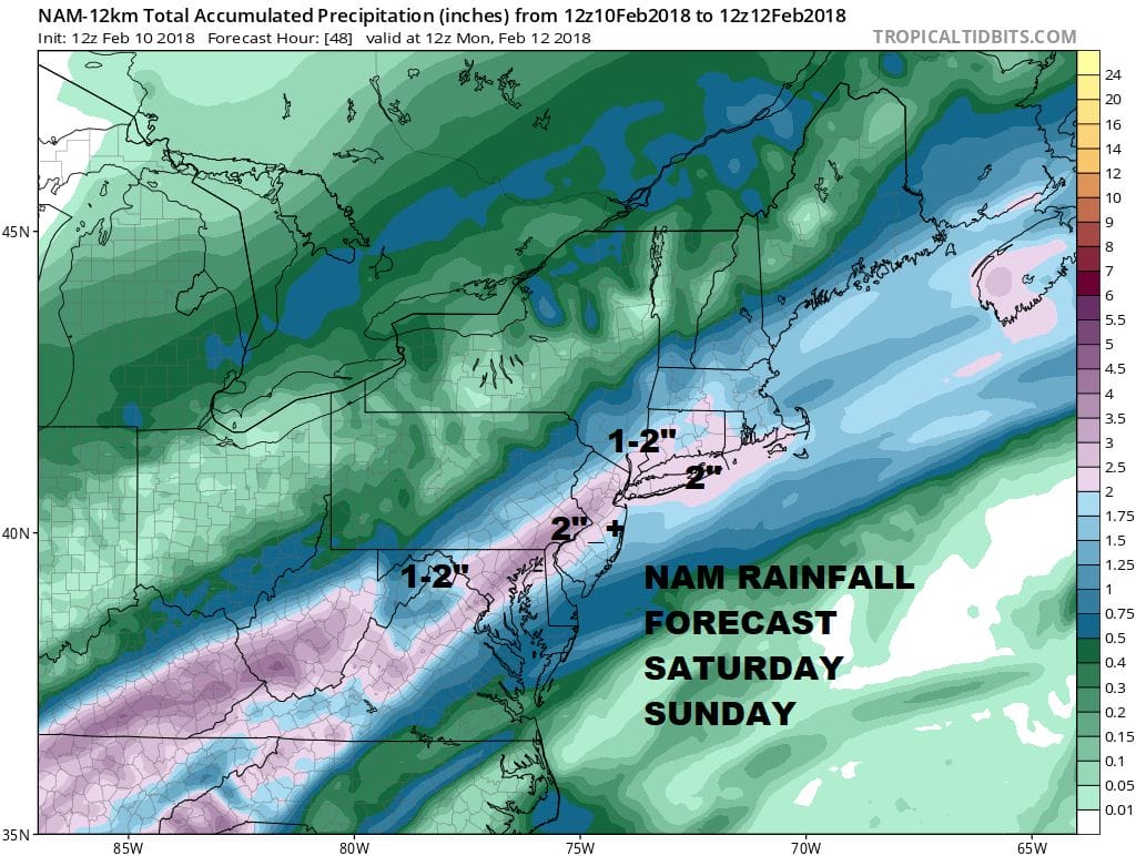
From this afternoon and evening until Sunday night, we will see on and off rain with some heavy downpours from time to time. Weather models have consistently shown at last 1 to 2 inches of rain and today’s NAM model is no different.
NAM WEATHER MODEL RAINFALL FORECAST
Once the rain ends Sunday evening weather conditions will try to improve on Monday but the problem may be a persistent northeast flow. That could keep us in clouds into early Wednesday. Another wave and upper air disturbance will be crossing late Tuesday and some showers can’t be ruled out for later Fat Tuesday. Wednesday is both Valentines Day & Ash Wednesday (there is a joke in there somewhere) and we should see improving weather conditions as the day wears on with clouds and developing sunshine. The rapid flow of weather systems continues with another front and showers later Thursday into Friday.
 GET JOE A CIGAR IF YOU LIKE

FiOS1 News Weather Forecast For Long Island
FiOS1 News Weather Forecast For New Jersey
FiOS1 News Weather Forecast For Hudson Valley


