
Rain Wind Issues Weekend Outlook
SHOP THE JOESTRADAMUS STORE
Rain Wind Issues Weekend Outlook
Weather conditions around the area have been rather windy but we are going to see winds diminish overnight and the satellite shows mainly clear skies. This should take temperatures down to the mid 20s to lower 30s in most places. This will probably be the best part of the weekend as we will be dealing with a storm heading into New England from the Great Lakes and a cold front sweeping eastward.
SATELLITE LOOP

REGIONAL RADAR

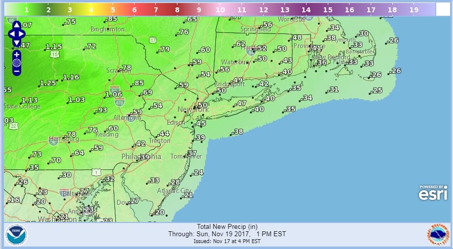
We don’t expect any showers until early Saturday afternoon in Eastern Pennsylvania & Western New Jersey and perhaps not until mid or late afternoon in areas to the East Like Long Island & Connecticut. Temperatures on Saturday will not hit their highs until right before midnight when readings by then will reach the 50s to near 60s. We will see showers until about daybreak Sunday and then we should dry out. Rainfall amounts will average around 1/2 inch coastal areas and in Central & South Jersey to an inch or so in parts of Eastern Pennsylvania.
RAINFALL FORECAST THIS WEEKEND
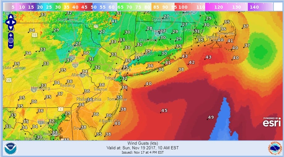
Once the rain ends the issue for Sunday will be the wind. While we will see sunshine developing Sunday it will be very wind. Winds will gust past 40 mph in some areas through Sunday afternoon.
WIND GUST FORECAST 10AM SUNDAY
Temperatures on Sunday will start the day in the 50s to near 60 and then fall into and through the 40s later Sunday morning and Sunday afternoon. After Sunday the week ahead looks quiet and calm with no storms for Thanksgiving week.
Long range shows strong blocking and weather models are showing some interesting possibilities down the road after Thanksgiving. JOESTRADAMUS has more on this in his latest long range post.
 GET JOE A CIGAR IF YOU LIKE

FiOS1 News Weather Forecast For Long Island
FiOS1 News Weather Forecast For New Jersey
FiOS1 News Weather Forecast For Hudson Valley


