
Rain Warm Front Moving Northeast
Rain Warm Front Moving Northeast
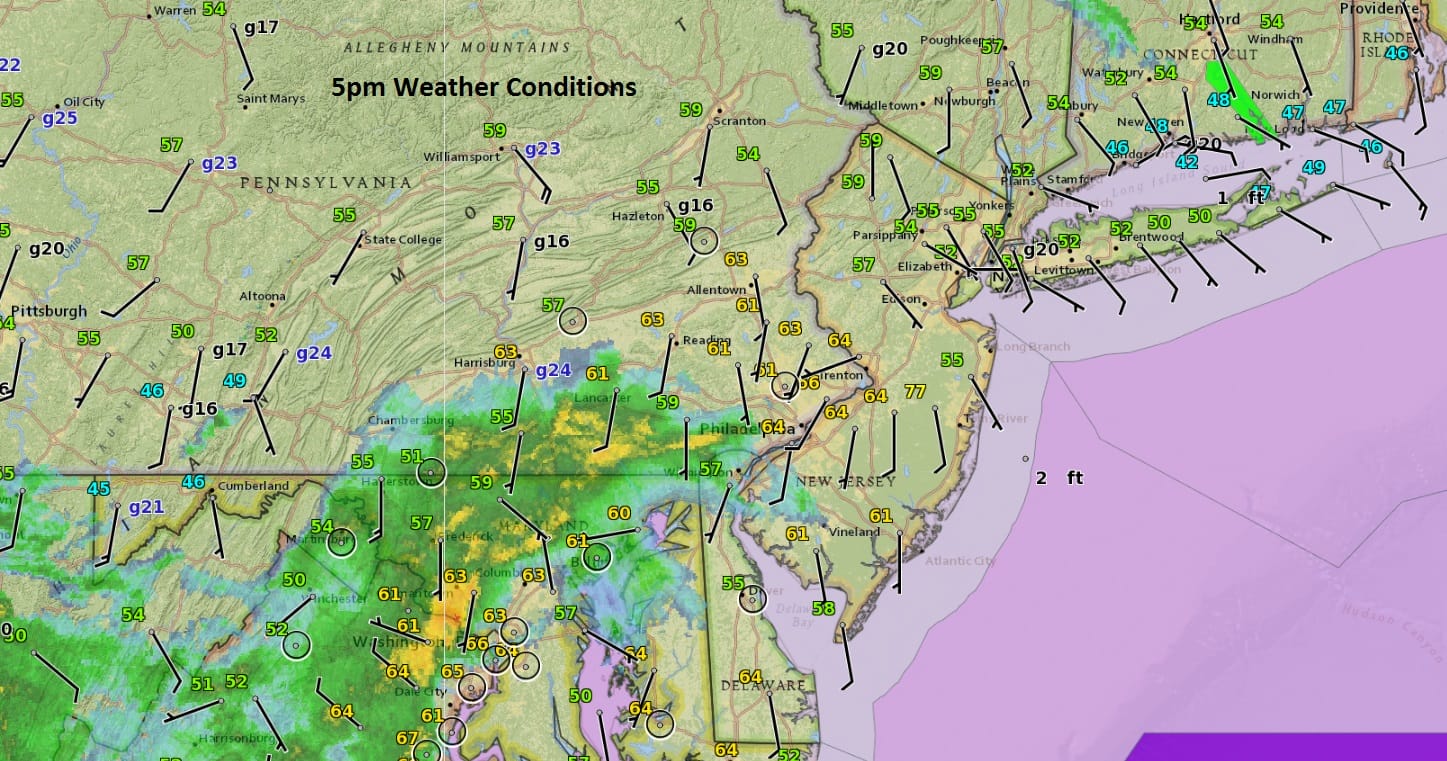
We are beginning to see the warm front to the south moving northeastward. As evidenced by the satellite and radar loops below clouds are thickening up. Rain is in Southern Pennsylvania. The area of rain with the warm front is moving more to the east than to the north so the bulk of this looks to be from Central New Jersey southward though the northern fringe of this round of rain should reach Long Island, NYC, and southern areas of the Hudson Valley after 8pm. Watch for the possibility of a thunderstorm as the warm front moves through tonight. Temperatures are in the
SATELLITE LOOP

REGIONAL RADAR

LOCAL RADAR NEW YORK CITY

LOCAL RADAR PHILADELPHIA


Wednesday we will see the severe weather threat play out with a burst of showers and thunderstorms coming through around mid to late morning as shown on the HRRR model.

Afterwards we will wait until about 3pm or so and watch a second area of showers and thunderstorms move through and its these storms that run the risk of reaching severe levels. Once the weather front moves through Wednesday night, colder air follows. The chance for some snow for some areas remains on Friday but this does not look to be a big deal if it happens. Very cold air will be with us this weekend especially on Saturday when temperatures will be hard pressed to get much above the low to mid 30s.
 GET JOE A CIGAR IF YOU LIKE

SNOW REMOVAL COMPANIES FOR YOUR WINTER NEEDS
LONG ISLAND ROCKLAND COUNTY Connecticut

![]()

ROCKLAND COUNTY TRI STATE SNOW REMOVAL JOHNSTOWN PA


FiOS1 News Weather Forecast For Long Island
FiOS1 News Weather Forecast For New Jersey
FiOS1 News Weather Forecast For Hudson Valley
NATIONAL WEATHER SERVICE SNOW FORECASTS
LATEST JOESTRADAMUS ON THE LONG RANGE
Weather App

Don’t be without Meteorologist Joe Cioffi’s weather app. It is really a meteorologist app because you get my forecasts and my analysis and not some automated computer generated forecast based on the GFS model. This is why your app forecast changes every 6 hours. It is model driven with no human input at all. It gives you an icon, a temperature and no insight whatsoever.
It is a complete weather app to suit your forecast needs. All the weather information you need is right on your phone. Android or I-phone, use it to keep track of all the latest weather information and forecasts. This weather app is also free of advertising so you don’t have to worry about security issues with your device. An accurate forecast and no worries that your device is being compromised.
Use it in conjunction with my website and my facebook and twitter and you have complete weather coverage of all the latest weather and the long range outlook. The website has been redone and upgraded. Its easy to use and everything is archived so you can see how well Joe does or doesn’t do when it comes to forecasts and outlooks.
Just click on the google play button or the apple store button on the sidebar for my app which is on My Weather Concierge. Download the app for free. Subscribe to my forecasts on an ad free environment for just 99 cents a month.
Get my forecasts in the palm of your hand for less than the cost of a cup of Joe!


