

Rain Tonight Through Saturday Slow Improvement Possible Sunday
As Coastal Storm Moves Northward
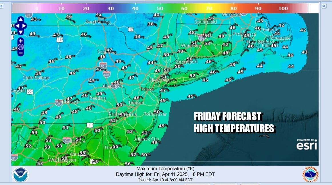
We are in the land of gloom & doom spring weather. Clouds are everywhere and low pressure is forming in the Appalachians today and this is our weather maker for the weekend. Onshore winds today, cloudy skies and developing rain later today and tonight will keep temperatures from going anywhere. Most highs in Eastern Pennsylvania to Southern New England will be in the upper 40s and lower 50s. Radars are not very active this morning but we will see rain develop in the Middle Atlantic later today and then move northward late this afternoon and evening.
SATELLITE WITH LIGHTNING STRIKES

WEATHER RADAR

Low pressure will move from the Southern Appalachians northeastward to off the Virginia coast tonight into Saturday. This system is not going to strengthen much as it heads northward and at the end of the day, it will not be a big issue regarding rain and wind. The low will make it only so far north to Coastal Delaware and then begin to slide out eastward Sunday as a cold front to the west acts as a kicker and keeps this system from stalling out.

We will have cloudy skies, breezy conditions tonight into Saturday afternoon before the rain begins to taper off. The onshore flow however continues into Sunday morning and that will likely keep things cloudy with patches of light rain or drizzle into Sunday morning. However as winds turn more northerly Sunday, there is a chance we could see some slow improvement from west to east.
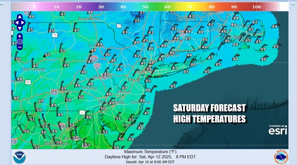
The northeast winds will keep temperatures raw and chilly. It is just going to be an ugly day for Saturday as temperatures in many areas will likely sit in the 40s all day long especially while it is raining. Onshore winds will be a bit breezy at times but the wind won’t be a big issue. Coastal flooding at high tides are possible over the weekend due to the full moon. However we are not expecting serious coastal flooding at this time.

It will remain cloudy and gloomy Saturday night into Sunday morning with patchy light rain or drizzle but the bulk of the rain will be long over with. Then as the wind turns more north we should see some slow improvement from west to east though it may take awhile for clouds to break up especially along the coast. Sunday will be the drier day this weekend. Highs should make it back into the 50s.
As far as rainfall is concerned, you can expect three quarters of an inch to an inch to an inch and a quarter at most so this is not a flash flooding issue. Monday brings drier warmer air with some sunshine and temperatures will be in the 60s and we might even see some highs near 70 in some places. Another cold front arrives with some showers Monday night into early Tuesday. Colder air eventually makes its way into the Eastern US for later Tuesday and Wednesday.
BE SURE TO DOWNLOAD THE FREE METEOROLOGIST JOE CIOFFI WEATHER APP &
ANGRY BEN’S FREE WEATHER APP “THE ANGRY WEATHERMAN!
MANY THANKS TO TROPICAL TIDBITS FOR THE USE OF MAPS
Please note that with regards to any severe weather, tropical storms, or hurricanes, should a storm be threatening, please consult your local National Weather Service office or your local government officials about what action you should be taking to protect life and property.


