
Gloom & Doom Continues into Sunday Morning
Before Weather Conditions Improve
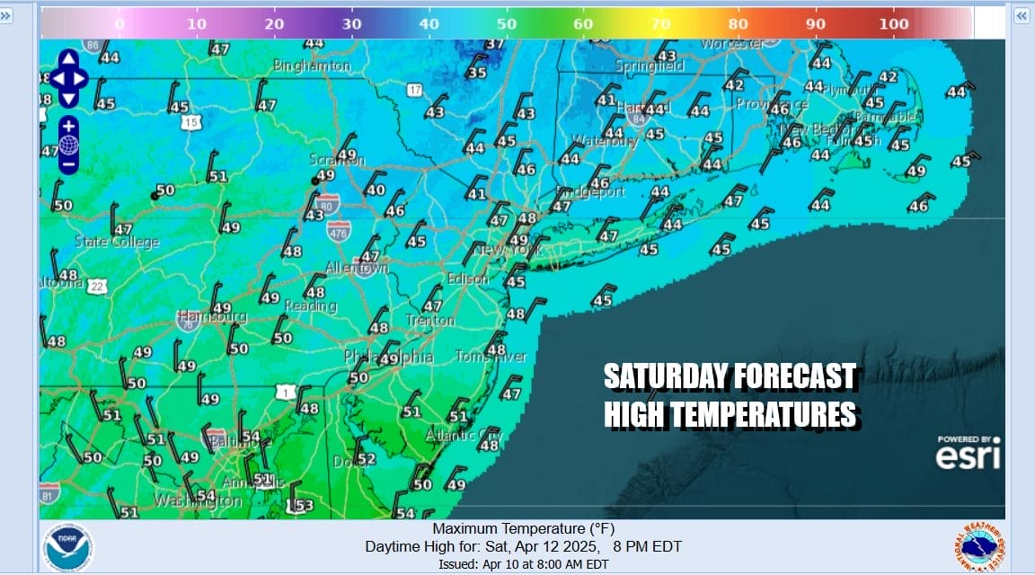
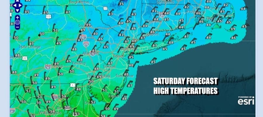
Overnight it was a cold rain that fell over much of Eastern Pennsylvania, and inland areas north and northwest of the coast above 750-1000 feet work up to a winter wonderland of wet snow. Several inches accumulated in some elevated areas of the Hudson Valley & into the Catskills. April snows that fall and accumulate at night tend to disappear quickly during the day thanks to the sun angle (yes the sun’s rays to make through). Overall today will be an overcast day with a raw north northeast wind and temperatures mostly in the low to middle 40s for highs. Most of the heavier rain is over with but we will see areas of light rain from time to time for the rest of today and tonight.
SATELLITE WITH LIGHTNING STRIKES

WEATHER RADAR

Low pressure is offshore and it will meander about today into Sunday morning. Areas of rain will rotate around it and make their way inland from time to time. Another low and cold front are racing southeastward into the Plains and this system will act as a kicker and punt the coastal low out to see allowing perhaps for some improvement in weather conditions later in the day. That is always a tough call.

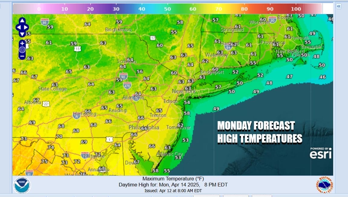
That next system will allow things to warm up briefly Monday but it also comes with the risk for showers and perhaps a thunderstorm Monday night. Areas to the west in Central and Western Pennsylvania could see severe weather risk from this front as it goes by. Behind the front is another shot of cold air and below normal temperatures.

Getting there we will have some patchy rain tonight into Sunday morning with steady temperatures in the 40s. Sunday winds turn more north and that should allow for some drying and perhaps a decrease in clouds in the afternoon. Most highs will be back in the 50s. Monday should be a decent day with sunshine giving way to some arriving clouds. High temperatures Monday will be in the 60s.
Monday night into early Tuesday morning some showers and thunderstorms will move by. Then during the day Tuesday we will see colder air arriving later in the day as a secondary front and upper trough move through. We will call Tuesday a mix of sun and clouds & windy with temperatures in the 60s and there is the risk for a few scattered afternoon showers as the colder air arrives. Wednesday will be a chilly day with some sunshine and a gusty wind. Highs will be just into the 50s. The rest of the week will be dry and temperatures will trend higher but we could see some showers and thunderstorms with a cold front next weekend.
BE SURE TO DOWNLOAD THE FREE METEOROLOGIST JOE CIOFFI WEATHER APP &
ANGRY BEN’S FREE WEATHER APP “THE ANGRY WEATHERMAN!
MANY THANKS TO TROPICAL TIDBITS FOR THE USE OF MAPS
Please note that with regards to any severe weather, tropical storms, or hurricanes, should a storm be threatening, please consult your local National Weather Service office or your local government officials about what action you should be taking to protect life and property.