DOWNLOAD MY NEW FREE JOESTRADAMUS WEATHER APP FOR ANDROID

SUBSCRIBE TO PATREON FOR A WEATHER EXPERIENCE FREE OF ADS, EXCLUSIVE VIDEOS FOR MEMBERS ONLY AND MUCH MORE…STARTS AT $2 A MONTH..MESSAGE ME AT ANY TIME

MAJOR STORM CANADIAN MARITIMES MOVES EASTWARD
RAIN LATE SATURDAY INTO EARLY SUNDAY
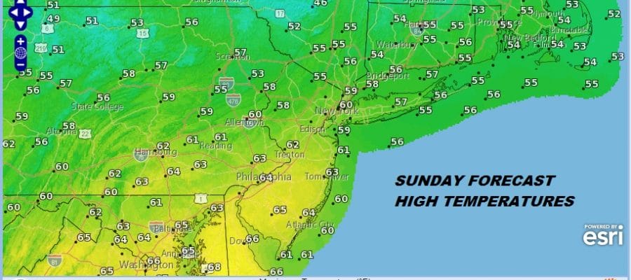
60S POSSIBLE SUNDAY AFTERNOON
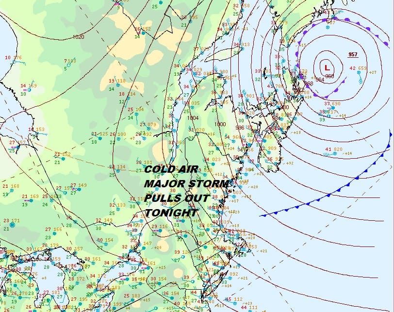
The major storm in the Canadian Maritime Provinces will being to pull away to the east tonight and Friday finally relaxing the pressure gradient here. Winds have eased somewhat from yesterday and they will continue drop off tonight. We at least saw some sunshine today which was a nice change from the gloom and doom clouds of the last two days. Now we move ahead to Friday and the weekend.
EASTERN SATELLITE

REGIONAL RADAR

There isn’t much happening on local radars and clouds will thin out somewhat tonight but we do have two weak disturbances heading our way which will bring high clouds back late tonight. Clouds will be around on Friday and then the second disturbance will bring a weakening area of rain and snow with it. There is the outside chance of a late afternoon or evening snow shower but that will be it. Temperatures Friday will be just into the 40s thanks to the cloudy skies.
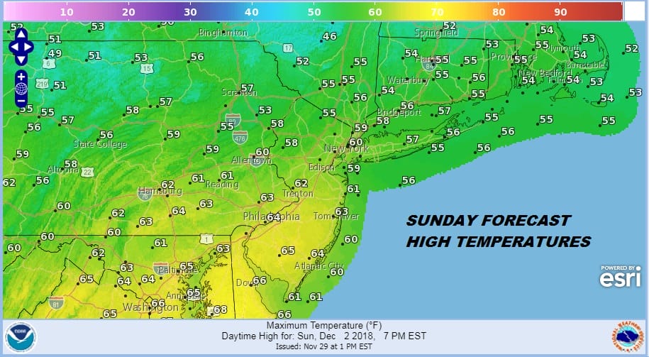
Saturday during the day will be cloudy as a storm in the midwest slowly moves towards the Great Lakes and a warm front lies to our south. Rain from this should hold off until late afternoon or evening but the day will be cloudy and raw with highs just in the 40s. We will see rain Saturday night until daybreak Sunday as temperatures start to rise overnight. The warm front should pass and assuming it does (sometimes they get stubborn) we should see some breaks of sunshine on Sunday. It will be a warm day Sunday if that warm front makes it through. Highs will be reaching into the 60s.
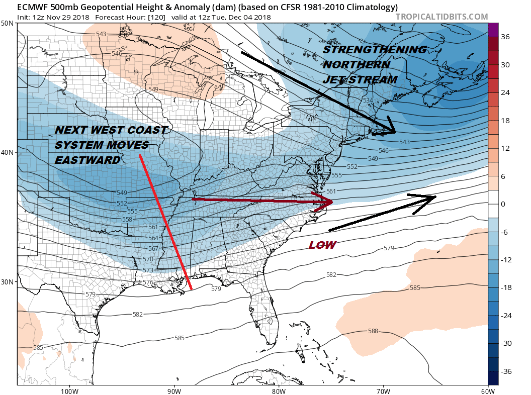
Next week brings colder air that starts arriving on Monday. Weather models continue to struggle somewhat with another West Coast powerhouse that comes inland over the weekend. Models have settled on a strengthening northern jet stream This means (at least for now) that the system will likely progress eastward toward the coast with little consequence. The north squashes it and keeps it from moving up the coast. Weather models do have a habit of coming in northwestward with these sorts of situations. If the northern jet is a little less suppressive, it could make things a bit interesting for later Tuesday into Wednesday of next week as it will be cold enough for snow. Right now we are still just watching this as models settle on the final outcome. Meanwhile be sure to take advantage of the warmer temperatures Sunday assuming they materialize with the warm front going by.
MANY THANKS TO TROPICAL TIDBITS FOR THE USE OF MAPS
Please note that with regards to any tropical storms or hurricanes, should a storm be threatening, please consult your local National Weather Service office or your local government officials about what action you should be taking to protect life and property.

