Rain Overnight Moving East

Rain Overnight Moving East
Clouds & Some Showers Into Monday
Coastal Low Monday Night Into Tuesday

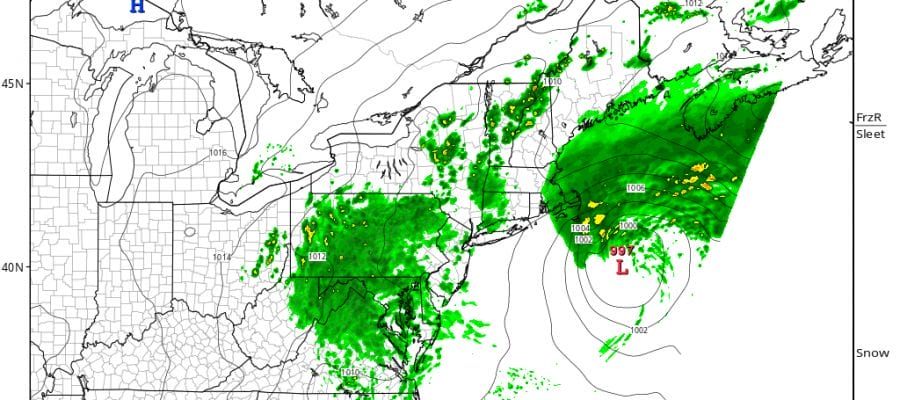
The rains during the day Saturday fell apart for many areas however there is a second area of rain tonight over the northern half of New Jersey & New York City that is moving to the east as the radar and satellite loops show. Look for that rain to continue east during the early morning hours and then that area should gradually fall apart before daybreak.
Rain Overnight Moving East Radar Loops


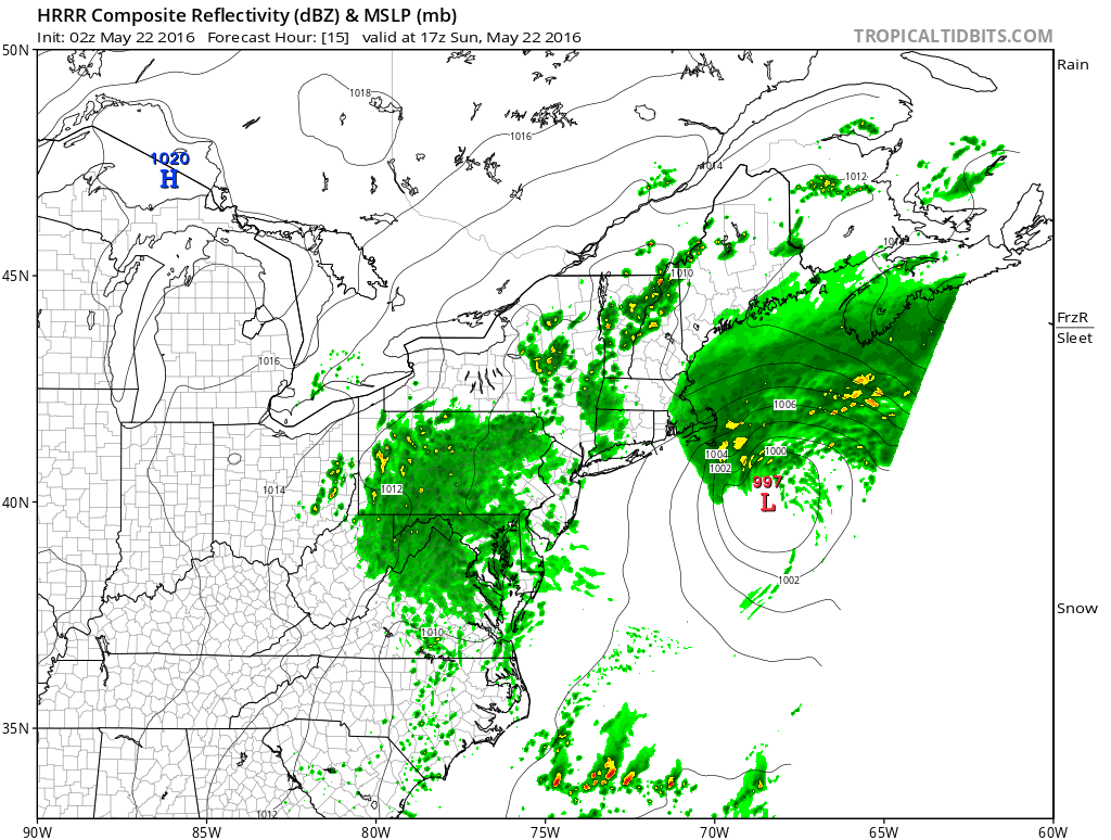
The latest HRRR model has much of the area surrounded by showers during the day on Sunday but timing them is going to be difficult. It is also going to be difficult to figure out who gets what, how much, and where. The safest forecast is to call for a chance for showers during the day Sunday but there will be dry periods as well.
Rain Overnight Moving East HRRR MODEL SUNDAY MIDDAY
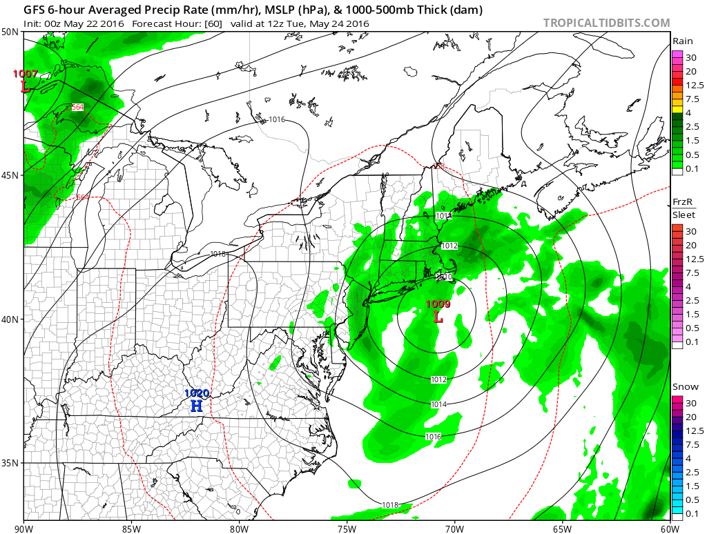
The chance for showers continues into Monday. A second low pressure area will move up the coast Monday night into Tuesday. The GFS model which has been better through all of this the last few days indicates some rain coming in from off the ocean Monday night into Tuesday.
GFS MODEL TUESDAY MORNING
Temperatures the next few days are going to be a tough call depending on the extent of cloud cover, showers, and if there are any bright spots or even breaks of sun. It is safe to say that most daytime temperatures will be in the 60s to near 70. We will skew higher where there are bright spots and lower where there are clouds and showers.
FiOS1 News Weather Forecast For Long Island
FiOS1 News Weather Forecast For New Jersey
FiOS1 News Weather Forecast For Hudson Valley
NATIONAL WEATHER SERVICE SNOW FORECASTS
LATEST JOESTRADAMUS ON THE LONG RANGE
Weather App

Don’t be without Meteorologist Joe Cioffi’s weather app. It is really a meteorologist app because you get my forecasts and my analysis and not some automated computer generated forecast based on the GFS model. This is why your app forecast changes every 6 hours. It is model driven with no human input at all. It gives you an icon, a temperature and no insight whatsoever.
It is a complete weather app to suit your forecast needs. All the weather information you need is right on your phone. Android or I-phone, use it to keep track of all the latest weather information and forecasts. This weather app is also free of advertising so you don’t have to worry about security issues with your device. An accurate forecast and no worries that your device is being compromised.
Use it in conjunction with my website and my facebook and twitter and you have complete weather coverage of all the latest weather and the long range outlook. The website has been redone and upgraded. Its easy to use and everything is archived so you can see how well Joe does or doesn’t do when it comes to forecasts and outlooks.
Just click on the google play button or the apple store button on the sidebar for my app which is on My Weather Concierge. Download the app for free. Subscribe to my forecasts on an ad free environment for just 99 cents a month.
Get my forecasts in the palm of your hand for less than the cost of a cup of Joe!
![]()
![]()

MENTION JOE CIOFFI AND GET A 5% DISCOUNT


