Rain Moving Northward Next 2 Days
Rain Moving Northward Next 2 Days
We managed a nice Sunday with only some high clouds that came in during the mid to late afternoon. Now we look southward as low pressure in the Southeast US meanders to the coast over the next 36 hours and then moves northward. Monday we will see clouds increasing and thickening up however the rain looks like it will come in 2 bursts. The first batch is shown on the HRRR model for Monday
RAIN MOVING NORTH HRRR MODEL MONDAY MORNING
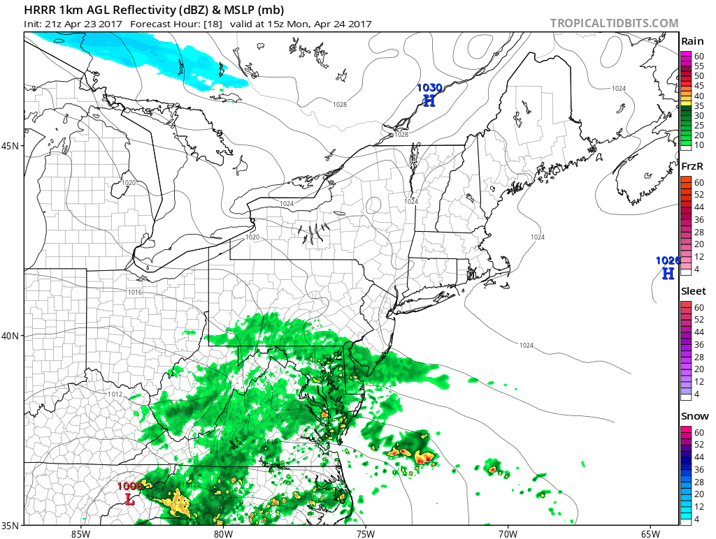
If the HRRR model is to be believed the first burst will be into Southern New Jersey and Southern Pennsylvania Monday morning however models that go beyond this time frame have this area of rain weakening as it moves northward. Some of will survive and there could be some light rain around the NYC Northern New Jersey Long Island Southern Connecticut area by late afternoon. Once that goes by, we may just transition over to some light rain or drizzle Monday night thanks to an onshore flow increasing with winds and moisture from off the ocean.
SATELLITE LOOP

The satellite loop this evening shows a well defined upper air system back through the Tennessee Valley that is not making much eastward progress at the moment. This is producing heavy rains across much of the Tennesse Valley into Virginia and Western North Carolina this evening. Our regional radar is showing that rain trying to move northward toward Maryland and Delaware.
REGIONAL RADAR

LOCAL RADAR NEW YORK CITY

LOCAL RADAR PHILADELPHIA


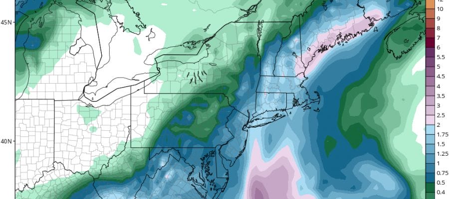
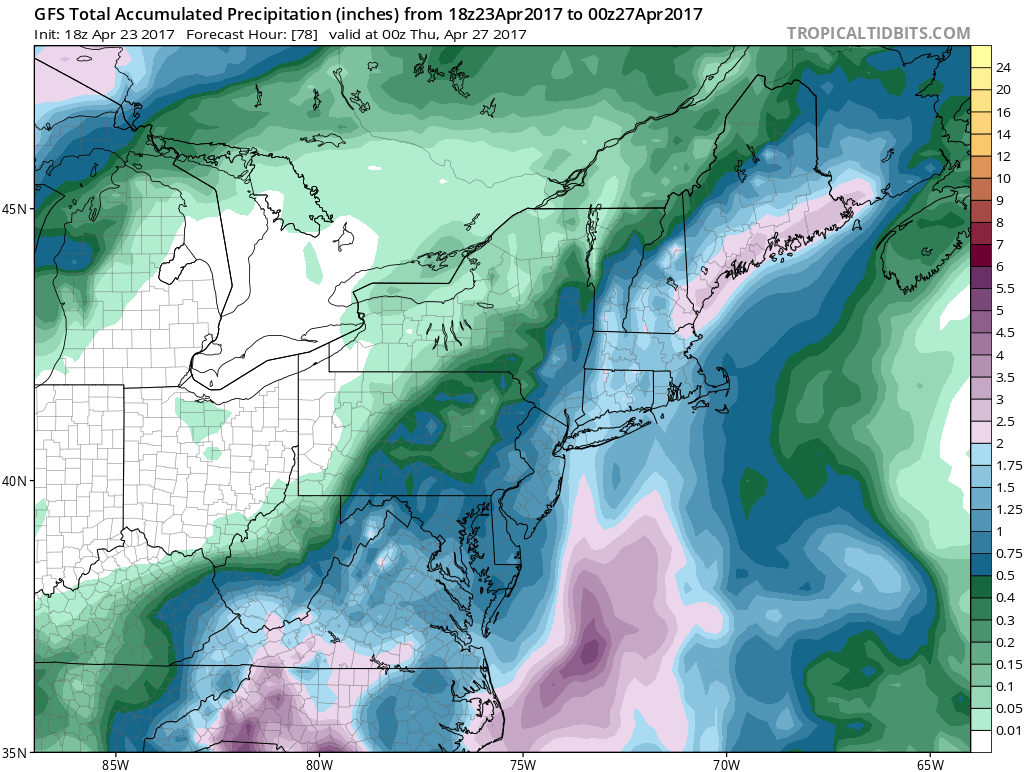
Weather models are showing a second heavier burst of rain for later Tuesday and Tuesday night as the upper air system moves northward. Today’s weather models have grown a little more bullish with rainfall amounts of 1 to 2 inches in most areas before the rain pulls out early Wednesday morning.
RAIN MOVING NORTH GFS MODEL TOTAL RAINFALL FORECAST
RAIN MOVING NORTH NAM MODEL TUESDAY AFTERNOON

NAM models show the heaviest rains Tuesday afternoon and Tuesday night and then the low slowly begins to pull away on Wednesday though there could still be leftover clouds and showers. The warm up for late next week remains on course though again there may be some complications as we move toward the weekend.
 GET JOE A CIGAR IF YOU LIKE

LANDSCAPE COMPANIES FOR YOUR NEEDS
LONG ISLAND ROCKLAND COUNTY Connecticut

![]()

ROCKLAND COUNTY TRI STATE SNOW REMOVAL JOHNSTOWN PA


FiOS1 News Weather Forecast For Long Island
FiOS1 News Weather Forecast For New Jersey
FiOS1 News Weather Forecast For Hudson Valley
NATIONAL WEATHER SERVICE SNOW FORECASTS
LATEST JOESTRADAMUS ON THE LONG RANGE
Weather App

Don’t be without Meteorologist Joe Cioffi’s weather app. It is really a meteorologist app because you get my forecasts and my analysis and not some automated computer generated forecast based on the GFS model. This is why your app forecast changes every 6 hours. It is model driven with no human input at all. It gives you an icon, a temperature and no insight whatsoever.
It is a complete weather app to suit your forecast needs. All the weather information you need is right on your phone. Android or I-phone, use it to keep track of all the latest weather information and forecasts. This weather app is also free of advertising so you don’t have to worry about security issues with your device. An accurate forecast and no worries that your device is being compromised.
Use it in conjunction with my website and my facebook and twitter and you have complete weather coverage of all the latest weather and the long range outlook. The website has been redone and upgraded. Its easy to use and everything is archived so you can see how well Joe does or doesn’t do when it comes to forecasts and outlooks.
Just click on the google play button or the apple store button on the sidebar for my app which is on My Weather Concierge. Download the app for free. Subscribe to my forecasts on an ad free environment for just 99 cents a month.
Get my forecasts in the palm of your hand for less than the cost of a cup of Joe!


