Moving Eastward, Rain Coming For Sunday & Monday
Rain Moving East For Sunday & Monday
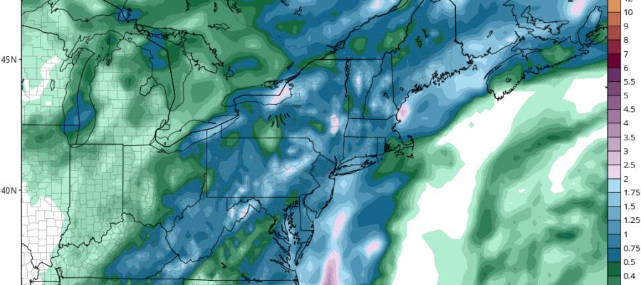
We will see weather conditions deteriorate on Sunday as a slow moving cold front begins to appoach the coast. There is a fair amount of moisture with this so hopefully we can grind out some much needed rain. There are going to be 2 solid areas of rain to deal with. The first one on Sunday will be west and north of the coast and set up inland across Northwest New Jersey Eastern Pennsylvania and Northern areas of the Hudson Valley. Cloudy skies should rule everywhere else. Then the rain shield will shift to the coast Sunday night and Monday. A second wave on the front will bring rain to coastal areas later Sunday night into Monday afternoon before the front pushes on through.


 We will start to see radars getting busy as the day wears on. Temperatures today will be in the 70s to near 80 however Central and Southern New Jersey and Southeastern Pennsylvania will probably reach into the 80s before the rain moves in.
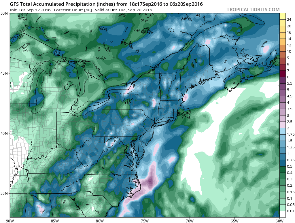
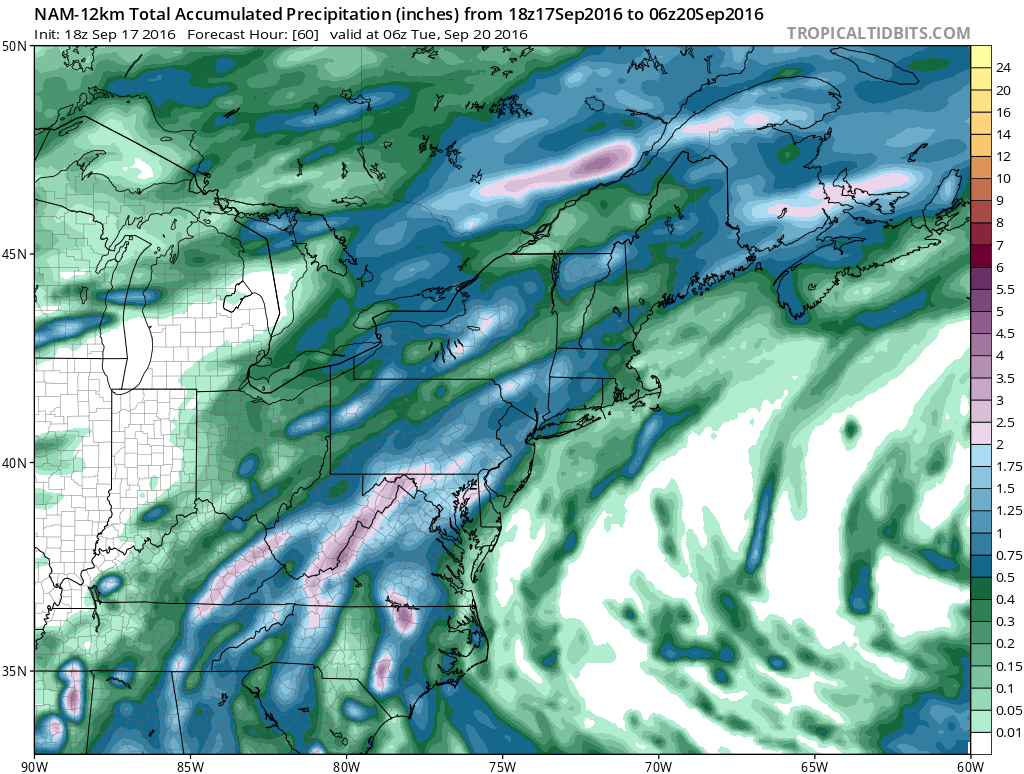
The GFS model this afternoon has grown more bullish on the rainfall totals across the area but the NAM model remains more subdued with amounts. The models have consistently overproduced reality over the last several months. Lets hope for the drought’s sake that the GFS is closer to reality.
Once the front passes weather conditions will improve. Tuesday and Wednesday look dry with sunshine back and highs reaching into the 80s. The end of the week also looks dry with some sunshine and more of an onshore flow which might lower the temperatures a couple of degrees. Overall this week temperatures will be above normal.
Some posts to look at if you haven’t seen them, JOESTRADAMUS looks at Tropical Storm Karl and the European Weather Model
WINTER 2016-2017 PART 1 OCEAN WATER TEMPERATURES
WINTER 2016-2017 PART 2 ARCTIC SEA ICE AND SIBERIAN SNOW COVER
FiOS1 News Weather Forecast For Long Island
FiOS1 News Weather Forecast For New Jersey
FiOS1 News Weather Forecast For Hudson Valley
NATIONAL WEATHER SERVICE SNOW FORECASTS
LATEST JOESTRADAMUS ON THE LONG RANGE
Weather App

Don’t be without Meteorologist Joe Cioffi’s weather app. It is really a meteorologist app because you get my forecasts and my analysis and not some automated computer generated forecast based on the GFS model. This is why your app forecast changes every 6 hours. It is model driven with no human input at all. It gives you an icon, a temperature and no insight whatsoever.
It is a complete weather app to suit your forecast needs. All the weather information you need is right on your phone. Android or I-phone, use it to keep track of all the latest weather information and forecasts. This weather app is also free of advertising so you don’t have to worry about security issues with your device. An accurate forecast and no worries that your device is being compromised.
Use it in conjunction with my website and my facebook and twitter and you have complete weather coverage of all the latest weather and the long range outlook. The website has been redone and upgraded. Its easy to use and everything is archived so you can see how well Joe does or doesn’t do when it comes to forecasts and outlooks.
Just click on the google play button or the apple store button on the sidebar for my app which is on My Weather Concierge. Download the app for free. Subscribe to my forecasts on an ad free environment for just 99 cents a month.
Get my forecasts in the palm of your hand for less than the cost of a cup of Joe!

MENTION JOE CIOFFI AND GET A 5% DISCOUNT


