Rain Into the Afternoon Cold Dry Weather Follows Sunday Week Ahead Outlook
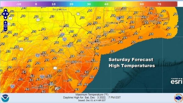
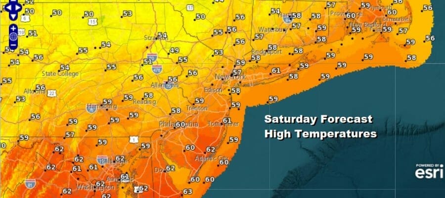
We begin the weekend with a cold front and some showers. The satellite loop shows the area of clouds with the front moving along to the east and the radars are busy with showers and even a few embedded thunderstorms. Some patches of heavier rain are in the mix but not everyone will see them. The front moves along and we should see some improvement this afternoon as the rain ends from west to east. Another big warm up has occurred today with highs reaching the upper 50s and lower 60s.
SATELLITE

WEATHER RADAR

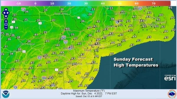
Once the front passes we will see weather conditions improve in what has been a wash rinse repeat pattern of cold fronts coming through every 2 to 3 days. This is the 4th front in 10 days. It will turn colder tonight as skies clear. Lows will be in the upper 20s inland and low to mid 30s along the coast and in warmer urban locations. Sunday will be a sunny breezy and cold day with most highs in the low to at best middle 40s. Some cold spots inland probably struggle to get back to 40 or so.
Moving into next week the pattern changes as the upper air begins a long grinding pattern change process. A developing block in the North Atlantic will send the jet stream further south and that will alter storm tracks. Part of the process of figuring out the longer term is the state of the Pacific. This is leading to highly volatile model runs with little consistency.
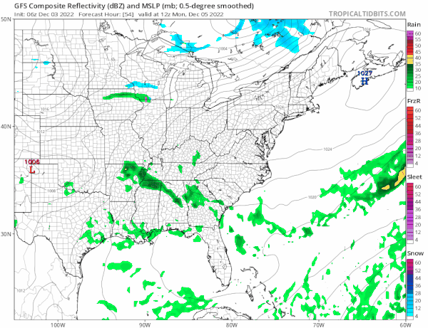
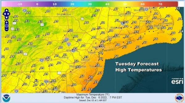
Monday will be a dry day of some sunshine as high pressure moves offshore. Highs will be in the 40s to around 50. Then then next and what should be the final cold front in a series of fronts will bring the chance for some showers developing later Tuesday and lasting into Wednesday. Tuesday highs will be in the 50s.

After that front passes high pressure with cold air will spread out of Canada and into the east and we will then watch low pressure coming our way late next week from the Plains. It should take a more southern track depending on the strength of the block. Too strong a block will shove any low to the south and east while too little blocking means a track further north. We at least have our first potential winter weather system to watch for later next week.
BE SURE TO DOWNLOAD THE FREE METEOROLOGIST JOE CIOFFI WEATHER APP &
ANGRY BEN’S FREE WEATHER APP “THE ANGRY WEATHERMAN!
MANY THANKS TO TROPICAL TIDBITS & F5 WEATHER FOR THE USE OF MAPS
Please note that with regards to any severe weather, tropical storms, or hurricanes, should a storm be threatening, please consult your local National Weather Service office or your local government officials about what action you should be taking to protect life and property.


